
Easter rental
|
market community Easter rental
|
||
|---|---|---|
| coat of arms | Austria map | |
 |
|
|
| Basic data | ||
| Country: | Austria | |
| State : | Upper Austria | |
| Political District : | Braunau am Inn | |
| License plate : | BR | |
| Surface: | 21.83 km² | |
| Coordinates : | 48 ° 3 ' N , 12 ° 50' E | |
| Height : | 423 m above sea level A. | |
| Residents : | 3,276 (January 1, 2020) | |
| Population density : | 150 inhabitants per km² | |
| Postal code : | 5121 | |
| Area code : | 06278 | |
| Community code : | 4 04 28 | |
| NUTS region | AT311 | |
| Address of the municipal administration: |
Bergstrasse 45 5121 Ostermiething |
|
| Website: | ||
| politics | ||
| Mayor : | Gerhard Holzner ( ÖVP ) | |
|
Municipal Council : (2015) (25 members) |
||
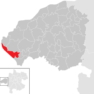
| Location of Ostermiething in the Braunau am Inn district | ||
  |
||
| Source: Municipal data from Statistics Austria | ||

Ostermiething is a market town in Upper Austria in the Braunau am Inn district in the Innviertel with 3276 inhabitants (as of January 1, 2020). The responsible judicial district is the judicial district Mattighofen , until 2004 the municipality belonged to the judicial district Wildshut .
geography
Ostermiething is located at an altitude of 423 m on the southern edge of the Upper Weilharts Forest in the Upper Innviertel. To the west, the Salzach forms the border with Bavaria. The Bavarian city of Tittmoning can be reached via a bridge. The extension is 8.1 km from north to south and 9.4 km from west to east. The total area is 21.7 km². 25.8% of the area is forested, 59.9% of the area is used for agriculture.
As one of the westernmost communities in Upper Austria, the market town of Ostermiething belongs to the production area of the Alpine foothills as a small production area of the Upper Innviertel . Due to its geological structure and the natural production conditions with mean annual temperatures of 7.7 ° C and rainfall around 1000 mm, this has favorable conditions for grassland and forage cultivation. The municipality of Ostermiething itself is climatically favored by its southwest exposure. The soil type is mainly sandy loam to loamy sand of the soil type parabrown earth. The lower terrace on the Salzach is of the Aubode type.
Community structure
The municipal area comprises the following 14 localities (population in brackets as of January 1, 2020):
|
|
The community consists of the cadastral communities Ernsting, Ettenau and Ostermiething.
coat of arms
Blazon : In Göppelschnitt divided; top right of blue and silver roughened diagonally right, top left a silver post in red; below in blue on a green hill a golden, formed, growing ray sun. The municipality colors are blue-white-red. The red-silver-red denotes that it belongs to Austria, the roughened blue-silver is a symbol of the long association with Bavaria . The motto under the coat of arms consists of the words Juste iudicate filii hominum ( "Judge righteously, you people (sons)" ). It refers to the court seat that existed here until 1355.
history
That since the year 600 BC The municipality area belonging to the Celtic empire Norikum was established in 15 BC. It was incorporated into the Roman Empire and remained under Roman rule until 400 AD. Around 500 the Agilolfingers built a farm in Ostermiething, which was elevated to a royal palace under the Franks . From 739 to 1784 Ostermiething was under the Archdiocese of Salzburg , then the Diocese of Linz . In 740 Ostermiething was first mentioned as Ostermuntingin in a deed of donation from Duke Odilo to the cell of St. Maximilian in Bischofshofen . The parish of Ostermiething was established in 1163 under Bavarian Duke Heinrich the Lion . Ostermiething was part of Bavaria for centuries. With the Treaty of Teschen in 1779, the entire Innviertel and Ostermiething became part of Austria. During the Napoleonic Wars briefly Bavarian again, the place has belonged to Upper Austria since 1814 by resolution of the Congress of Vienna . On December 6, 1927, the community was raised to the market. After Austria was annexed to the German Reich on March 13, 1938, the place belonged to the Gau Oberdonau , after 1945 the restoration of Upper Austria took place.
politics
As of 2015, the municipal council with 25 members has the following distribution of seats: ÖVP: 15, FPÖ: 6, SPÖ: 4.
- mayor
- since 2003 Gerhard Holzner (ÖVP)
Culture and sights

- Catholic parish church Ostermiething Mariä Himmelfahrt: The baroque parish church, decorated with rococo furnishings, was built between 1676 and 1683 under master builder Josef Vilzkotter von Steckenbach. A marble plaque at the left side entrance reminds of the first issue of documents in Ostermiething by the Agilolfingen Duke Tassilo III. in 748.
- Former vicarage Ostermiething: In the former vicarage, built in 1462 and now a nursing home, late Gothic dry frescoes uncovered in 1941 represent an upside-down world in which birds live in the water and fish on trees.
- Former Ofenwang Castle : At this point there is now a farm.
traffic
Ostermiething can be reached on the road from Salzburg via Bergheimer Landesstraße (L118) and / or Lamprechtshausener Straße (B156) - St. Georgener Landesstraße (L205) - Weilhart Landesstraße (L501), from Braunau via Weilhart Landesstraße (L501) and from Mattighofen via Oberinnviertler Landesstraße (L503) - Frankinger Landesstraße (L504) - Mühlen Bezirksstraße 1009.
Ostermiething has been the terminus of the route from Bürmoos since December 14, 2014 . Until then, the Bürmoos – Trimmelkam railway with its terminus Trimmelkam ran up to about four kilometers from the market town. Following a resolution by the Upper Austrian Landtag , the route, which is integrated into the Salzburg S-Bahn as S11 and operated by Salzburg AG , was extended to the outskirts of Ostermiething. Construction began in November 2013.
Sports
The extreme bike race Race Around Austria , which takes place every August, runs through Ostermiething . In 2010 the so-called Penalty Point was set up for the first time due to the proximity to the finish in Schärding , where participants have to serve possible penalty times.
The Tauern Cycle Path , which begins in Krimml in Salzburg , runs along the Salzach, Saalach and Inn rivers to Passau and passes Ostermiething at kilometer 198.
The Ostermiething Gymnastics and Sports Union is represented in various sports, including football and tennis. In 2011 it celebrated its 60th anniversary. The football club reached first place in the table in the Upper Austrian District League West in the 2013/14 season.
Public facilities
- kindergarten
- Elementary school
- New Middle School
- State music school
- outdoor pool
- District retirement and nursing home
- Police inspection
Personalities
- Honorary citizen
- Richard Hingsammer (1912-2004), medic
- Sons and daughters of the church
- Anton Filzmoser (1897–1969 in Braunau am Inn), academic local painter
- Josef Rems (* 1936), sculptor
- Werner Gruber (* 1970), physicist and author, teaches at the University of Vienna
- Hermann Hingsammer (1960–2004), community doctor
- Stefanie Holzer (* 1961), writer and journalist
- Dieter Muckenhammer (* 1981), Bundesliga soccer referee
- Walter Resch (1939–1995), technician and politician, Vice Mayor of Ostermiething
- Theophil Ruderstaller (1906–1946), Franciscan priest and China missionary
- Hubert Schatz (* 1960), author, painter, graphic artist and natural spirit researcher
- Hubert Sommerauer (* 1957), painter and graphic artist
- Ferdinand Tiefnig (* 1965), politician
- Erwin Bernecker (1951–2019), founder of B&R Industrial Automation
Web links
- Website of the market town
- Tourism website
- 40428 - Easter rental. Community data, Statistics Austria .
- Further information about the municipality of Ostermiething can be found on the geographic information system of the federal state of Upper Austria .
Individual evidence
- ^ Province of Upper Austria - Geographical data for the municipality of Ostermiething .
- ↑ Statistics Austria: Population on January 1st, 2020 by locality (area status on January 1st, 2020) , ( CSV )
- ^ State of Upper Austria, history and geography, coat of arms. Retrieved April 6, 2019 .
- ↑ Mayoral election 2003. Retrieved on August 23, 2016 .
- ↑ Extension of the Salzburg Local Railway to Ostermiething (PDF file; 2.0 MB)
- ↑ Turn- u. Sportunion Ostermiething. Marktgemeinde Ostermiething, accessed on July 14, 2012 .
- ↑ 60 years of Union Ostermiething. Marktgemeinde Ostermiething, accessed on July 14, 2012 .
- ^ Union Stampfl-Bau Ostermiething. In: ticker.ligaportal.at. Retrieved July 4, 2014 .
- ^ Anton Filzmoser , in: Regiowiki.at website
- ↑ Josef Rems , in: Web presence of Regiowiki.at

Altheim | Aspach | Auerbach | Braunau am Inn | Burgkirchen | Eggelsberg | Feldkirchen | Franking | Geretsberg | Gilgenberg | Haigermoos | Handenberg | Helpfau-Uttendorf | Hochburg-Ach | Höhnhart | Jeging | Kirchberg | Lengau | Punch | Maria Schmolln | Mattighofen | Wall churches | Mining | Moosbach | Moosdorf | Munderfing | Neukirchen | Easter rental | Palting | Perwang | Pfaffstätt | Pischelsdorf | Polling | Rossbach | St. Georgen | St. Johann | St. Pantaleon | St. Peter | St. Radegund | St. Veit | Bowl | Schwand | Tarsdorf | Treubach | Oversize | Weng