Mining
|
Mining
|
||
|---|---|---|
| coat of arms | Austria map | |
|
|
||
| Basic data | ||
| Country: | Austria | |
| State : | Upper Austria | |
| Political District : | Braunau am Inn | |
| License plate : | BR | |
| Surface: | 16.55 km² | |
| Coordinates : | 48 ° 17 ' N , 13 ° 10' E | |
| Height : | 346 m above sea level A. | |
| Residents : | 1,254 (January 1, 2020) | |
| Population density : | 76 inhabitants per km² | |
| Postal code : | 4962 | |
| Area code : | 07723 | |
| Community code : | 4 04 23 | |
| NUTS region | AT311 | |
| Address of the municipal administration: |
Hofmark 19 4962 Mining |
|
| Website: | ||
| politics | ||
| Mayor : | Josef Zechmeister ( ÖVP ) | |
|
Municipal Council : (2015) (19 members) |
||
| Location of mining in the Braunau am Inn district | ||
| Source: Municipal data from Statistics Austria | ||
Mining is a municipality with 1254 inhabitants (as of January 1, 2020) in the northeast of the Upper Austrian district of Braunau am Inn . The place is above the Inn reservoir , the responsible judicial district is the judicial district of Braunau am Inn .
geography
Community structure
The municipality includes the following 12 localities (population in brackets as of January 1, 2020):
- Alberting (51)
- Amberg (63)
- Frauenstein (103)
- Gundholling (28)
- Holl (13)
- Kaltenau (19)
- Mamling (214)
- Mining (700)
- Obersunzing (9)
- Ooppling (18)
- Unterbergham (17)
- Untersunzing (19)
The community consists of the cadastral communities Amberg, Gundholling and Mining.
history
Since the founding of the Duchy of Bavaria, the place was Bavarian until 1779 and came to Austria after the Treaty of Teschen with the Innviertel (then 'Innbaiern'). During the Napoleonic Wars briefly Bavarian again, the place has been part of Upper Austria since 1814.
Mining is located on a terraced landscape formed by the Ice Age on the Lower Inn in the northeast of the Braunau am Inn district. It was first mentioned in a document in AD 885. Numerous finds point to a very early settlement (e.g. bronze jug and bronze plate from the La Tène period in the fourth century BC in the village of Sunzing - can be seen in the Landesmuseum Linz). In the Gothic parish church there are interesting gravestones from the period after 1500 on the side walls and remind of the former rulers of the three castles Mamling , Sunzing and Frauenstein . The Mamling Castle Chapel is particularly worth seeing. Other interesting sights are the Inn power plant Ering-Frauenstein with a view of the reservoir and Frauenstein Castle.
coat of arms
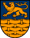
The design of the coat of arms of Mining refers to the powerful family of the imperial counts of Paumgarten zu Ering and Frauenstein , who exercised the manorial rule in Mining for centuries and who also had their burial place in the parish church.
Culture and sights
- Parish Mining Church
- Mamling Castle and the Mamling Castle Chapel
- Sunzing Castle
- Frauenstein Castle in Upper Austria
Personalities
- Franz Amberger (1887–1943), locomotive heater and resistance fighter
- Karl Seeburger (1914–1979), Mayor of Mining and member of the Upper Austrian state parliament.
- Marianne Hagenhofer (* 1948), politician, member of the Mining Municipal Council and member of the National Council from 1993 to 2011.
Individual evidence
- ↑ Statistics Austria: Population on January 1st, 2020 by locality (area status on January 1st, 2020) , ( CSV )
- ^ State of Upper Austria, history and geography, coat of arms. Retrieved April 9, 2019 .
Web links
- Side of the community
- 40423 - mining. Community data, Statistics Austria .
- More information about the municipality of Mining on the geo-information system of the federal state of Upper Austria .


