Haiger moss
|
Haiger moss
|
||
|---|---|---|
| coat of arms | Austria map | |
|
|
||
| Basic data | ||
| Country: | Austria | |
| State : | Upper Austria | |
| Political District : | Braunau am Inn | |
| License plate : | BR | |
| Surface: | 7.44 km² | |
| Coordinates : | 48 ° 3 ' N , 12 ° 53' E | |
| Height : | 470 m above sea level A. | |
| Residents : | 626 (January 1, 2020) | |
| Population density : | 84 inhabitants per km² | |
| Postal code : | 5120 | |
| Area code : | 06277 | |
| Community code : | 4 04 11 | |
| NUTS region | AT311 | |
| Address of the municipal administration: |
Haigermoos 23 5120 Haigermoos |
|
| Website: | ||
| politics | ||
| Mayor : | Johann Schwankner ( ÖVP ) | |
|
Municipal Council : (2015) (13 members) |
||
| Location of Haigermoos in the Braunau am Inn district | ||
 View of Haigermoos |
||
| Source: Municipal data from Statistics Austria | ||
The municipality of Haigermoos with 626 inhabitants (as of January 1, 2020) is located in the Braunau am Inn district in Upper Austria in a hilly landscape between the Holzöstersee and the Höllerersee . The responsible judicial district is the judicial district Mattighofen , until 2004 the municipality belonged to the judicial district Wildshut .
geography
Haigermoos is located in the Oberinnviertel Lake District, halfway between Salzburg and Braunau. The municipality also includes the villages of Aich, Edt, Hehermoos, Marktl, Ortholling, Pfaffing, Weyer and Witzling. Haigermoos borders on Geretsberg , Franking , St. Pantaleon and Ostermiething .
Community structure
The municipality includes the following nine localities (population in brackets as of January 1, 2020):
- Aich (27)
- Edt (21)
- Haigermoos (192)
- Hehermoos (75)
- Marktl (2)
- Ortholling (23)
- Pfaffing (37)
- Weyer (229)
- Witch (20)
The community consists of the cadastral community Haigermoos.
coat of arms
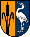
Blazon : Split; on the right a black cattail in gold, on the left a silver heron in blue. The community colors are yellow-blue-white.
The municipal coat of arms , awarded in 1968, symbolizes the name, which was first verifiable around 1070 and is composed of ahd. Heigir 'heron' and mhd. Mos for 'moor, swamp floor'. At the same time, it refers to the location of the community in the Oberinnviertel lake and moor area.
history
middle Ages
Aribo II. , One of the founders of the Millstatt Monastery from the Aribonen family , died in 1102 as aribo comes de hegirmos - in German Aribo Graf von Haigermoos. However, this title does not include a real county.
Interwar period
As in the rest of Austria, emergency money was introduced in Haigermoos in 1919, as coins were no longer available due to the lack of metal. During the time of the corporate state , there was the Austrian Young People in Haigermoos , the youth organization of the Fatherland Front .
time of the nationalsocialism
During the Nazi era , the Haigermoos community was part of the St. Pantaleon community. During this time the work education and gypsy detention camp St. Pantaleon-Weyer existed in today's Gasthaus Spick.
Infrastructure
The place has a kindergarten and a primary school as well as two inns.
Culture and sights
Late Gothic double church
The parish church of Haigermoos is a late Gothic double church with a lower church. The upper church has a single nave, the choir with a 3/8 end is only slightly drawn in. The lower church has two aisles, the choir is also only slightly drawn in and has a 3/8 end. The church was built from exposed tuff and completed in 1466. The upper church is consecrated to Peter and Paul. The lower church is now also used as a morgue.
Haigermoos nature trail
The Haigermooser Naturweg offers a good opportunity for a hike through the forest and moorland around Haigermoos and offers beautiful views. The path is 5.5 km long and starts in front of the municipal office (parking facilities). From there it leads over the Brack (a forest north of Haigermoos), the plague cemetery, the Hehermooser Moor and the Leitenberg back to Haigermoos.
More Attractions
- Haigermoos local history museum in the Anthalerhof's Bundwerkstadel .
- Pfeili's Oldtimer Museum
- Höllerersee
- Hehermooser Moor
Individual evidence
- ↑ Statistics Austria: Population on January 1st, 2020 by locality (area status on January 1st, 2020) , ( CSV )
- ^ Herbert Erich Baumert: The coats of arms of the cities, markets and communities of Upper Austria (2nd supplement) . In: Oberösterreichische Heimatblätter, Heft 1/2, 1970, p. 55, online (PDF; 1.6 MB) in the forum OoeGeschichte.at
Web links
- Website of the municipality of Haigermoos
- Haigermoos, data and facts from the state of Upper Austria
- 40411 - Haigermoos. Community data, Statistics Austria .
- Further information about the municipality of Haigermoos can be found on the geographic information system of the federal state of Upper Austria .
- GPS hike to the Haigermoos nature trail


