
Pfaffstätt
|
Pfaffstätt
|
||
|---|---|---|
| coat of arms | Austria map | |
 |
|
|
| Basic data | ||
| Country: | Austria | |
| State : | Upper Austria | |
| Political District : | Braunau am Inn | |
| License plate : | BR | |
| Surface: | 9.21 km² | |
| Coordinates : | 48 ° 5 ' N , 13 ° 9' E | |
| Height : | 471 m above sea level A. | |
| Residents : | 1,152 (January 1, 2020) | |
| Population density : | 125 inhabitants per km² | |
| Postal code : | 5223 | |
| Area code : | 07742 | |
| Community code : | 4 04 31 | |
| NUTS region | AT311 | |
| Address of the municipal administration: |
Kirchenplatz 1 5223 Pfaffstätt |
|
| Website: | ||
| politics | ||
| mayor | Wolfgang Gerner ( ÖVP ) | |
|
Municipal Council : (2015) (13 members) |
||
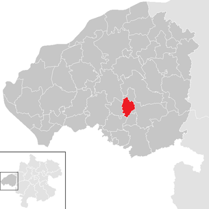
| Location of Pfaffstätt in the Braunau am Inn district | ||
  |
||
| Source: Municipal data from Statistics Austria | ||

Pfaffstätt is a municipality in Upper Austria in the Braunau am Inn district in the Innviertel with 1152 inhabitants (as of January 1, 2020). The competent judicial district is the judicial district Mattighofen .
geography
Pfaffstätt is 471 m above sea level in the Innviertel. The extension is 4.8 km from north to south and 3.3 km from west to east. The total area is 9.16 km². 37.% of the area is forested, 56.5% of the area is used for agriculture.
Community structure
The municipality includes the following six localities (population in brackets as of January 1, 2020):
- Erlach (6)
- Fludau (5)
- Kitzing (14)
- Kuglberg (88)
- Pfaffstätt (911)
- Sollern (128)
The community consists of the cadastral community Pfaffstätt.
Population development
In 1991 the municipality had 888 inhabitants according to the census, in 2001 it had 946 inhabitants. Since both the birth balance and the migration balance were positive, the population rose further to 1,000 in 2011 and to a new high of 1,101 in 2018.
coat of arms
Official description of the municipal coat of arms : Between two green, blue wave flanks lined with silver wave bars, a golden baptismal font, consisting of a column base, column, heptagonal basin and lid in the form of a seven-sided truncated pyramid with a Latin cross on top. The community colors are yellow-green-yellow.
history
Since the founding of the Duchy of Bavaria, the place was Bavarian until 1779 and came to Austria after the Treaty of Teschen with the Innviertel (then 'Innbaiern'). Briefly Bavarian again during the Napoleonic Wars , since 1814 it has finally belonged to Upper Austria. After the connection of Austria to the German Reich on 13 March 1938, the place to "Upper Danube" belonged. After 1945 the restoration of Upper Austria took place.
politics
- mayor
- until 2009 Susanne Lanzer (SPÖ)
- since 2009 Wolfgang Gerner (ÖVP)
people
- Ludwig Weinberger (1911–1966), Quaternary researcher , born in Pfaffstätt
Culture and sights

Web links
- Community website
- 40431 - Pfaffstätt. Community data, Statistics Austria .
- Further information about the municipality of Pfaffstätt can be found on the geographic information system of the federal state of Upper Austria .
Individual evidence
- ^ Province of Upper Austria - Geographical data of the municipality of Pfaffstätt .
- ↑ Statistics Austria: Population on January 1st, 2020 by locality (area status on January 1st, 2020) , ( CSV )
- ^ Statistics Austria, A look at the community of Pfaffstätt, population development. Retrieved April 6, 2019 .
- ^ State of Upper Austria, history and geography, coat of arms. Retrieved April 6, 2019 .
- ^ Pfaffstätt municipality, politics, mayor. Retrieved April 6, 2019 .

Altheim | Aspach | Auerbach | Braunau am Inn | Burgkirchen | Eggelsberg | Feldkirchen | Franking | Geretsberg | Gilgenberg | Haigermoos | Handenberg | Helpfau-Uttendorf | Hochburg-Ach | Höhnhart | Jeging | Kirchberg | Lengau | Punch | Maria Schmolln | Mattighofen | Wall churches | Mining | Moosbach | Moosdorf | Munderfing | Neukirchen | Easter rental | Palting | Perwang | Pfaffstätt | Pischelsdorf | Polling | Rossbach | St. Georgen | St. Johann | St. Pantaleon | St. Peter | St. Radegund | St. Veit | Bowl | Schwand | Tarsdorf | Treubach | Oversize | Weng