
Auerbach (Upper Austria)
|
Auerbach
|
||
|---|---|---|
| coat of arms | Austria map | |
 |
|
|
| Basic data | ||
| Country: | Austria | |
| State : | Upper Austria | |
| Political District : | Braunau am Inn | |
| License plate : | BR | |
| Surface: | 10.78 km² | |
| Coordinates : | 48 ° 4 ' N , 13 ° 7' E | |
| Height : | 488 m above sea level A. | |
| Residents : | 661 (January 1, 2020) | |
| Population density : | 61 inhabitants per km² | |
| Postal code : | 5224 | |
| Area code : | 07747 | |
| Community code : | 4 04 03 | |
| NUTS region | AT311 | |
| Address of the municipal administration: |
Auerbach 2 5224 Auerbach |
|
| Website: | ||
| politics | ||
| Mayor : | Friedrich Pommer ( ÖVP ) | |
|
Municipal Council : (2015) (13 members) |
||
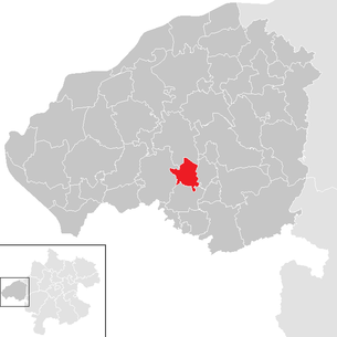
| Location of Auerbach in the Braunau am Inn district | ||
  |
||
| Source: Municipal data from Statistics Austria | ||

Auerbach is a municipality in Upper Austria in the Braunau am Inn district in the Innviertel with 661 inhabitants (as of January 1, 2020). The competent judicial district is the judicial district Mattighofen .
geography
Auerbach lies at an altitude of 488 m in the Innviertel. The extension is from north to south 4.3 km, from west to east 5 km. The total area is 10.9 km². 33.0% of the area is forested, 60.6% of the area is used for agriculture.
Community structure
The municipality includes the following 11 localities (population in brackets as of January 1, 2020):
- Au (24)
- Auerbach (197)
- Wooden (101)
- Höring (74)
- Oberirnprechting (106)
- Oberkling (24)
- Riensberg (11)
- Rietzing (5)
- Unterirnprechting (103)
- Lower blade (6)
- Wimpassing (10)
The community consists of the cadastral communities Auerbach and Irnprechting.
Neighboring communities
| Pischelsdorf am Engelbach | ||
| Feldkirchen near Mattighofen |
.svg)
|
Pfaffstätt |
| Kirchberg near Mattighofen |
coat of arms
Blazon : In blue above a silver twin wavy bar, a silver, swimming duck with a golden leg and golden beak, holding a silver host with the letters IHS. Community colors: green-yellow-black.
history
Since the founding of the Duchy of Bavaria, the place was Bavarian until 1779 and came to Austria after the Treaty of Teschen with the Innviertel (then 'Innbaiern'). Briefly Bavarian again during the Napoleonic Wars , since 1814 it has finally belonged to Upper Austria. After Austria was annexed to the German Reich on March 13, 1938, the place belonged to the "Gau Oberdonau". After 1945 the restoration of Upper Austria took place.
politics
Friedrich Pommer of the ÖVP has been mayor since 2002.
Population development
In 1991 the municipality had 498 inhabitants according to the census, in 2001 it had 504 inhabitants. Despite a slightly negative balance of migration , the population increased to 525 in 2011 and to a high of 583 in 2018 due to a positive birth balance .
Culture and sights
Sons and daughters of the church
- Gustav Streicher (1873–1915), Austrian playwright and writer
Individual evidence
- ↑ Statistics Austria: Population on January 1st, 2020 by locality (area status on January 1st, 2020) , ( CSV )
- ^ State of Upper Austria, history and geography, coat of arms. Retrieved April 6, 2019 .
- ^ Province of Upper Austria, History, Mayor. Retrieved April 6, 2019 .
- ^ Statistics Austria, A look at the community of Auerbach, population development. Retrieved April 6, 2019 .
Web links
- 40403 - Auerbach (Upper Austria). Community data, Statistics Austria .
- Further information about the municipality of Auerbach (Upper Austria) can be found on the geographic information system of the federal state of Upper Austria .

Altheim | Aspach | Auerbach | Braunau am Inn | Burgkirchen | Eggelsberg | Feldkirchen | Franking | Geretsberg | Gilgenberg | Haigermoos | Handenberg | Helpfau-Uttendorf | Hochburg-Ach | Höhnhart | Jeging | Kirchberg | Lengau | Punch | Maria Schmolln | Mattighofen | Wall churches | Mining | Moosbach | Moosdorf | Munderfing | Neukirchen | Easter rental | Palting | Perwang | Pfaffstätt | Pischelsdorf | Polling | Rossbach | St. Georgen | St. Johann | St. Pantaleon | St. Peter | St. Radegund | St. Veit | Bowl | Schwand | Tarsdorf | Treubach | Oversize | Weng