
Inn
|
Inn En / Sela |
||
 Course and catchment area of the Inn |
||
| Data | ||
| Water code | CH : 44, AT : 2-8, DE : 18 | |
| location | Switzerland , Austria , Germany | |
| River system | Danube | |
| Drain over | Danube → Black Sea | |
| source | Above the Lunghinsee in the Upper Engadine 46 ° 24 ′ 56 ″ N , 9 ° 40 ′ 0 ″ E |
|
| Source height | 2564 m above sea level M. | |
| muzzle | In Passau in the Danube Coordinates: 48 ° 34 ′ 22 " N , 13 ° 28 ′ 39" E 48 ° 34 ′ 22 " N , 13 ° 28 ′ 39" E |
|
| Mouth height | 289 m above sea level NHN | |
| Height difference | 2275 m | |
| Bottom slope | 4.4 ‰ | |
| length | 517 km | |
| Catchment area | 26,130 km² | |
| Discharge at the Martina gauge (Swiss border) A Eo : 1941 km² |
NNQ (2004) MNQ 1970–2016 MQ 1970–2016 Mq 1970–2016 MHQ 1970–2016 HHQ (1987) |
2.37 m³ / s 37.7 m³ / s 53.3 m³ / s 27.5 l / (s km²) 81.3 m³ / s 481 m³ / s |
| Discharge at the Innsbruck A Eo gauge: 5,631.5 km². Location: 298.51 km above the mouth |
NNQ (Jan. 31, 1962) MNQ 1971–2009 MQ 1971–2009 Mq 1971–2009 MHQ 1971–2009 HHQ (Aug. 23, 2005) |
18.8 m³ / s 40.1 m³ / s 163 m³ / s 28.9 l / (s km²) 718 m³ / s 1525 m³ / s |
| Discharge at the Wasserburg A Eo gauge: 11,980 km² Location: 158.7 km above the mouth |
NNQ (28 Dec. 1969) MNQ 1965/2006 MQ 1965/2006 Mq 1965/2006 MHQ 1965/2006 HHQ (23 Aug 2005) |
93.8 m³ / s 131 m³ / s 358 m³ / s 29.9 l / (s km²) 1450 m³ / s 2940 m³ / s |
| Discharge at the Passau Ingling A Eo gauge: 26,063 km² Location: 3.1 km above the mouth |
NNQ (Nov. 2, 1947) MNQ 1921/2006 MQ 1921/2006 Mq 1921/2006 MHQ 1921/2006 HHQ (Jul. 10, 1954) |
195 m³ / s 283 m³ / s 740 m³ / s 28.4 l / (s km²) 2960 m³ / s 6700 m³ / s |
| Left tributaries | Sanna , Brandenberger Ache , Mangfall , Attel , Isen , Rott | |
| Right tributaries | Ötztaler Ache , Melach , Sill , Ziller , Murn , Alz , Salzach | |
| Big cities | innsbruck | |
| Medium-sized cities | Rosenheim , Passau | |
| Small towns | Landeck , Imst , Telfs , Hall in Tirol , Schwaz , Rattenberg , Wörgl , Kufstein , Wasserburg , Mühldorf , Töging , Altötting , Neuötting , Simbach , Braunau , Schärding | |
| Navigable | Not navigable, local passenger shipping | |
 The Inn between Wernstein and Passau |
||
The Inn ( Rhaeto-Romanic , Latin Aenus , also Oenus , ancient Greek Αἶνος ) is a 517 km long right tributary of the Danube that runs through Switzerland , Austria and Germany . At the mouth in Passau , an average of 738 m³ / s of water flows into the Danube, which is only 690 m³ / s. The larger mean of the Inn is based on the floods of the mountain river. For seven months, the Inn at the confluence in Passau carries less water than the Danube.
etymology

The name Inn is derived from the Celtic words en and enios , which freely translated means water . In a document from the year 1338 the river is registered with the name water . The first written mention comes from the years 105 to 109 of Tacitus (Publii Corneli Taciti historiarium liber tertius). It reads: "... Sextilius Felix ... ad occupandam ripam Aeni fluminis, quod Raetos Noricosque interfluit, missus." Or: "... Sextilius Felix ... was sent to take the bank of the river Inn, which flows between Rätern and Norikern ." Also other authors of the Roman Empire mention the river as Ainos (Greek) or Aenus (Latin). In medieval Latin it is mostly written Enus , the humanists Oenus . Through the sound change in Old Bavarian from e to i, Enus becomes In . Until the 17th century it was written like this or Yn , but also Him or Yhn . The double n did not appear until the 16th century, for example in the Tyrolean rhyme of 1557. This spelling and pronunciation with a short vowel has been common since the 18th century. In the past, the term was mostly viewed as a neuter ( daz In , for example, in the Nibelungenlied ), since the 16th century exclusively as a masculine term.
The mentions in Roman times refer to the lower reaches, the Tyrolean section is first referred to as Aenus by Venantius Fortunatus in the 6th century . The name Engadin and the Rhaeto-Romanic name En indicate that the upper reaches have always been called that. Even if the opinion was occasionally taken that the Inn rises near the Adige on the Reschen , its origin has been uniformly seen in the area of the lakes at the Malojapass since the 16th century at the latest .
There may be a connection between the name Inn and that of the French river Ain .
geography
Length and catchment area
With a total length of 517 kilometers, the Inn is one of the longest and most powerful Alpine rivers. Almost two thirds of its course is in the Alps . The Inn flows 193 km through Austria .
The catchment area of the Inn is 26,130 km² (according to other information 26,053 km²). 1689 km² of this are in the canton of Graubünden , 254 km² (on the upper reaches of the Spöl and Stillebach ) in Italy, 7880 km² in Tyrol , 8061 km² in Bavaria and around 8250 km² in Salzburg and Upper Austria .
In the catchment area of the Inn there are 823 glaciers, which together cover 395 km² or 1.5% of the area. The highest point in the catchment area is the Piz Bernina at 4049 m above sea level. M.
Hydrology
With an average water volume of 738 cubic meters per second, the Inn is the fourth richest river in Germany and the second richest in Austria after the Rhine , the Danube and the Elbe (if the tributaries of the estuary are included). It supplies the Danube with more water than the Lech , Isar , Enns and Traun combined. Although the Elbe drains five times as much river basin, it is only insignificantly richer in water, as the amounts of precipitation and runoff rates are higher in the Alps.
The runoff regime of the Inn is more unbalanced than that of the Danube due to the alpine snowmelt and the greater mean slope inclination in its catchment area. Especially in the upper reaches, the runoff regime is strongly influenced by glaciation on the main Alpine ridge (central areas of the Ötztal , Stubai , Zillertal Alps and Hohen Tauern ). At the Innsbruck gauge, the Inn has a nivo-glacial runoff regime with a share of 10% glacier water, which only occurs in the period from May to October and in July and August reaches the highest share of runoff at 25%.
1920/2005 series

The mean discharge of the Inn in Passau is around 7% greater than that of the Danube, but the Inn carries less water for most of the year (from early autumn to spring). Even if the visual impression and overall water flow suggest that the Danube flows into the Inn, the name Danube can be justified for the combined river; because the Danube is here with 547 km longer than the Inn with 517 km and the Danube, unlike the Inn, maintains its direction of flow unchanged.
River course

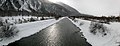
The river rises northeast of the Lunghin Pass in the Swiss Upper Engadin at an altitude of 2564 m above Lake Lunghin . The pass above the origin is a major European watershed point ( North Sea , Black Sea , Adriatic Sea ).
.jpg)
Until the confluence with the larger Flaz , the Inn (En) is also called Sela and initially flows through the Silser , Silvaplan , Champfèr and St. Moritz lakes . The small Lej da Gravatscha near the mouth of the Flaz is an important breeding area for birds. In the Lower Engadine, the Inn flows through several gorges with a significantly steeper gradient.
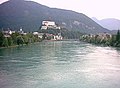
Below the Swiss-Austrian border at the Finstermünz bottleneck , its valley in the state of Tyrol is called Oberinntal and below the confluence of the Melach near Zirl Unterinntal . The Austrian-German state border runs in the middle of the river between Kufstein and Erl . Then the Inn crosses the southeast corner of Bavaria ; from the mouth of the Salzach to the city limits of Passau, it marks the German-Austrian border again . There are several large dams on the lower Inn . The Unterer Inn European reserve extends over a length of 55 kilometers . The Inn between Braunau and Schärding is the namesake for the adjacent Upper Austrian Innviertel (political districts Braunau , Schärding , Ried im Innkreis ).
.jpg)
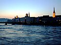
The Inn flows into the Danube in the “three-river city” of Passau . For a long time after the confluence, the green glacier melt water of the Inn, the blue Danube water and the dark moor water of the Ilz flowing into the Danube from the north remain unmixed. The rocky island of Kräutelstein , located 2.34 km below the mouth of the Inn, near the right bank, is still washed by the unmixed Inn water. It is striking how strongly the green water of the Inn pushes the water of the Danube aside. This is due to the sometimes very large amount of water in the Inn and the different depths of the two bodies of water (Inn: 1.90 meters, Danube: 6.80 meters) - "the Inn overflows the Danube".
Important places on the Inn
- Switzerland: St. Moritz , Samedan , Scuol
- Austria: Landeck , Imst , Telfs , Zirl , Völs , Innsbruck , Hall in Tirol , Wattens , Schwaz , Jenbach , Brixlegg , Rattenberg , Kundl , Wörgl , Kufstein , the flow through Bavaria follows, from here border river, Braunau am Inn , Obernberg am Inn , Schärding
- Germany: Rosenheim , Wasserburg am Inn , Mühldorf am Inn , Neuötting , Marktl , from here border river, Simbach am Inn , Passau
geology
As far as Landeck, the Inn runs through the Central Alps , mainly touching crystalline areas and entering the Engadine window with its Bündner schists near Ardez . From Fliess to Landeck it breaks through the Landeck quartz phyllite . From Landeck onwards, the Inn Valley, as a large Alps, forms the border between the Northern Limestone Alps and the Central Alps. Between Schwaz and Brixlegg, the Inn flows through the Grauwackenzone and then through the Northern Limestone Alps. At Erl it reaches the foothills of the Alps and crosses the flysch and molasse zone in Bavaria, which was shaped by the Ice Age and is characterized by moraine remains , diluvial gravel bodies and terraces. At Schärding he joins the Bohemian masses . During the cold periods, the upper and middle reaches of the valley were filled with glacial ice. Investigations on peat deposits of the Lanser See near Innsbruck show that the valley was at the latest from 15,379 ± 282 years BC. Must have been ice-free. The Rödschitz peat shifts the age of de-icing even further back to the time 16,668 ± 503 BC. In the area of the Traungletscher .
Tributaries


The following table contains all tributaries with a catchment area of more than 500 km² or a mean discharge (MQ) of more than 10 m³ / s. A comprehensive list can be found under List of tributaries of the Inn .
| inflow | page | Length + in km |
Catchment area in km² |
MQ × in m³ / s |
|---|---|---|---|---|
| Spöl | right | 28 | 310 | 10.8 |
| Sanna | Left | 53.2 | 728 | 20.0 |
| Ötztaler Ache | right | 66.5 | 894 | 31.3 |
| Sill | right | 42.2 | 855 | 24.5 |
| Ziller | right | 55.7 | 1135 | 44.5 |
| Brandenberger Ache | Left | 33.1 | 282 | 10.4 |
| Brixentaler Ache | right | 28 | 330 | 10.9 |
| Mangfall | Left | 58 | 1099 | 26.9 |
| Isen | Left | 76 | 586 | 5.6 |
| Alz | right | 150 | 2239 | 68.5 |
| Salzach | right | 225 | 6700 | 252 |
| Red | Left | 111.4 | 1200 | 9.3 |
ecology

Today the Inn has been straightened and built over long stretches, its flow route is impaired by numerous power plants; there is a longer free stretch of 150 km between Fließ and Kirchbichl . Occasionally there are still more natural sections and remains of the original alluvial forests , which are often designated as nature or landscape protection areas. On the lower Inn in the Bavarian-Upper Austrian border area, the character of the Inn has changed fundamentally from an alpine to a lowland river with large, open bodies of water as a result of the construction of power plants. In addition to these water areas, landings and extensive floodplains were created, which represent an internationally important breeding, resting and wintering area for around 300 species of birds.
The floodplains and water areas on the lower Inn are among other things designated as a European protected area.
flora

Within the flood protection dams on the lower Inn there are white willow meadows , the alluvial forests outside consist mainly of ash and gray alder , in drier areas also of sycamore maples .
The German tamarisk , which used to be widespread, has almost been eradicated by building structures; individual stocks can be found in the Mieminger and Rietzer Innauen, in the Upper Court and in the Engadin.
At the reservoirs on the lower Inn are endangered plant species fir fronds and swan flowers .
fauna
From the origin to Landeck the Inn belongs to the trout region , below to the grayling region, in the lower reaches there is a transition from the barbel to the bream region. In the Tyrolean Inn, only 17 of the original 31 fish species could now be detected. Brown trout , rainbow trout and grayling are among the species that occur in the entire Tyrolean region , while huchen , streams and eel rods are considered endangered .
In the lower Inn, the fish fauna has changed due to the construction of the power plant. In addition to the barbel , nose and huchen species that were typical in the past , fish species that prefer calmer sections of the river or stagnant waters have settled, including bream , carp , pike , rudd and roach .
The European beaver was reintroduced on the Bavarian side of the Inn reservoirs in the 1970s and has spread since then. Between the mouth of the Salzach and the mouth of the Antiesen there are around 15 areas, but the beaver has also migrated upstream to the Tyrolean Oberinntal. Gradually the otter is also settling again on the lower Inn .
The floodplains serve numerous bird species, including many endangered species, as a habitat and breeding space. Significant are u. a. Breeding population of Sandpiper , Nachtigall and treecreeper in the Silzer Innau, the flow Plover in the Innschleife at Kirchbichl, or bittern , night heron , Seidenreiher , harrier , black kite , gull , Tern , Kingfisher , Blaukehlchen , Brandgans , Weißkopfmöwe and Lachmöwe at the lower Inn.
Water quality
In Tyrol, Bavaria and Upper Austria, the Inn has water quality class II (moderately polluted) throughout , with the exception of the Tyrolean section from the confluence of the Sanna to the confluence of the Pitze , where it reaches classes I-II.
use
shipping
| Passenger shipping on the Inn | |||||||||||||||||||||||||||||||||||||||||||||
|---|---|---|---|---|---|---|---|---|---|---|---|---|---|---|---|---|---|---|---|---|---|---|---|---|---|---|---|---|---|---|---|---|---|---|---|---|---|---|---|---|---|---|---|---|---|
|
|||||||||||||||||||||||||||||||||||||||||||||

Shipping on the Inn was already available in Roman times. In 1190, Emperor Heinrich IV granted the establishment of a salt pile branch in Mühldorf am Inn. Other inns followed with various rights to trade on the Inn. The upper end point of the Inn shipping was Hall , which was thereby the most important goods transshipment point in North Tyrol and u. a. had the right to stack grain. Further up to Mötz the Inn could still be navigated with rafts (mostly downstream). In addition to the salt from Tyrol, iron ore, silver, copper, lime, wood, cloth and Tyrolean wine in particular were shipped in trains downriver to Vienna. Wood was rafted from the Engadin to Innsbruck, to the salt pan in Hall and, in some cases, to Rosenheim. Wasserburg am Inn was the most important city in the shipping industry. There and in the other cities, the shipmaster families achieved considerable prosperity.
For the journey downriver, simple, flat panels were usually built that could be sold as construction or timber at the destination. On the return journey, wheat, meat, fat and Austrian wine in particular were transported. The ships were pulled upstream by a horse leader on the towpath under the guidance of a pole rider . Six to twenty horses stretched one behind the other pulled the ships, so up to 100 tons of grain could be transported upriver on a lead ship with two to three cargo ships. The journey from Hall to Kufstein took around five hours and to Vienna just under a week. Upstream, it took four to five days to pull a truck from Kufstein to Hall.
In addition to goods, people were also transported on the Inn. For the military in particular, the river was an important and safe supply route. In 1532, 20,000 Italians and Spaniards were shipped to Vienna on 45 ships in Hall, where they were supposed to strengthen the army of Emperor Charles V against the Turks. In 1765 the body of Emperor Franz I Stephan, who died in Innsbruck, was transported on a ship from Hall to Vienna, followed by 19 ships with his wife Maria Theresa and her court.
The opening of the Lower Inn Valley Railway from Kufstein to Innsbruck in 1858 marked the end of shipping on the Inn in Tyrol. With the construction of barrages with hydroelectric power stations that did not have locks, continuous shipping became impossible. Passenger shipping takes place on the Inn only locally, for example between Neuhaus am Inn / Schärding and Passau and in Wasserburg am Inn .
From Kufstein to Niederndorf there was a tourist-oriented Inn shipping from 1998, initially with the smaller motor ship Tirol , from April 2000 with the two-screw 85-tonne 116-passenger ship St. Nikolaus until 2011. It was also discontinued because floods sometimes prevented operation, due to insufficient passenger numbers; the ship St. Nikolaus was sold to Hamburg in April 2013.
Road traffic

The Inn is not a favorable natural guideline for traffic along the entire length of its Alpine valley, on the one hand because of several bottlenecks, on the other hand because of the unfavorable longitudinal valley direction for cross-Alpine traffic; Nevertheless, its breadth and relative favorable climate make the Inn valley an economic area that was settled early on. Since there used to be only a few bridges on the wide and heavily flowing Inn, bridge tolls, mostly from wagons, for example in Zams , have been required for construction and maintenance since the Middle Ages .
Today the pass federal highway 93 and the Inn Valley motorway A 12 and the Unterinntalbahn and the Arlberg railway in the Inn Valley. The distribution function for low alpine passes such as Reschenpass and Brennerpass is beneficial to the economy on the one hand, but is increasingly burdening the valley with the environmental consequences of individual traffic . The EU limit values for air pollution control in the Lower Inn Valley are often significantly exceeded. The New Lower Inn Valley Railway is currently under construction as an access route to the Brenner Base Tunnel .
fishing
In the past, fishing on the Inn played a major economic role. Fish from the Inn and the Upper Engadine lakes were sold to Italy until the 19th century. The fishery sometimes got out of hand, so that as early as 1553 a fish order for the Duchy of Bavaria was enacted as part of the Bavarian Land Code in 1553 and printed in the same year by the brothers Alexander and Samuel Weißenhorn in Ingolstadt with high-quality woodcuts, as the fish population was almost "deserted" was. For the first time, catch restrictions and minimum dimensions (e.g. "Prüttel size", "Prüttl measure" or "Brütel size" with 10 cm or "carp measure" with 26.4 cm) were introduced. In addition, the operation of "arks" (also called "Fache"), trap-like installations in the river, was prohibited, which not only decimated the fish stocks, but also presented obstacles to shipping. Today fishing is no longer of commercial importance.
Power plants

There are several hydropower plants on the upper reaches of the Inn from the Swiss area to Landeck in Tyrol in Austria . Barrages in the lower reaches from Kufstein serve both for energy generation and for flood protection . Since these power plants do not have locks, the navigability of the Inn is severely restricted by these power plants.
The oldest Tyrolean power plant is in Kirchbichl, after more than 70 years the existing weir system is being expanded for extreme events and an additional drainage facility is being created in addition to the existing weir system. To this end, the expansion of the approximately one kilometer long headrace is planned. As a result of this and the construction of a flood relief system, the power house can be expanded by a turbine; the regular annual generation will increase by around 45 GWh from the current 131 GWh.
The Imst power plant uses a drop height of 143.5 m, which is unusually high for a run-of-river power plant, by damming the Inn in the Runserau near Fliess and directing the water through a 12.3 km long pressure tunnel across the Venet massif into the Imsterau , which makes it Innknie cuts off at Landeck.
|
Stat. + [km] |
place |
Nominal output in MW |
built (operated since) |
Flow in m / s |
Fall height in m |
Number of turbines |
operator | comment |
|---|---|---|---|---|---|---|---|---|
| 4th | Passau-Ingling | 86 | 1962 (1965) | 285 | 10.4 | 4th | Marginal power plants | |
| 19th | Schärding-Neuhaus | 96 | 1961 (1963) | 287.5 | 11.2 | 4th | Marginal power plants | |
| 35 | Egglfing-Obernberg | 80.7 | 1944 | 186 | 10.1 | 6th | VERBUND Hydro Power AG | |
| 48 | Ering-Frauenstein | 72.9 | 1942 | 352 | 9.1 | 4th | VERBUND Hydro Power AG | |
| 61 | Braunau-Simbach | 100 | 1953 | 287.5 | 12.1 | 4th | Marginal power plants | |
| 75 | Stammham | 23.2 | 1955 | 185 | 5.7 | 3 | VERBUND Hydro Power AG | |
| 83 | Perach | 19.4 | 1977 | 170 | 5.2 | 3 | VERBUND Hydro Power AG | |
| 91 | Neuötting | 26.1 | 1951 | 196 | 6.7 | 4th | VERBUND Hydro Power AG | |
| 100 | Töging | 85.3 | 1924 | 340 | 30th | 14th | VERBUND Hydro Power AG | on the Inn Canal |
| 128 | Jettenbach 1 | 0.4 | 1994 | 5 | 8.4 | 1 | VERBUND Hydro Power AG | |
| 128 | Jettenbach 2 | 5.0 | 1994 | 37.5 | 8.4 | 2 | VERBUND Hydro Power AG | |
| 137 | Gars on the Inn | 25th | 1938 | 90 | 7.2 | 5 | VERBUND Hydro Power AG | |
| 147 | Teufelsbruck | 25th | 1938 | 90 | 7th | 5 | VERBUND Hydro Power AG | |
| 160 | Moated castle | 24.1 | 1938 | 95 | 7th | 5 | VERBUND Hydro Power AG | |
| 173 | Feldkirchen | 38.2 | 1970 | 178 | 8.7 | 3 | VERBUND Hydro Power AG | |
| 188 | Rosenheim | 35.1 | 1960 | 215 | 8.3 | 3 | VERBUND Hydro Power AG | |
| 199 | Nussdorf | 47.9 | 1982 | 550 | 11.7 | 2 | Innwerk AG | |
| 211 | Oberaudorf-Ebbs | 59 | 1992 | 580 | 12.4 | 2 | Marginal power plants | |
| 223 | Langkampfen | 31.5 | 1998 | 425 | 8.3 | 2 | TIWAG | |
| 233 | Kirchbichl | 23 | 1941 | 250 | 9.7 | 3 | TIWAG | Diversion power plant |
| 383 | Imst | 89 | 1956 | 85.3 | 143.5 | TIWAG | Diversion power plant | |
| ~ 425 | Scuol | 288 | 1970/1994 | 72 | Engadine power plants | Diversion power plant | ||
| ~ 466 | S-chanf / Ova-Spin | 50 | 1970 | 29 | Engadine power plants | Diversion power plant | ||
| ~ 486 | St. Moritz | 4.36 | 1932 | St. Moritz electrical works |
leisure

In the upper reaches of the Inn, the Inn offers a wide range of opportunities for water sports , especially white water paddling and rafting , on the Upper Engadine lakes ( Lake Sils , Lake Silvaplana and Lake St. Moritz ) and the like. a. for windsurfing and kitesurfing . A popular section with white water sports enthusiasts is the 5 km long Imster Gorge , the level of difficulty of which is between WW II-III and III-IV depending on the water level.
There are long, connected stretches of cycle paths along the flood dams. The Inn cycle path follows the course of the river from Maloja to the mouth. There are many quarry ponds along the Inn that were created through gravel extraction. Passenger ships operate locally. The Inn Museum in Rosenheim documents the history of the Inn and the Inn shipping .
Extraction of inn gold
A special feature from the history of use was the extraction of gold from the sand of the Inn to mint river gold ducats . They can be recognized by the legend EX AURO OENI (= from the gold of the Inn).
gallery

Inn bridge at Silvaplana
The young Inn near Bever in the Engadin

The Inn near Susch in the Lower Engadine

The Inn in Ried im Oberinntal

The Inn near Brixlegg

Dredger in the reservoir near Langkampfen
The Inn near Kufstein
The Inn near Wasserburg
The Inn near Mühldorf am Inn

The Inn near Neuhaus Castle


See also
literature
- Franz Hafner: Inn - The green river from the Alps. Film documentation, Austria, 2011. 45 min. Station information with many pictures, media library.
- A. Stancik, H. Schiller, O. Behr et al .: Hydrology of the River Danube / Hydrologie der Donau. Joint research project of the Danube countries and the IHD , 272 pages, Priroda Verlag, Bratislava 1988.
- Valentin Weber-Wille, Manfred Wehdorn: Architecture at VERBUND. Die Bavarian Innkraftwerke , Volume 105 of the publication series Research in VERBUND AG, self-published, Vienna 2012, ISBN 3-9502188-6-6 .
- Josef Grünberger: Land am Inn - From the origin to the mouth. Tyrolia Verlag 2004, ISBN 3-7022-2586-2 .
Web links
- Inn on the ETHorama platform
Individual evidence
- ↑ Geoserver of the Swiss Federal Administration ( information )
- ^ German Hydrological Yearbook Danube Region 2006 Bavarian State Office for the Environment, p. 302, accessed on October 4, 2017, at: bestellen.bayern.de (PDF, German, 24.2 MB).
- ↑ a b c d e f Land Tirol / Ministry of Life Austria: The Inn and its catchment area (PDF; 3.7 MB)
- ↑ Martina measuring station 1970–2016 (PDF) Federal Office for the Environment FOEN
- ↑ Federal Ministry for Agriculture, Forestry, Environment and Water Management (ed.): Hydrographisches Jahrbuch von Österreich 2009. 117th volume. Vienna 2011, p. OG 99, PDF (12.1 MB) on bmlrt.gv.at (2009 yearbook)
- ^ Deutsches Gewässerkundliches Jahrbuch Danube region 2006 Bavarian State Office for the Environment, p. 225, accessed on October 4, 2017, at: bestellen.bayern.de (PDF, German, 24.2 MB).
- ↑ a b German Hydrological Yearbook Danube Region 2006 Bavarian State Office for the Environment, p. 227, accessed on October 4, 2017, at: bestellen.bayern.de (PDF, German, 24.2 MB).
- ↑ Itinerarium Antonini
- ↑ Claudius Ptolemy 2.11.5
- ↑ Water flow of the Danube at the mouth of the Inn ( page no longer available , search in web archives ) Info: The link was automatically marked as defective. Please check the link according to the instructions and then remove this notice. in the profile of the Danube water volume ( cooperation and implementation of the EU WFD in the catchment area of the Danube , information event on water management cooperation and objectives in the development cooperation area of the Danube , Sigmaringen, January 25, 2006)
- ↑ Wolf-Armin Frhr. v. Reitzenstein : Lexicon of Bavarian place names. Origin and meaning . CH Beck, Munich 2006, ISBN 3-406-55206-4 , p. 123 .
- ↑ a b Otto Stolz: History of the waters of Tyrol. Schlern-Schriften, Volume 32, Innsbruck 1932, pp. 6-14 and 83-88 ( digitized version )
- ^ Arnaud Vendryes: L'Ain: le nom d'une rivière à travers les sources. In: Société d'Emulation du Jura, Travaux 2015, pp. 147–168
- ↑ a b List of stream and river areas in Bavaria - Inn river area, page 1 of the Bavarian State Office for the Environment, as of 2016 (PDF; 2.8 MB)
- ↑ Markus Weber, Ludwig Braun, Wolfram Mauser, Monika Prasch: The significance of glacier melt for the discharge of the Danube now and in the future . In: Information sheet of the Hydrographic Service in Austria, No. 86 (2009), pp. 1–30 ( PDF; 6.1 MB ( Memento from November 12, 2013 in the Internet Archive ))
- ↑ Reinhard Wimmer, Harald Wintersberger, Günter A. Parthl: Hydromorphologische Leitbilder. River typing in Austria. Volume 3: Great Rivers. Federal Ministry of Agriculture, Forestry, Environment and Water Management, Vienna 2012 ( PDF; 2.3 MB ( Memento from December 22, 2014 in the Internet Archive ))
- ^ Sigmar Bortenschlager : Contributions to the vegetation history of Tyrol I. Inner Ötztal and lower Inntal , in: Reports of the Natural Science Medical Association, Innsbruck 71 (1984) 19–56 ( online , PDF).
- ↑ Dirk van Husen: On the facies and stratigraphy of the Jungpleistocene deposits in the Trauntal , in: Yearbook of the Federal Geological Institute 120 (1977) 1–130.
- ↑ a b c d e f Office of Upper Austria. Provincial government, nature conservation department (ed.): Nature and landscape - models for Upper Austria. Volume 27: Inntal room unit. Revised Version, Linz 2007 ( PDF; 6.5 MB )
- ↑ Tyrolean protected areas: Mieminger - Rietzer Innauen ( Memento from October 26, 2014 in the Internet Archive )
- ↑ Urs Landergott: Floodplain development on the Inn since the Pradella - Martina power plant level went into operation (1993-2010). Report on behalf of Engadiner Kraftwerke AG. Zurich 2011 ( online )
- ^ BMLFUW: Reservoirs on the Lower Inn
- ↑ General information on the fishes in the Inn , uner-inn.at (PDF; 426 kB)
- ↑ The European beaver (Castor fiber) , Unser-inn.at (PDF; 36 kB)
- ↑ Walter Sage: The otter Lutra lutra on the "Lower Inn". Situation and outlook. In: Mitteilungen der Zoologischer Gesellschaft Braunau, Volume 10, No. 3 (2012), pp. 271–279 ( PDF; 344 kB )
- ↑ Tyrolean protected areas: Silzer Innau
- ↑ Little Ringed Plover , Unser-inn.at (PDF; 90 kB)
- ↑ Federal Ministry of Agriculture, Forestry, Environment and Water Management (ed.): Saprobiological water quality of the flowing waters of Austria. Status 2005, p. 3 ( PDF; 1 MB ( Memento from December 22, 2015 in the Internet Archive ))
- ↑ Bavarian State Ministry for Environment, Health and Consumer Protection and Ministry for Environment and Transport Baden-Württemberg (Ed.): Implementation of the European Water Framework Directive 2000/60 / EG (WFD) Report on the inventory for the German Danube region. Munich 2005, p. 58 ( PDF; 2.1 MB )
- ↑ a b Land Tirol / Austrian Ministry of Life: Waterway Inn (PDF; 3.7 MB)
- ^ A b Paul Eugen Grimm: Inn. In: Historical Lexicon of Switzerland .
- ↑ Inn shipping on Tirol Multimedial
- ↑ The last journey of the St. Nikolaus on the Inn 2011 ( memento from February 16, 2012 in the Internet Archive ), tirol-schiffahrt.at
- ↑ Ship St. Nikolaus started journey to Hamburg at mein district.at, April 30, 2013, accessed February 3, 2018 - Photo report of the excavation at the Langkampfen Inn power plant located above Kufstein and road transport.
- ↑ Inn shipping finally discontinued orf.at, November 9, 2011, accessed February 3, 2018.
- ^ Federal Environment Agency (ed.): Program according to § 9A IG-L for the state of Tyrol. Report REP-0119, Vienna 2010 ( PDF; 5.9 MB )
- ↑ This Vischordnung, as it is supposed to be kept on the Thunaw and every other half in Vnserm Principality, is considered to be the first German print that contains a lifelike representation of fish. See Heinrich Grimm: New contributions to the "fish literature" of the XV. to XVII. Century and through their printer and bookkeeper. In: Börsenblatt for the German book trade - Frankfurt edition. No. 89, November 5, 1968 (= Archive for the History of Books. Volume 62), pp. 2871–2887, here: pp. 2876–2878 and 2882.
- ↑ Archen: "Poles of about 250-300 quart feet tall, which were built from the banks in streams and lakes for fishing." Heinrich Grimm: New contributions to the "fish literature" of the XV. to XVII. Century and through their printer and bookkeeper. 1968, pp. 2878, 2880 and 2882.
- ↑ TIWAG plans to expand the Kirchbichl power plant ( Memento from March 28, 2014 in the Internet Archive )
- ↑ a b TIWAG: Imst power plant
- ↑ Innsbruck and the flood. (PDF) Retrieved January 13, 2017 .
- ↑ a b Innsbruck and the flood. (PDF) Retrieved January 13, 2017 .
- ↑ TIWAG: Langkampfen power plant ( Memento from August 8, 2013 in the Internet Archive )
- ↑ TIWAG: Kirchbichl power plant ( Memento from August 8, 2013 in the Internet Archive )
- ↑ Innsbruck and the flood. (PDF) Retrieved January 13, 2017 .
- ↑ Imster Schlucht on kajaktour.de
- ^ Paul Arnold, Harald Küthmann, Dirk Steinhilber: Large German coin catalog from 1800 to today , Augsburg 1997: p. 54, Bavaria, no.68, inn gold ducats from 1830
Rivers with a total length of more than 30 km:
Aare |
Albula |
Allaine |
Old Rhine |
Arbogne |
Areuse |
Swiss stone pine |
Birs |
Brenno |
Broye |
Calancasca |
Doubs |
Drance de Bagnes |
Thinning |
Emme |
Engelberger Aa |
Ergolz |
Glâne |
Smooth |
Glenner (Glogn) |
Hinterrhein |
Inn (En) |
Julia (Gelgia) |
Kander |
Little Emme |
Landquart |
Land water |
Langete |
Limmat |
Linth |
Lorze |
Maggia |
Mentue |
Moësa |
Muota |
Murg |
Necker |
Orbe |
Petite Glâne |
Plessur |
Rabiusa |
Reuss |
Rhine |
Rhone |
Saane |
Schüss (Suze) |
Seez |
Scythe |
Sihl |
Simme |
Sitter |
Sorne |
Suhre |
Talent |
Tamina |
Ticino (Ticino) |
Thur |
Töss |
Venoge |
Verzasca |
Vispa |
Vorderrhein |
Wigger |
Wyna
![]() Islas |
S-chanf-Pradella |
Pradella-Matina |
Community power plant Inn |
Imst |
Kirchbichl |
Langkampfen |
Oberaudorf-Ebbs |
Nussdorf |
Rosenheim |
Feldkirchen |
Moated castle |
Teufelsbruck |
Gars |
Jettenbach |
Töging |
Neuötting |
Perach |
Stammham |
Braunau-Simbach |
Ering-Frauenstein |
Egglfing-Obernberg |
Schärding-Neuhaus |
Passau-Ingling
Islas |
S-chanf-Pradella |
Pradella-Matina |
Community power plant Inn |
Imst |
Kirchbichl |
Langkampfen |
Oberaudorf-Ebbs |
Nussdorf |
Rosenheim |
Feldkirchen |
Moated castle |
Teufelsbruck |
Gars |
Jettenbach |
Töging |
Neuötting |
Perach |
Stammham |
Braunau-Simbach |
Ering-Frauenstein |
Egglfing-Obernberg |
Schärding-Neuhaus |
Passau-Ingling![]()
![]()
![]()
![]()
![]()
![]()
![]()
![]()
Planned: Imst-Haiming (2025)