Lunghin Lake
| Lunghinsee (Lägh dal Lunghin) | ||
|---|---|---|

|
||
| Lunghin Lake | ||
| Geographical location |
Albula Alps Graubünden Switzerland |
|
| Tributaries | small mountain streams | |
| Drain | Inn | |
| Data | ||
| Coordinates | 771 849 / 143099 | |
|
|
||
| Altitude above sea level | 2485 m above sea level M. | |
| surface | 5.168 hectares | |
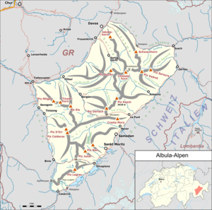
The Lunghinsee or Lägh dal Lunghin (in Bergell dialect) is a small lake in the Albula Alps at 2,485 m above sea level. M. above Maloja in the canton of Graubünden . It has an area of approx. 5.2 hectares
The lake is about 300 m below the Piz Lunghin summit and the Lunghin Pass , which is the most important watershed point in Europe. The lake is considered the source of the river Inn , which flows from here into the Silsersee and 517 km later flows into the Danube in Passau .
Web links
Commons : Lunghinsee - Collection of images, videos and audio files
- Lunghinsee on the ETHorama platform
- Lunghinsee on schweizersee.ch
