
Plessure


| ||
Source and mouth of the Plessur
|
The Plessur is a 33 km long river in the Swiss canton of Graubünden . It rises in the area of the municipality of Arosa in the Plessur Alps , flows through the Schanfigg and flows into the Alpine Rhine in the canton capital Chur .
Headwaters and lakes through which it flows
In the headwaters between Älplisee , Totseeli and the Erzhorn - Aroser Rothorn - Älplihorn area , the Plessur practically only has water during the snowmelt or after heavy rainfall. The rest of the time, it flows underground and only emerges shortly before the Mulde of the Älpisee. Its outflow is partly below the surface, so that the plessure is only permanently visible in the Chlus above the Schwellisee . Below the Schwellisees, in the Büalatobel , the Herrabächli flows from the Untera Wasserboda into the Plessur. In Gründji above the elbow macaroni -Express -Talstation flowing Gampibach , below the Alpatobelbach to before the Büdemji the source of the water in the Aroser Bärabadschanze sub Berg ( Schafrügg to join). At Müliboda , the Melchernabach , in the Isel the Welschtobelbach and - coming from the Untersee - the Seebach and the Plessur join before it flows into the Arosa reservoir . The Furggabach , which comes from the Maienfelder Furgga, flows directly into the lake. The Plessur leaves the reservoir via Schwellwuhr / Schluck in the direction of Langwies .
Further tributaries
- Schwarzseebach ( left )
- Wissbach (Usserwald) ( left )
- Wissbach ( Grüenseeli ) ( right )
- Seebach ( Unter Prätschsee ) ( left )
- Tiejer Bach ( right )
- Büelenbach ( right )
- Sapüner Bach ( right )
- Platzbach ( right )
- Pirigerbach ( right )
- Gründjitobelbach ( right )
- Matteltjibach ( left )
- Frauentobelbach (right)
- Ruchbach ( left )
- Farbtobelbach ( right )
- Telf ( right )
- Trümmelatobelbach ( left )
- Rungser Rüfibach ( left )
- Pardielertobelbach ( right )
- Grosstobelbach ( right )
- Grossbach ( left )
- Rüfinalertobelbach ( left )
- Gadenstetter brooks ( left )
- Clasauerertobelbach ( right )
- Sagenbach ( left )
- Pajüelbach ( left )
- Schelmentobelbach ( right )
- Prader brooks ( left )
- Castielertobelbach ( right )
- Calfreisertobelbach ( right )
- Sagentobelbach ( left )
- Steinbach ( left )
- Rabiosa ( left )
- Nasstobelbach ( right )
bridges
On the route of the Arosabahn , the Plessur near Langwies is crossed by the Rhaetian Railway . The striking Langwieser Viaduct , completed in 1914 by the engineer Eduard Züblin, spans the Plessur and the Sapüner / Fondeierbach flowing there at a height of 62 m and a length of 287 m. As the second major crossing, the St. Luzibrücke is planned as a new route for the Schanfiggerstrasse before the gates of Chur .
Historical

The origin of the name "Plessur" is unclear, it may even have a pre-Roman character. According to old documents, the Plessur was also called Schanfigger Rhein or Aroser Wasser in the past . In the Walser settlements of Arosa, Langwies and Praden , the terms Landwasser and Landtbach were also used .
In the year 1300 the Plessur caused a great water shortage in Chur. In 1570 the Plessur broke out in a storm and severely damaged the area around Chur. The damage was estimated at over 1,000 crowns. In 1584, too, floods caused damage in Chur. A chronicler wrote: The townspeople were called to the weir. They had to cut down many fertile trees to swell the water in front of the city.
On 6./8. July 1861 the raging Plessur at midnight startled the Chur population from their sleep. The Plessurfall and the Totenbrücke were destroyed. The city poor house, 45 meters from the bank, was under water a good 1.5 meters.
Today the Plessur in the area of the city of Chur, for example at Plessurquai , is heavily canalized and no longer poses a threat.
Varia
In the absence of other options, the EHC Chur played partly in the area of the Lindenquais on the frozen Plessur in the winter of 1937/38.
Picture gallery

Headwaters of the Plessur on the Aroser Rothorn

At the Schwellisee

At the former Plessurschanze
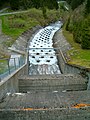
In the Schlugg at the Schwellwuhr dam (Arosa reservoir)

Plessur at the Langwieser Viaduct

Plessurfall in Chur

Muzzle into the Rhine


literature
- Ernst Rahm: The Arosa Lakes , Arosa printing house, Arosa 1982, p. 14.
Web links
- Jürg Simonett: Plessur. In: Historical Lexicon of Switzerland .
- Website Fischzucht Plessur
Individual evidence
- ↑ a b Geoserver of the Swiss Federal Administration ( information )
- ↑ Evaluations of the water network. (XLSX) FOEN , December 2013, accessed on August 9, 2017 (listing of Swiss rivers> 30km).
- ↑ Topographical catchment areas of Swiss waters: sub-catchment areas 2 km². Retrieved August 4, 2018 .
- ↑ Plessur - Chur. (PDF) In: Federal Office for the Environment. Retrieved May 28, 2019 .
- ↑ Hans Danuser : Arosa place and field names with inclusion of the Welschtobel and some areas near the border of neighboring communities, self-published Danuser, Arosa 2011, ISBN 3-905342-49-9 , p. 77.
- ↑ Rheinzeitung of November 13, 2013, p. 3.
Rivers with a total length of more than 30 km:
Aare |
Albula |
Allaine |
Old Rhine |
Arbogne |
Areuse |
Swiss stone pine |
Birs |
Brenno |
Broye |
Calancasca |
Doubs |
Drance de Bagnes |
Thinning |
Emme |
Engelberger Aa |
Ergolz |
Glâne |
Smooth |
Glenner (Glogn) |
Hinterrhein |
Inn (En) |
Julia (Gelgia) |
Kander |
Little Emme |
Landquart |
Land water |
Langete |
Limmat |
Linth |
Lorze |
Maggia |
Mentue |
Moësa |
Muota |
Murg |
Necker |
Orbe |
Petite Glâne |
Plessur |
Rabiusa |
Reuss |
Rhine |
Rhone |
Saane |
Schüss (Suze) |
Seez |
Scythe |
Sihl |
Simme |
Sitter |
Sorne |
Suhre |
Talent |
Tamina |
Ticino (Ticino) |
Thur |
Töss |
Venoge |
Verzasca |
Vispa |
Vorderrhein |
Wigger |
Wyna