
Churwalden
| Churwalden | |
|---|---|
 |
|
| State : |
|
| Canton : |
|
| Region : | Plessure |
| BFS no. : | 3911 |
| Postal code : | 7074 Malix 7075 Churwalden 7076 Parpan |
| Coordinates : | 760 722 / 183251 |
| Height : | 1230 m above sea level M. |
| Height range : | 624–2681 m above sea level M. |
| Area : | 48.53 km² |
| Residents: | 1949 (December 31, 2018) |
| Population density : | 40 inhabitants per km² |
| Website: | www.churwalden.ch |
 Churwalden |
|
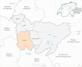
| Location of the municipality | |
  |
|
Churwalden ( Romansh outdated Curvalda ) is a municipality in Churwaldnertal and belongs to Region Plessur in the Swiss canton of Grisons . Since January 1, 2010, the municipality of Churwalden has consisted of the merged municipalities of Churwalden, Malix and Parpan .
geography

Churwalden is 8 km south of the canton capital Chur on the pass path to Lenzerheide . The municipal area comprises two sections of opposite landscape of the valley, which runs from south to north and is traversed by the Rabiosa , a left tributary of the Plessur . The river, whose name means "the raging", arises from several source streams in the area of a 1200 m wide basin between the Stätzerhorn chain in the west and the Rothorn chain in the east. On the left side of the valley, the territory on the Stätzerhorn (2574 m, highest point in the municipality) and Fulhorn (2529 m) reach the ridge, on the right slope, which climbs in several stages, it extends to the Täliflue (2301 m), which joins the Gürgaletsch, the northernmost foothills of the Rothorn chain, upstream. Down the valley, the Rabiusa created a narrow, largely pathless gorge through erosion of the soft layers of Bündner slate . Here the course of the river separates the communities; only the right side of the valley belongs to Churwalden. The Rabiosa flows into the Plessur near Araschga in Meiersboden , at 630 m the lowest point in the municipality, which forms the northern border of Churwalden over a length of almost 2 km (upstream to the Steinbachtobel ).
The village of Churwalden in the area of the valley basin, originally a scattered settlement, has developed into an approximately 2 km long street village as a result of construction activity in the 20th century. The community includes the surrounding hamlets of Stettli, Brugg, Pradaschier, Lax and Egga, a number of individual farmsteads and Maiensässen on the terraces on the right side of the valley, the Kurhaus Passugg near the mouth of the Rabiusa and the houses in Meiersboden.
Neighboring communities are Chur , Tschiertschen-Praden , Vaz / Obervaz , Almens , Tomils and Domat / Ems .
coat of arms

Blazon: Blue bars in gold, topped with a six-pointed golden star.
With the merger on January 1, 2010, the new community received a new coat of arms. The symbols of the individual communities were integrated into a coat of arms. The colors are those of the Ten Judgment League .
The star already used in the court seal in 1550 also appears in the district coat of arms.
history

Nucleus of the settlement was probably around 1150 by the barons of Vaz founded Norbertine abbey monastery Churwalden , a daughter house in southern Germany Roggenburg . The monastery located at the northern end of today's village is documented in 1149 as S. Maria in silva Augeria, in 1191 as Curwalde . In 1295 an earthquake with severe building damage occurred in the epicentral area (intensity VIII).
During the Reformation in 1527, the monastery property was confiscated and the convent was effectively abolished, even if an abbot was in office until 1599 and then an administrator of the mother monastery until 1803. The former monastery church served both denominations as a parish church until 1967.
Secular rule, the center of which was Strassberg Castle 3 km north of Churwalden, came from the Vazern to the Toggenburgs and in 1477 to the House of Habsburg . In the three leagues , the Churwalden dish (with Malix, Parpan and Tschiertschen, but without Praden) belonged to the ten-court league . In 1649 Austria was ransomed.
In addition to agriculture, pass traffic played an important role. The transports over the Lenzerheide , which forms a section of the historical transit route from Chur to the Julier and Septimer passes , were carried out by Port Lenz. From the middle of the 19th century, Churwalden developed into a climatic health resort, and since the 1960s, winter sports took off thanks to the neighboring villages of Lenzerheide and Valbella.
population
| Population development | |||||||
|---|---|---|---|---|---|---|---|
| year | 1623 | 1850 | 1900 | 1950 | 1990 | 2000 | 2016 |
| Residents | 575 | 695 | 620 | 815 | 1247 | 1236 | 1998 |
1949 inhabitants currently live in Churwalden (as of December 31, 2018). However, this number can vary widely within a year. In the winter months, the number of residents increases rapidly, as many seasonal workers come from all parts of Europe to work in winter sports businesses and hotels.
Churwalden is a denominational traditional parity village with a Reformed - Catholic mixed population. The monastery church was used by both denominations at the same time until the reformed church was rebuilt in the 1960s; Since then it has been in Catholic possession, and is also used as an abdication church for residents of all denominations.
politics
The Churwalden community council has seven members (including the community president). Ralf Kollegger is mayor (as of 2010). A community meeting takes place several times a year .
Taxes
The tax rate of the municipality Churwalden is from the tax year 2007 108% of the basic cantonal tax of Grisons. At the community meeting on November 28, 2006, this was reduced by 115%. With the merger of the municipalities of Churwalden, Malix and Parpan to form the new municipality of Churwalden, the tax rate could be reduced to 90% of the simple cantonal tax in Graubünden.
economy
The municipality of Churwalden offers a well-developed infrastructure. In the community there are several craft and service companies, an electricity company, construction companies, meat dryers and the mineral water company in Passugg . There are also hotel restaurants, dining restaurants, mountain restaurants open in summer and winter, an international hotel and tourism school in Passugg, a retirement and nursing home and two warehouses. There is also a doctor's practice, a heated outdoor pool, bank branches, a tourist office and a teaching and demonstration power plant.
In the agricultural sector, there are seven larger dairy farms, two smaller dairy farms, two suckler cow farms, two rearing farms and two sheep breeding farms.
education
The Fontana Passugg educational facility and the Swiss School of Tourism and Hospitality are located on Churwalden territory .
traffic
The community is connected to the public transport network by the hourly postbus courses on the Chur – Lenzerheide line (sometimes further to Bivio - St. Moritz or Davos ). Passugg is on the Chur – Tschiertschen line . Meiersboden, where there is a civil defense training center, is served by the Chur city bus.
tourism
Winter tourism is vital for the entire Lenzerheide region (Malix, Churwalden, Parpan, Valbella and Lenzerheide).

The Alp Stätz and Pradaschier snow sports areas can be reached quickly and easily from Churwalden. The toboggan run and the rope park are in operation all year round. In the region there are also cross-country ski trails, a natural ice rink and groomed winter hiking trails. Churwalden has been part of the Arosa Lenzerheide ski area since winter 2013/14 .
Even in summer there are numerous opportunities for recreational activities. Either you go on the longest toboggan run on rails (3.1 km) from Pradaschier to Churwalden, or you go climbing on the rope park in Pradaschier. There is also a heated outdoor pool, three tennis courts and various bike and hiking opportunities.
Attractions


The former Premonstratensian monastery church of St. Maria and Michael, today's Catholic parish church , was built at the end of the 15th century after the previous Romanesque building burned down in 1472. The layout of the late Gothic church is similar to the Chur cathedral; The nave and choir are separated by a rood screen. The winged altar from 1477 comes from southern Germany.
The reformed village church from 1968 is a modern sacred building .
The buildings of the district school Churwalden and the gymnasium were designed by the Swiss architect Peter Zumthor .
Personalities
- Friedrich Brügger (born March 21, 1854 in Churwalden, † January 29, 1930 in Chur ), Swiss corps commander
- Heini Hemmi (born January 17, 1949 in Churwalden), former Swiss ski racer and Olympic champion
literature
- Jürg Simonett: Churwalden (community). In: Historical Lexicon of Switzerland .
- Florian Hitz: Churwalden (monastery). In: Historical Lexicon of Switzerland .
- Erwin Poeschel : The art monuments of the canton of Graubünden II. The valley communities Herrschaft, Prättigau, Davos, Schanfigg, Churwalden, Albula valley. (= Art Monuments of Switzerland. Volume 9). Edited by the Society for Swiss Art History GSK. Bern 1937. DNB 811066703 .
- Uta Bergmann: Swiss Art Guide GSK, Volume 611: The former Premonstratensian Monastery Church of St. Maria and Michael Churwalden , Bern 1997, ISBN 3-85782-611-3
- Helvetia sacra Volume IV / 3: The Premonstratensians in Switzerland, edited by several authors, edited by Bernard Andenmatten and Brigitte Degler-Spengler , Basel 2002. pp. 271–329. Authors: Jürg L. Muraro, Silke Redolfi.
Web links
- Official website of the municipality of Churwalden
- Churwalden on the ETHorama platform
Individual evidence
- ↑ Permanent and non-permanent resident population by year, canton, district, municipality, population type and gender (permanent resident population). In: bfs. admin.ch . Federal Statistical Office (FSO), August 31, 2019, accessed on December 22, 2019 .
Arosa | Chur | Churwalden | Haldenstein | Tschiertschen-Praden
Former municipalities: Calfreisen | Castiel | Hof Chur | Langwies | Lüen | Maladers | Malix | Molinis | Pagig | Parpan | Peist | Praden | St. Peter-Pagig | St. Peter | Tschiertschen
Canton of Graubünden | Regions of the Canton of Graubünden | Municipalities of the Canton of Graubünden