St. Peter GR
| GR is the abbreviation for the canton of Graubünden in Switzerland and is used to avoid confusion with other entries of the name St. Peter . |
| St. Peter GR | ||
|---|---|---|
| State : |
|
|
| Canton : |
|
|
| Region : | Plessure | |
| Political community : | Arosa | |
| Postal code : | 7028 | |
| Coordinates : | 767 418 / 189251 | |
| Height : | 1253 m above sea level M. | |
| Area : | 6.90 km² | |
| Residents: | 168 (December 31, 2007) | |
| Population density : | 24 inhabitants per km² | |
| Website: | www.stpeter-pagig.ch | |
| map | ||
|
|
||
St. Peter is a town in the Plessur region and a locality in the municipality of Arosa in the canton of Graubünden . Until 2008 St. Peter was an independent parish.
geography
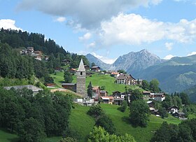
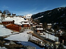
St. Peter, nine kilometers (as the crow flies) east of Chur on the northern side of the Schanfigg valley, consists of several hamlets on the cantonal road to Arosa and numerous individual farms. The most important hamlets are St. Peter (west quarter with the church, 1253 m above sea level and east quarter, 1259 m), Lavein (1274 m) and Cufa (1263 m). Above is Fatschel (1515 m), a former Maiensäss that has become the tourist center of the municipality and is now inhabited all year round.
Apart from a small corner in the very south-west, where the former municipal area met the Plessur valley river in the area of the Sandgrind mountain nose , St. Peter and the neighboring municipality of Molinis decided to define the common border along the Chur – Arosa railway line, which was opened in 1914. Above this, the territory extended as a narrow strip, bounded in the west by Grosstobel and Pardieler Tobel , including the shoulder of the Fatschazer Tobel in the east , up to the ridge of the Hochwang chain , where the Cunggel ( 2,416 m above sea level ) the highest point the community represented. To the west of it, the Dängelstöck ( 2360 m above sea level ) forms the border.
Of the total local area of 688 hectares, 420 hectares are agriculturally usable, 350 hectares of which are alpine pastures. In addition, 207 hectares are covered by forest and wood and 32 hectares of mountains. The remaining community area was the 29 hectares of settlement area.
coat of arms
| Description : In a blue pole as asked , fallen golden (yellow) key . The key is the attribute of St. Peter , who is the patron of the oldest parish church in Schanfigg, and indicates the name of the parish. Colors of the Ten Court Association . |
history
The church of St. Peter , mother church of the outer valley section populated by Romans, is mentioned in a document in 831 as the property of the Pfäfers monastery . In the three leagues , the place belonged as the neighborhood of the Ausserschanfigg court to the ten-court league. Little by little, the other neighborhoods built their own churches, but St. Peter retained its central importance as a regional parish of the valley. Around 1530 the village joined the Reformation ; At the end of the 16th century, there was a transition from Romansh to German.
St. Peter was an independent political municipality . Neighboring communities were Pagig , Furna , Peist and Molinis . In 2008 it was combined with the neighboring village of Pagig out of the valley to form the municipality of St. Peter-Pagig . This community, along with other neighboring communities, came to Arosa as early as 2013 . Since then, St. Peter has been run partly as an independent village (according to the official register of localities ), partly together with Pagig (Arosa municipality: St. Peter and Pagig ).
From 1851 until the beginning of the 21st century, St. Peter was the venue for the Bsatzig im Schanfigg .
population
Population development
| year | 1850 | 1900 | 1950 | 2000 | 2005 |
| population | 108 | 115 | 161 | 154 | 163 |
Of the 156 residents at the end of 2004, 140 (= 90%) were Swiss citizens.
Economy and Transport
St. Peter forms the center of the Hochwang winter sports area with 20 km of ski slopes. There is a chairlift from the Fatschel valley station and a drag lift.
As of 2000–01, 11 people were employed in agriculture and forestry, 7 in the commercial sector and 26 in the service sector.
St. Peter is connected to the public transport network through the St. Peter-Molinis station on the Chur – Arosa railway line of the Rhaetian Railway and, since May 5, 1957, with several stops on the current Chur – Peist postbus line on Schanfiggerstrasse .
Attractions
The landmark of St. Peter is the massive church tower , formerly a free-standing defensive tower. Parts of the nave walls still come from the first church building from the 9th century; the church received its current character with a polygonal choir and carved wooden ceiling in the nave in the 15th century. In 1922 frescoes that were created between 1500 and 1510 were uncovered.
literature
- Jürg Simonett: Sankt Peter (GR). In: Historical Lexicon of Switzerland .
- The municipalities of the canton of Graubünden. Chur / Zurich, 2003. ISBN 3-7253-0741-5 .
- E. Rud: The Schanfigg. Buchdruckerei AG Arosa, Arosa undated (around 1920).
- Dr. C. Fischer: Land and people in the Schanfigg valley. Manatschal Ebner & Cie., Chur 1905.
- Erwin Poeschel : The art monuments of the canton of Graubünden. Volume II: The valleys of Herrschaft, Prättigau, Davos, Schanfigg, Churwalden, Albula Valley (= Swiss art monuments. Volume 9). Edited by the Society for Swiss Art History GSK. Bern 1937. DNB 811066703 .
- Peter Masüger: From Old Rhaeto-Romanic to «Tschalfiggerisch». In: Terra Grischuna 48/1 (1990) ISSN 1011-5196 .
- Christian Patt: Schanfigger words. A supplement to the Davos dictionary. Walservereinigung Graubünden publisher, Chur 1986.
- Hans Danuser / Walser Association Graubünden (ed.): Old ways in Schanfigg. Publishing house Walser Association Graubünden, Splügen 1997.
Web links
Individual evidence
-
↑ 7028 (00) St. Peter. map.geo.admin.ch, accessed December 4, 2017;
Although St. Peter has the same postcode (the criterion of an official location) as Pagig (7028), the post-internal 6-digit postcode is 702800, Pagig's 702801. - ^ Localities of Arosa. gemeindearosa.ch, accessed November 29, 2017.
- ↑ Bündner Woche, May 22, 2013, p. 35.
- ^ Reformed Church of St. Peter


