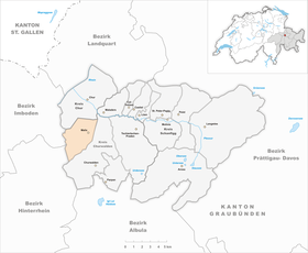
Malix
| Malix | ||
|---|---|---|
| State : |
|
|
| Canton : |
|
|
| Region : | Plessure | |
| Political community : | Churwalden | |
| Postal code : | 7074 | |
| former BFS no. : | 3912 | |
| Coordinates : | 759 814 / 186764 | |
| Height : | 1116 m above sea level M. | |
| Area : | 12.56 km² | |
| Residents: | 731 (December 31, 2009) | |
| Population density : | 58 inhabitants per km² | |
|
On the right in the background Malader , on the right below the tower of the ruins of Strassberg Castle |
||
| map | ||
|
|
||
Malix was a municipality in the former county Churwalden , district Plessur of the Swiss canton of Grisons . On January 1, 2010, the municipalities of Churwalden, Malix and Parpan merged to form the municipality of Churwalden .
geography
Malix is four kilometers (as the crow flies) south of Chur in the Churwaldnertal on the road to Lenzerheide . The municipality covers the left flank of the lower Churwalden valley from the Rabiusa river (lowest point at the Passugger mill, 760 m above sea level ) to the ridge of the northern foothills of the Stätzerhorn chain with the Dreibündenstein . There, in the very south-west of the territory, on the Windegga, the highest point at 2282 m is reached. In addition to the clustered village of Malix, which is located on a slope, the community also includes the hamlets of Kreuz (north, on the road to Chur) and Spina (south-west, on the gorge of the same name) as well as some Maiensäss .
In 1997, 42% of the municipal area was used for agriculture, the forest took up 47%, the settlements 5%. 6% were considered unproductive.
Until 2009, neighboring communities were the city of Chur , Churwalden, Scheid and Domat / Ems .
coat of arms
Description : A blue ear of wheat with a stalk, surrounded by two six-pointed golden stars.
The ear is reminiscent of the grain cultivation that is characteristic of Malix , the two stars indicate that it belongs to the Churwalden district, and the colors are those of the Ten Dish Association .
history
In the place on the historical transit route from Chur to Northern Italy, but only mentioned as Umbilico in 1149 , the monasteries of St. Luzi in Chur and Churwalden were wealthy. At the end of the 12th century, Strassberg Castle was built on a hill south of the village , which later came to the Barons of Vaz and formed the center of a small lordship. After reaching the House of Habsburg via the Toggenburgs , Malix belonged to the Three Leagues in the Churwalden court of the Ten Courts Union. In 1526 there was the conversion to the Reformed faith, at the end of the 16th century the transition from the Romansh to the German language.
population
| Population development | ||||||
|---|---|---|---|---|---|---|
| year | 1623 | 1850 | 1900 | 1950 | 2000 | 2009 |
| Residents | 375 | 426 | 340 | 450 | 663 | 731 |
Economy and Transport
While agriculture and animal husbandry used to form the economic foundation, Malix has developed into a popular residential community since 1950, to which the convenient location between the canton capital Chur and the well-known sports and leisure resort Lenzerheide makes a significant contribution. In the village itself there were 27 jobs in agriculture and forestry, 26 in the commercial sector and 85 in the service sector (as of 2000/01). The Fontana educational facility for the deaf is located in the municipality of Malix .
The community is connected to the public transport network by the Chur – Lenzerheide post bus line.
tourism
At 1500 to 1600 m above sea level, it has become the tourist center of the municipality. The former Brambrüesch mountain pasture zone , located northwest of the village center, developed. It has been quickly reached from Chur by cable car since 1957 and offers various winter sports options , with the Dreibündenstein ski area extending up to almost 2200 m. The cable car was renewed in summer / autumn 2006.
Attractions
The late Gothic reformed church was given its present form in 1515 with a reticulated choir and pointed spire. The tower and the remains of the surrounding wall have been preserved from Strassberg Castle .
literature
- Erwin Poeschel : The art monuments of the canton of Graubünden. Volume II: The valleys of Herrschaft, Prättigau, Davos, Schanfigg, Churwalden, Albula Valley (= Swiss art monuments. Volume 9). Edited by the Society for Swiss Art History GSK. Bern 1937. DNB 811066703 .
Web links
- Jürg Simonett: Malix. In: Historical Lexicon of Switzerland .
- Website of the municipality of Churwalden
- Malix on the ETHorama platform


