Lenzerheide (pass)
| Lenzerheide | |||
|---|---|---|---|
|
Parpanerhöhe |
|||
| Compass direction | North | south | |
| Pass height | 1547 m above sea level M. | ||
| Canton | Grisons | ||
| Watershed | Rhine | Albula | |
| Valley locations | Chur | Tiefencastel | |
| expansion | Hauptstrasse 3 | ||
| Built | 1935-1940 | ||
| profile | |||
| Ø pitch | 5% (881 m / 17.6 km) | 5.1% (713 m / 14 km) | |
| Max. Incline | 10.7% | 10% | |
| Map (Graubünden) | |||
|
|
|||
| Coordinates | 762000 / 180 298 | ||
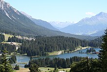
The Lenzerheide (occasionally also the Lenzerheide Pass ) is a high valley in the canton of Graubünden in Switzerland , which extends south from the Parpanerhöhe (1547 m above sea level) south of the village of Parpan with a mostly gentle gradient over a length of a good six kilometers extends to St. Cassian (1415 m. above sea level). Most of the high valley lies in the municipality of Vaz / Obervaz . In the far south it is on the soil of the municipality of Lantsch / Lenz .
The 32-kilometer section of Hauptstrasse 3 , which runs from Chur via Lenzerheide / Lai to Tiefencastel, crosses Lenzerheide along its entire length. It not only serves to develop the neighboring communities, but is also heavily frequented by through traffic in the direction of Oberhalbstein and Engadin , as the route over the Lenzerheide is shorter than the connection over the Schin Gorge .
history

In Roman times and in the Middle Ages, one of the two historically most important Graubünden Alpine traverses, the so-called Obere Strasse , led from Chur over the Lenzerheide and further over the Julier and Maloja passes, or later the Septimer pass . On the way over the Lenzerheide, you could avoid the detour via the Domleschg and the Schin Gorge , which used to be very exposed . The Obere Strasse competed with the Unteren Strasse via Thusis and the Splügen Pass to Chiavenna or via the San Bernardino to Bellinzona , whose bottleneck, the Viamala , was expanded into a mule track in 1473. In a huge road construction program after the famines of 1816/17, when grain deliveries on the southern side of the Alps spoiled because transport was not possible on the mule tracks , all valleys up to Averserstrasse were expanded into commercial roads at least four meters wide in 1897 .
The extension of the route over the Lenzerheide to the Kunststrasse began around 1840. As expected, tourist use experienced an upswing from 1926 onwards, as private motor vehicles were allowed . From 1935 to 1940 the road was redesigned for automobile traffic. In the 1960s it was already possible for motorists to drive briskly on the road , while the western route through the Schin Gorge was still very slow and careful . Today, however, following the signaling, the greater part of the traffic from Chur in the direction of the Julier Pass is via the A13 motorway and the Schinstrasse.
geography

The Lenzerheide extends the average for approximately one kilometer wide high valley between Valbella and Parpan located Parpanerhöhe in the north to St. Cassian in the south. The high valley is divided, from north to south, into the areas of Canols (with the village of Valbella), Lai (with the Heidsee and the village of Lenzerheide / Lai ), and Planoiras, with the extensive forest area and the golf course. Like the area around St. Cassian, the latter is located in the municipality of Lantsch / Lenz .
With the exception of a so-called residual amount of water, the water from the Heidsee flows from the water intake at Clavadoiras in a south-westerly direction, first through a canal and then, with a gradient of 599 meters, through a pressure tunnel to the Solis power plant and from there through another pressure tunnel Northwest to the power plant in Sils im Domleschg , before it reaches the Albula and after a good kilometer into the Hinterrhein . The remaining water flows through its ancestral stream bed, as Rain digl Lai , southwards directly into the Albula.
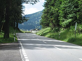
The high valley is accessed via main road 3. Its north ramp rises at the exit of the Churwaldnertal with three pairs of serpentines and reaches a maximum gradient of eleven percent. The south ramp is less steep and, after two hairpin bends above Tiefencastel , runs gently up to the Lenzerheide plateau.
The wide high valley runs almost parallel to the lower part of the Hinterrhein with the Domleschg. In between there is a mountain range with the Stätzerhorn , Piz Danis , Piz Scalottas and Crap la Pala mountains . The Lenzerheide seems to continue the Oberhalbstein to the north. The assumption that emerged in the 19th century that the Lenzerheide valley , formed by ice age glaciers, was the former lower reaches of the Albula valley system is controversial.
The valley, formed by landslides and ice age glaciers, is said to have been notorious for its wildness, harsh climate and snowstorms until well into modern times. Thanks to the targeted foresting of large parts of the plateau, the valley, which was previously strongly exposed to the wind, received its present mild climate.
Surname
The name Lenzerheide can be traced back to the rough meadows overgrown with alpine flowers, which shaped the landscape between Lenz and the Heidsee . Incidentally, the origin of this North German-sounding name in the Romance language area (the field names on Lenzerheide are all Romance) has not yet been researched.
The earliest known document, in which the name "Lenzerhaid" is mentioned, is the purchase contract of February 20, 1456, with which the then just independent municipality Obervaz from the completely impoverished Count von Werdenberg-Sargans the current municipality area, to which how mentioned, also owned by Lenzerheide, bought for 600 guilders. The area came into the possession of the Counts of Werdenberg-Sargans around 1440 through the marriage of Ursula von Vaz, a daughter and heir of the mighty Baron Donat von Vaz, who presumably died in 1438, with the Count of Werdenberg-Sargans. In the Middle Ages, German was spoken in the noble houses, while their rural subjects spoke Romansh in large parts of Graubünden. This explains why the field names are all Romanesque, while the sovereigns used German names for larger areas. Geu van a Lenzerheid was never heard in Obervaz until well into the 19th century . but Geu van a Cuolm ( I go to the mountain or to my mountain property ).
With the beginning of the exploration of the alpine valleys by German alpine explorers in the 18th century, the name Lenzerheide then appeared in travel reports. Evidence of this can be found in the late 18th century.
"From Parpan you can get to Lenz, Laentz in 2 hours via the two thousand paces long Lentzer Haide Planuras, which are so much vocal because of the prevailing winds and weather there because of the prevailing winds and weather there, but you come across an inn on the way 1 hour from Parpan."
The name Planoiras, which refers to the area south of Lenzerheide / Lai (Obervazer-Romansh for plains ) is not recorded on the Swiss national map , but according to the Codesch da Vaz published by the municipality of Vaz / Obervaz in 1993, it was attested as early as the 18th century. It is particularly popular in connection with the Planoiras run, a cross-country run that has been taking place on Lenzerheide for several years.
The name Lai (Romanesque for lake ) of the middle part with the village Lenzerheide and the Heidsee comes from the time when the plain between Valbella and the northern entrance of Lenzerheide was mostly covered by the lake. Over the centuries, this withdrew further and further in the direction of today's Valbella, until it was expanded into a reservoir from 1917 to 1919. Even today, the soil between the Heidsee dam and the northern exit of the village of Lenzerheide is partly swampy.
The name Canols of the northern part of the Lenzerheide plateau with Valbella is also Romanesque and probably means canals .
The term Lenzerheidepass (also: pass over the Lenzerheide ) is not an official name; neither the national map nor the 142 field names researched show a passport. It was only with the advent of private transport - motor vehicles were only registered in the canton of Graubünden in 1926 - these new terms were used from around 1930 in publications on the subject of Alpine roads.
In 1930 the crossing was called the Parpan Pass .
The relevant inventory of historical traffic routes in Switzerland uses the description of a pass-like counter-slope of almost 700 m , because the route is seen as a section of the important Upper Road. On the overview of the road passes, the Graubünden civil engineering department does not list Lenzerheide among the passes that are open all year round.
literature
- Toni Cantieni: Lenzerheide / Valbella. In: Historical Lexicon of Switzerland . November 25, 2008 .
Web links
- Map, GPS track and elevation profile Lenzerheide
- Profile of the range from Chur and Tiefencastel
- Lenzerheide information on schweizerseiten.ch
- Photos, map and description of the Lenzerheide (pass)
Individual evidence
- ↑ a b GR 23 “Chur – Tiefencastel; Lenzerheide ". (PDF; 417 kB) In: geo.admin.ch. Inventory of historical traffic routes, p. 1 , accessed on November 1, 2019 (referred to as a “pass-like counter slope of almost 700 m”).
- ↑ a b c Kurt Mair: The elevated roads of the Alps. Volume II. The high roads of Switzerland and France . Richard Carl Schmidt & Co, Berlin 1930, p. 36.
- ↑ GR 23.2 (route GR 23 “Chur – Tiefencastel; Lenzerheide”, route 2 “Kunststrasse”). (PDF; 2.4 MB) In: geo.admin.ch. Inventory of historical traffic routes, accessed on November 1, 2019 .
- ↑ Kurt Mair: The elevated roads of the Alps . Richard Carl Schmidt & Co, Braunschweig 1965, p. 323.
- ^ Fritz Ludescher: Lenzerheide-Valbella. From the Maiensäss to the health resort . Casanova Druck AG, Chur 1984, p. 3.
- ^ Hilarius Simonet: From the history of the health resort Lenzerheide . Buchdruckerei Condrau, Disentis 1954, p. 24.
- ^ Hilarius Simonet: From the history of the health resort Lenzerheide . Buchdruckerei Condrau, Disentis 1954, p. 20.
- ^ Hilarius Simonet: From the history of the health resort Lenzerheide . Buchdruckerei Condrau, Disentis 1954, p. 105.
- ↑ Heinrich Ludwig Lehmann: The Republic of Graubünden presented historically, geographically and statistically . tape 2 . Keil, Magdeburg / Brandenburg 1799, p. 72 f . ( Place on Google Books ).
- ↑ Directory of field names
- ^ History. In: Graubünden Holidays. Retrieved November 1, 2019 .
- ↑ Graubünden civil engineering office: passes


