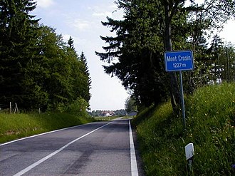
Mont Crosin
| Col du Mont Crosin | |||
|---|---|---|---|
|
Mont Crosin |
|||
| Compass direction | Northeast | ||
| Pass height | 1227 m above sea level M. | ||
| Canton | Bern | ||
| Valley locations | Tramelan | Saint-Imier | |
| expansion | Pass road | ||
| profile | |||
| Ø pitch | 3.5% (216 m / 6.15 km) | 8.2% (412 m / 5 km) | |
| Max. Incline | 8th % | 10.9% | |
| Map (Bern) | |||
|
|
|||
| Coordinates | 569 511 / 226 037 | ||
The Mont Crosin is a pass in the Swiss Jura in the canton of Bern . It is located between the towns of Saint-Imier and Tramelan and leads over the ridge of the Montagne du Droit ; the pass is at 1227 m.
Scooters can be hired from the Saint-Imier - Mont Soleil cable car station . There is a restaurant at the Mont Crosin bus station.
The Mont Crosin wind farm was built on Mont Crosin in the 1990s , and for a long time it was the only wind farm in Switzerland. Repowering took place in 2013 and 2016 .
Web links
Commons : Mont Crosin - Collection of Images, Videos and Audio Files
Individual evidence
- ↑ Presentation slides "Renewable Energies" , 2005, p. 6
- ↑ Repowering 2016 , juvent.ch

