Hirzel Höhi
| Hirzel Höhi | |||
|---|---|---|---|
|
Hirzel Höhi from Zimmerberg |
|||
| Compass direction | Northeast side | Southwest side | |
| Pass height | 734 m above sea level M. | ||
| Canton | Zurich | train | |
| Valley locations | Horgen | Sihlbrugg | |
| expansion | Mule track | Driveway | |
| Mountains | Zimmerberg | ||
| profile | |||
| Ø pitch | 4.6% (96 m / 2.1 km) | 8.7% (201 m / 2.3 km) | |
| Map (Zurich) | |||
|
|
|||
| Coordinates | 687 781 / 231196 | ||
The Hirzel Höhi is a mule pass in the foothills of the canton of Zurich , which connects Horgen and Sihlbrugg .
The former trade route continued via Baar , Zug , Immensee - Küssnacht or Brunnen across Lake Lucerne to Flüelen to the Gotthard and to Italy. The most important goods transported were salt from north to south and wine vice versa. In addition, silk, velvet, brocade, linen, iron, grain, rice, cheese and oil were traded.
Location and surroundings
The Hirzel Höhi connects Horgen on Lake Zurich with Sihlbrugg in the Sihltal . The top of the pass is in the area of the political municipality of Horgen , near the Hirzelpass .
height
The Hirzel Höhi is 734 m above sea level.
Accesses
The Hirzel Höhi is accessible from two sides:
- From Horgen Dorf over an old mule track
- From Sihlbrugg Dorf via a small road
Mule trail Horgen - Hirzel Höhi - Sihlbrugg
With the development of the Schöllenen , the international trade route between Germany and Italy, which had been leading over the Bündner passes since Roman times, was replaced by the shorter Gotthard route . This made the mule track over the Hirzel Höhi an important transport route from 1230 to 1830. The goods came from Zurich on Ledischiffs (Nauen) to the Sust in the port of Horgen, where they were loaded onto mules and later onto pack horses.
The upper Säumerweg (also Morschwanderweg) led from the Sust Horgen on the Dorfgasse and the Kirchstrasse up to the Horgenberg. There via Morschwand, Wüeribach, Bruppacher, Eschtürli, Zimmerberg to the Hirzel Höhi and down to Dürrenmoos, Chalbisau, past Tobelmüli to the Sihl crossing on the Babenwaagbrücke to Sihlbrugg Dorf.
The lower Säumerweg (also Säumer Gass or Grindelstrass) led from Sust Horgen via Dorfgasse, Kirchstrasse, Chlausen, Grindel, Simmismoos, Widenbach, Harhalden (Alter Hirschen), Hirzel Höhi, Dürrenmoos, Chalbishau, Tobelmüli to Sihlbrugg.
1534 the Council of Zurich over the protests of Säumer allows the car traffic. Because of the increased demands from the wagon traffic, a stone bed had to be laid in 1674, which was not yet common at the time.
Around 1800 the better route from Richterswil to Brunnen led to a certain shift in the traffic of muleers. With the construction of the Zugerstrasse from Horgen via Hanegg over the Hirzelpass from 1839 to 1846, the function of a supra-regional and regional connection to Zug was lost for the mule track.
With the opening of the Sihltalstrasse in 1884 and the Zimmerberg tunnel in 1897, the Gotthard route finally shifted from the mule track and sea route to road and rail.
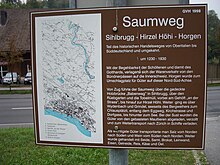
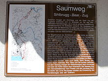
The former Saum- and today's hiking trail from the Sust Horgen over the Hirzel Höhi to Sihlbrugg is marked as a cultural trail with brown boards.
gallery
The Babenwaag was the main bridge in Sihlbrugg until 1960. Today it is 3 km upstream. Her predecessor was burned in the Sonderbund War in 1847 .
literature
- Association Pro Sihltal (Ed.): "Blätter" No. 14, 1964.
- Municipality of Horgen (Hrsg.): Horgner yearbook 2007: Local museum Sust . Horgen 2007. pp. 4-9.
- Paul Kläui : History of the community of Horgen . Horgen 1952. pp. 262-286.
Web links
- Tourist office Horgen: The mule track from 1230 to 1830
- Inventory of historical traffic routes in Switzerland IVS: Untere Säumerstrasse Horgen-Sihlbrugg PDF 1776 kB
- Inventory of historical traffic routes in Switzerland IVS: Obere Säumerstrasse Horgen-Sihlbrugg ZH PDF 1340 kB


