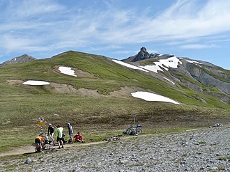
Pass Chaschauna
| Pass Chaschauna | |||
|---|---|---|---|
|
Chaschaunapass |
|||
| Compass direction | north | south | |
| Pass height | 2694 m above sea level M. | ||
| Canton | Grisons | ||
| Watershed | Ova da Chaschauna, Inn | Torrente Federia, Lake Livigno | |
| Valley locations | S-chanf | Livigno | |
| expansion | Mountain path | ||
| Map (Graubünden) | |||
|
|
|||
| Coordinates | 801.74 thousand / 159 442 | ||
The Chaschauna Pass is a mule track that leads over the southern main ridge of the Alps . The border between Italy and Switzerland runs at the top of the pass . The Chaschaunapass connects the municipality of S-chanf in the canton of Graubünden with Livigno in the valley of the same name in Italy.
On the Italian side is the Rifugio Cassana at 2601 m , a former barracks from the First World War.
Web link
Commons : Chaschauna pass - collection of images, videos and audio files

