Passo di Naret
| Passo di Naret | |||
|---|---|---|---|
|
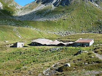
Val Torta (2214 m) with Passo di Naret |
|||
| Compass direction | North | south | |
| Pass height | 2437 m above sea level M. | ||
| Canton | Ticino | Ticino | |
| Watershed | Ticino → Po | Maggia → Lake Maggiore | |
| Valley locations | Ossasco | Fusio | |
| map | |||
|
|
|||
| Coordinates | 685 883 / 148141 | ||
The Passo di Naret (German Naret Pass ) is a mule track in the Swiss Alps and connects the Bedretto valley with the Lavizzara valley , both in the canton of Ticino . It is an often used transition with a hiking trail (marked white-red-white) from Val Torta (Bedretto) to Lago del Narèt (Val Sambuco).

