Giümela Pass
| Giümela Pass | |||
|---|---|---|---|
|
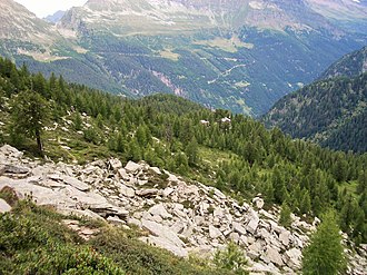
Pass Giümela (on the horizon on the left) with the road from Rossa. View from the Calanca Höhenweg . |
|||
| Compass direction | west | east | |
| Pass height | 2117 m above sea level M. | ||
| Canton | Ticino | Grisons | |
| Watershed | Legiuna , Brenno → Ticino | Calancasca , Moësa → Ticino | |
| Valley locations | Fontana | Rossa | |
| map | |||
|
|
|||
| Coordinates | 727.37 thousand / 136976 | ||
The Pass Giümela (German Giümelapass ) is a mule track in the Swiss Alps and connects the Calanca Valley with the Blenio Valley . It is a rather seldom used crossing with a hiking trail (marked white-red-white) from Rossa ( Graubünden ) to Val Pontirone ( Ticino ). A two-day hike leads past the Capanna Cava .
The long mountain range that borders the Calanca valley to the west and the ridge of which marks the border between the cantons of Graubünden and Ticino has only two marked crossings: the Giümela and the Bocchetta di Pianca Geneura ( 2366 m ), the first being the deeper. The pass was used in the Middle Ages for the exchange of goods and passenger traffic between the old Confederates in Leventina and Messrs. Trivulzi in Misox .
The toponym "Giümela" comes from the Latin "gemelus" (twin). At the Alpe di Giümela the two pastures of the Giümelatals and the Vedrign meet. The pass is also known as the "bride's pass" (Passo delle spose) because Pontironese people went over the pass to marry their friends in Val Calanca.


