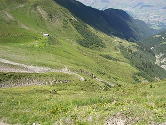
Güner Lückli
| Güner Lückli | |||
|---|---|---|---|
|
Ascent to Güner Lückli from Duvin via the lower ( 1852 m ) and upper Alp Gretg ( 2109 m ) |
|||
| Compass direction | west | east | |
| Pass height | 2470 m above sea level M. | ||
| region | Graubünden , Switzerland | ||
| Watershed | Glenner | Rabiusa | |
| Valley locations | Duvin | Rinmatta | |
| expansion | Mule track | ||
| Map (Graubünden) | |||
|
|
|||
| Coordinates | 741 288 / 174 774 | ||
The Güner Lückli is a Saumpass in the Swiss canton of Graubünden , which connects the Lugnez, Romansh Val Lumnezia , with the German-speaking Safiental .
The pass height is 2470 m above sea level. M. It used to be the first of the three Graubünden crossings (Güner Lückli, Safierberg , Splügenpass ) on the way from the Vorderrhein to Chiavenna , which took the passers around 17 hours.
The starting point for a high alpine hiking or ski tour are the villages of Duvin im Lugnez and Gün near Safien . The pass route, like other alpine trails in the Safiental and other parts of Graubünden, was expanded by Polish internees during the Second World War, mainly for military purposes, which is where the name “ Poland Trail ” comes from. From Safien you can cross the Glaspass or the Tomülpass two further alpine crossings, which are often used with mountain bikes (bicycles) these days.

