Chrüzli Pass
| Chrüzli Pass | |||
|---|---|---|---|
|
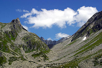
Chrüzlital with Chrüzlipass (from the west) |
|||
| Compass direction | northwest | Southeast | |
| Pass height | 2347 m above sea level M. | ||
| Canton | Uri | Grisons | |
| Watershed | (Etzlibach, Chärstelenbach , Reuss , Aare , Rhine ) | (Strem, Vorderrhein , Rhine ) | |
| Valley locations | Amsteg | Sedrun | |
| expansion | Mule track | ||
| Mountains | Glarus Alps | ||
| map | |||
|
|
|||
| Coordinates | 700116 / 175 425 | ||
The Chrüzlipass is a mountain pass in the Glarus Alps . At an altitude of 2347 m above sea level. M. it connects the towns of Amsteg in the canton of Uri and Sedrun in the canton of Graubünden . A mule track leads over the pass .
location
The pass lies between the Witenalpstock ( 3016 m ) in the north and the Chrüzlistock ( 2717 m ) in the southwest. The Oberalpstock lies further to the northeast . The Gotthard base tunnel of the Gotthard axis of the NEAT runs under the pass .
From the rear Etzlital, a side valley of the Maderanertal , the path climbs through the Chrüzlital east to the top of the pass. At the beginning of the Chrützlital, where the Etzlital turns west to the Pörtlilücke , is the Etzlihütte .
On the other side of the Chrützli Pass, the path leads down into Val Strem , which is reached at Alp Strem, and continues through the valley to Sedrun. The Val Strem, on the other hand, has been closed in the middle part since a rock fall in 2016 (updated in summer 2019), as an even larger demolition is feared. The exclusion zone must be bypassed over a large area with a 300 meter high ascent to Alp Caschlè. As an alternative, there is the path over Mittelplatten ( 2,484 m above sea level ) and the Val Milà.
history
It is believed that the Chrützlipass was already used in the Iron Age . For a long time it served as a connection not only from the Tujetsch to the north, but also from the southern side of the Alps in connection with the Lukmanier Pass . The residents of Tujetsch use the pass to sell small cattle to central Switzerland and for pilgrimages to Einsiedeln . He also linked the monasteries Disentis and Engelberg .
During the Second Coalition War in 1799, Austrian troops topped the pass.
literature
- The Krüzli Pass . In: Raststättegesellschaft N2 Uri AG (Ed.): Traffic routes in Uri: Surenen, Chinzig Chulm and Krüzlipass . Uri 1999 ( historia-tujetsch.ch [PDF; accessed on August 6, 2019]).
Web links
- Adolf Collenberg: Chrüzli Pass. In: Historical Lexicon of Switzerland .
- Collection of historical information on the Chrüzli Pass ( Memento from May 1, 2013 in the Internet Archive )
Individual evidence
- ↑ Val Strem exclusion zone. In: Tujetsch community. Retrieved August 3, 2019 .
- ↑ wehm: Val Strem - The next rock fall is sure to come. In: SRF 1, Graubünden regional journal. October 30, 2017, accessed August 3, 2019 .
- ^ A b Adolf Collenberg: Chrüzlipass. In: Historical Lexicon of Switzerland .
- ↑ From Sedrun over the Chrüzli Pass. In: SAC. Retrieved August 3, 2019 .


