Saaspass
| Saaspass | |||
|---|---|---|---|
|
The Sihlseeli below the Saas Pass. The valley of the Saas Pass can be seen in the mirror image. |
|||
| Compass direction | west | east | |
| Pass height | 1896 m above sea level M. | ||
| Canton | Schwyz | Glarus | |
| Watershed | Sihl → Limmat → Aare → Rhine | Chlön → Löntsch → Linth → Limmat → | |
| Valley locations | Studen ( Unteriberg ) | Richisau | |
| expansion | Mule track | ||
| map | |||
|
|
|||
| Coordinates | 708.61 thousand / 208489 | ||
The Saaspass is an attainable only on foot mountain pass in the Fläschenspitzkette at 1,896 m above sea level. M. in the canton of Schwyz . It connects Studen (Canton Schwyz) , which is located south of the Sihlsee and belongs to the municipality Unteriberg , with Richisau in the Klöntal ( Canton Glarus ). On the east side of the pass there is a connection over the Schwialppass into the nearby Wägital , and over the Pragelpass into the Muotathal .
Immediately below the pass, on the Schwyz side, lies the Sihlseeli mountain lake . This drainless lake, popular with amateur fishermen, got its name because the Sihl rises nearby .

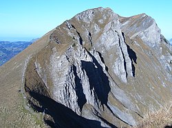
Biet (1968 m), in the foreground the Saas Pass

