
Delete
| Delete | ||
 The Löntsch in Netstal |
||
| Data | ||
| Water code | CH : 2260 | |
| location | Switzerland | |
| River system | Rhine | |
| Drain over | Linth → Limmat → Aare → Rhine → North Sea | |
| origin |
Klöntalersee 47 ° 2 ′ 10 ″ N , 9 ° 0 ′ 23 ″ E |
|
| Source height | 848 m above sea level M. | |
| muzzle | at Netstal in the Linth coordinates: 47 ° 3 '45 " N , 9 ° 3' 37" E ; CH1903: 723 183 / 213664 47 ° 3 '45 " N , 9 ° 3' 37" O |
|
| Mouth height | 453 m above sea level M. | |
| Height difference | 395 m | |
| Bottom slope | 62 ‰ | |
| length | 6.4 km | |
| Catchment area | 90.93 km² | |
| Discharge at the mouth A Eo : 90.93 km² |
MQ Mq |
3.81 m³ / s 41.9 l / (s km²) |
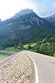
The Löntsch is a stream in the Swiss canton of Glarus .
It drains the Klöntalersee and flows into the Linth near Netstal . The course of the stream through the narrow valley reaches a climax with the deep Löntschtobel, which can be observed from the (upper) Löntschtobel bridge. An important source river of the Löntsch is the Chlü , which is the largest source river of the Klöntalersee.
The power plant on the Löntsch was built from 1903 to 1908 . At that time, a modest, drivable dam wall was built over the Klöntal rockslide, which the Löntsch has to cross.
Picture gallery

Löntschtobel Bridge
Dam and Breitchamm

.jpg)
Individual evidence
- ↑ a b c Geoserver of the Swiss Federal Administration ( information )
- ↑ a b Topographical catchment areas of Swiss waters: sub-catchment areas 2 km². Retrieved September 24, 2017 .