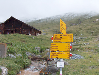
Stallerberg
| Stallerberg | |||
|---|---|---|---|
|
Ascent from Juf to the Stallerberg |
|||
| Compass direction | west | east | |
| Pass height | 2580 m above sea level M. | ||
| Canton | Grisons | ||
| Watershed | Jufer-Rhine, Hinterrhein | Eva dalla Valetta, Julia | |
| Valley locations | Juf | Bivio | |
| expansion | Mule track | ||
| Map (Graubünden) | |||
|
|
|||
| Coordinates | 765 964 / 146382 | ||
The Stallerberg is a mule track in the Swiss Alps in the canton of Graubünden . It connects Juf in Averstal with Bivio in Oberhalbstein . The Walserweg Graubünden leads over the Stallerberg.

