Schoneggpass
| Schoneggpass (Sinsgäuer Schonegg) | |||
|---|---|---|---|
|
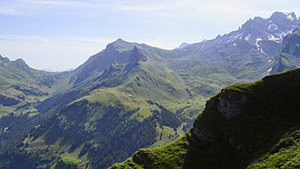
from left: Sinsgäuer Schonegg (1924 m), Chaiserstuel (2400 m), Bannalper Schonegg (Schoneggeli) (2250 m), Ruchstock (2818 m) |
|||
| Compass direction | west | east | |
| Pass height | 1913 m above sea level M. | ||
| region | Nidwalden | Uri | |
| Watershed | Secklisbach, Engelberger Aa , Lake Lucerne | Sulztalerbach, Isentalerbach → Vierwaldstättersee | |
| Valley locations | Oberrickenbach , Sinsgäu | St. Jakob , Sulztal, Grosstal | |
| Map (Nidwalden) | |||
|
|
|||
| Coordinates | 679 113 / 193543 | ||
The Schoneggpass (also: Sinsgäuer Schonegg) is a mule track at 1913 m above sea level. M. in the Swiss Alps and connects the chapel community Oberrickenbach ( 894 m above sea level ), canton Nidwalden via the Alp Sinsgäu with the Sulztal and St. Jakob ( 988 m above sea level ) in the Grosstal in the canton Uri . The pass lies between the Brisen ( 2403 m above sea level ) and the Chaiserstuel ( 2400 m above sea level ).
Web links
Commons : Schoneggpass - collection of images, videos and audio files


