Bocchetta di Trescolmen
| Bocchetta de Trescolmen | |||
|---|---|---|---|
|
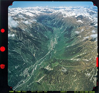
Center left: Ascent to the Bocchetta at the southern edge of the village of Mesocco |
|||
| Compass direction | west | east | |
| Pass height | 2161 m | ||
| Canton | Grisons | Grisons | |
| Watershed | Rià de Campalesc, Calancasca , Moësa | Moësa , Ticino | |
| Valley locations | Valbella / Calanca valley | Mesocco / Misox | |
| expansion | Mule track | ||
| Mountains | Adula Alps | ||
| Map (Graubünden) | |||
|
|
|||
| Coordinates | 734 148 / 140231 | ||
The Bocchetta de Trescolmen is a mountain pass in the Adula Alps in the Italian-speaking part of the canton of Graubünden . At an altitude of 2161 m above sea level. M. the pass connects the places Valbella ( 1334 m ) and Mesocco ( 769 m ). A mule track and hiking trail leads over the middle of the three crossings from Calanca Valley to Misox .
The pass lies between the Piz de Trescolmen ( 2581 m ) in the north and the Cima de Gagela ( 2805 m ) in the south. The pass path crosses the Calanca high path below the pass .
Web links
Commons : Rossa - collection of images, videos and audio files

