Rotstein Pass
| Rotstein Pass | |||
|---|---|---|---|
|
Berggasthaus Rotsteinpass with Lisengrat and Säntis in the background |
|||
| Compass direction | southwest | Northeast | |
| Pass height | 2119 m above sea level M. | ||
|
|
|
|
|
| Watershed | Thur | Schwendibach | |
| Valley locations | Thurwies | Outer fabric | |
| expansion | trail | ||
| Mountains | Appenzell Alps ( Alpstein ) | ||
| map | |||
|
|
|||
| Coordinates | 745 853 / 234268 | ||
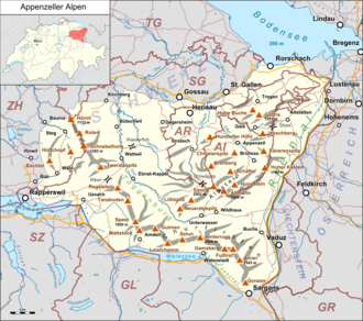
The at an altitude of 2119 m above sea level. M. lying Rotsteinpass is a mountain pass on the border between the Swiss cantons of Appenzell Inner Rhodes and St. Gallen in the Appenzell Alps .
Between the two highest peaks of the Alpstein region , Säntis and Altmann , lies the pass crossing, which is easily accessible through mountain hiking trails. The watershed from Säntis over the Lisengrat and Rotsteinpass to Altmann forms the natural border between the two cantons of Appenzell Innerrhoden and the canton of St. Gallen.
Hiking trails

A mountain hiking trail leads over the pass between Unterwasser / Wildhaus and Meglisalp via Seealpsee to Wasserauen . For sure-footed and vertigo-free hikers ( grade T3 ), the Säntis summit can be reached via secured Lisengrat (steel ropes, artificial steps). In the opposite direction, a via ferrata-like white-red-white marked mountain hiking trail leads through the Flis-Schafboden-Wand to the foothills of the Nädliger ridge and from there either as a mountain trail to the Altmannsattel in front of the Altmann or as a mountain trail to the Zwinglipass .
Mountain inn
The mountain inn Rotsteinpass near the pass summit (north above at 2124 m above sea level ) offers accommodation and is located in Schwende on Appenzell Innerrhoder Boden.
Between 1934 and 1999 the mountain inn was supplied with food by seaming with mules from Wasserauen (AI). Between 1999 and 2014, the food transportation was conducted with the help of helicopters from the above underwater situated Alp from 'Thurwis "(SG). Since the 2015 summer season, this task has been taken over by a less weather-dependent material transport conveyor . The permit for the construction of this cable car was granted in November 2012 by the Wildhaus-Alt St. Johann community . The cable car is located in the canton of St. Gallen, the mountain inn on Innerrhoder Boden.
Web links
- Berggasthaus Rotsteinpass
- Interactive spherical panorama of the Rotstein Pass from a nearby hill
- Video Berggasthaus Rotsteinpass near "Alpstein from above"
Individual evidence
- ↑ a b Height according to SwissTopo (maps of Switzerland)
- ↑ Mules walk like horses and pull like Ochsen Wiler Zeitung , article from September 4, 2014
- ^ A train on the Rotsteinpass Wiler Zeitung , article from September 4, 2014

