Soredapass
| Soredapass | |||
|---|---|---|---|
|
From left: Plattenberg (3040 m), Soredapass (2759 m), Pizzo Cassinello (3102 m), Rheinwaldhorn (3402 m) |
|||
| Compass direction | west | Northeast | |
| Pass height | 2759 m | ||
| Canton | Ticino | Grisons | |
| Watershed | Ri di Scaradra, Lago di Luzzone , Brenno , Ticino | Valser Rhein , Zervreilasee , Glenner , Vorderrhein | |
| Valley locations | Campo Blenio / Blenio Valley | Vals / Valsertal | |
| expansion | Mule track | ||
| Mountains | Adula Alps | ||
| Map (Ticino) | |||
|
|
|||
| Coordinates | 721 219 / 156 334 | ||
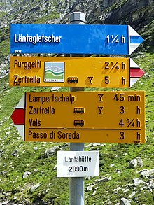
The Soredapass (Italian: Passo Soreda) is a mountain pass in the Adula Alps on the border of the cantons of Ticino and Graubünden . At an altitude of 2759 m above sea level. M. it connects the places Campo Blenio ( 1215 m ) and Vals ( 1252 m ). A mule track and hiking trail leads over the pass .
The pass lies between the Plattenberg ( 3040 m ) in the north and the Pizzo Cassinello ( 3102 m ) in the south. It connects two huts of the Swiss Alpine Club , the Motterasciohütte and the Länta-Hütte .


