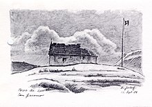
Passo San Giacomo
| Passo San Giacomo | |||
|---|---|---|---|
|
Pass summit, looking south, from Switzerland to Italy (Italian guard house) |
|||
| Compass direction | Northeast | southwest | |
| Pass height | 2306 m above sea level M. | ||
| region | Canton Ticino , Switzerland | Verbano-Cusio-Ossola Province , Italy | |
| Watershed | Ri di San Giacomo → Ticino | Torrente Roni → Toce | |
| Valley locations | All'Acqua | Rials | |
| expansion | trail | ||
| Mountains | Alps | ||
| map | |||
|
|
|||
| Coordinates , ( CH ) | 46 ° 27 '32 " N , 8 ° 27' 8" O ( 677 866 / 145800 ) | ||
The Passo San Giacomo connects to the Italian province of Verbano-Cusio-Ossola belonging Val Formazza with the Val Bedretto in the Swiss canton of Ticino . To the west of the pass is the Helgenhorn (2836 m above sea level), to the east the Marchhorn (2961 m above sea level). There is also a connection to Valais via the Nufenen Pass .
description
The Val Formazza is the northern part of the long Tocetal , where this river, which flows into Lake Maggiore, also originates. The valley, which is one of the longer Alpine valleys and is called Pomatt in dialect , divides the Swiss cantons of Valais and Ticino from one another, but forms a linguistic bridge between the Valais Goms and the Ticino Walser village of Bosco / Gurin . Until 1920, the Pomatt was only accessible on foot or by donkey.
history
The pass was particularly important as a traffic route between the end of the 13th and the end of the 15th century. Säumergenossenschaften transported goods over the San Giacomo and further over the Gotthard . The hospice Val d'Olgia was first mentioned in 1405; The chapel of SS. Nicolao, just under a kilometer northeast of the top of the pass, has been preserved from him.
With the opening of the Gotthard Railway in 1882, traffic over the San Giacomo continued to decline. At the same time, Switzerland viewed the border over the pass as a military threat, as the pass is only 14 kilometers away from the south portal of the Gotthard tunnel near Airolo . This was one of the reasons why fortifications , for example the Forte Airolo , were built in the Airolo area from 1886 .

On August 15, 1929, a road to the top of the pass opened on the Italian side. It should serve to develop the area for the construction of power plants and for tourism. Around 1930, the Milanese architect Piero Portaluppi built a restaurant for automobile tourists with his Wagristoratore project, almost a kilometer west of the pass , consisting of a sleeping car and a dining car . The factory was destroyed by Italian partisans in 1943 . The transport of the two rail cars made clear the efficiency of the 4.5 meter wide road. On the part of Switzerland, the road construction was perceived as an additional threat, as the road could also be used for military purposes, for example to transport artillery to the top of the pass, which meant that the Gotthard area was within reach of the Italian artillery . The extension of the road, requested by the Italian side, was rejected by Switzerland.
From 1935 onwards, fortifications were built on the Swiss pass side as part of the San Giacomo locking point ( Grandinagia artillery plant ), which were further expanded, particularly during the Second World War . Most recently, the San Giacomo blocking point comprised 30 individual objects, for which the military operated a cable car . The fortifications were classified as a blocking point of national importance after their abandonment in the 1990s.
literature
- Mario Fransioli: San Giacomo, Passo di. In: Historical Lexicon of Switzerland . January 11, 2011 .
- Charles Knapp, Maurice Borel, Victor Attinger, Heinrich Brunner, Société neuchâteloise de géographie (editors): Geographical Lexicon of Switzerland . Volume 4: Plessur - Switzerland . Verlag Gebrüder Attinger, Neuenburg 1906, p. 373, keyword San Giacomo (Passo di) ( scan of the lexicon page ).
Web links
- Passo San Giacomo on the platform ETHorama * Passo San Giacomo at quaeldich.de
- Artillery Works Grandinagia ( Memento from August 30, 2011 in the Internet Archive ) in festung-oberland.ch (accessed on: May 2, 2016.)
- Military fortifications on the pass at festung-oberland.ch ( Memento from July 15, 2010 in the Internet Archive )
Individual evidence
- ↑ Marchhorn on ETHorama
- ↑ Werner Rutschmann: Gotthard fortification. The forts on the axis cross of the military roads. Planning and construction 1885–1914. Verlag Neue Zürcher Zeitung, Zurich 1992, ISBN 3-85823-363-3 , pp. 16, 112.
- ↑ According to the Archivio del Verbano Cusio Ossola , the factory was destroyed by the fascists because the partisans used it as a base and accommodation when they fled to neutral Switzerland
- ↑ Hansjakob Burkhardt: Gotthard Fortress - Fortificazione del San Gottardo Foppa Grande. ( Page no longer available , search in web archives ) Info: The link was automatically marked as defective. Please check the link according to the instructions and then remove this notice. (pdf, 32.4 MB) p. 12.
- ↑ Lock point San Giacomo ( Memento of the original from 23 September 2015 in the Internet Archive ) Info: The archive link was inserted automatically and has not yet been checked. Please check the original and archive link according to the instructions and then remove this notice. . In: Federal Department of Defense, Civil Protection and Sport (ed.): Military monuments in the canton of Ticino. Inventory of the combat and command structures. (pdf, 5.3 MB) pp. 30-31.


