Surenen Pass
| Surenen Pass | |||
|---|---|---|---|
|
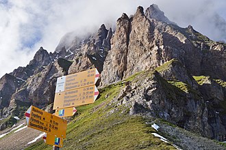
Surenenpass with a view of the Blackenstock |
|||
| Compass direction | west | east | |
| Pass height | 2291 m above sea level M. | ||
| Canton |
|
||
| Watershed | Engelberger Aa | Reuss | |
| Valley locations | Engelberg | Altdorf UR | |
| expansion | Mule track | ||
| Mountains | Uri Alps | ||
| map | |||
|
|
|||
| Coordinates | 684 458 / 187847 | ||
The Surenenpass ( 2291 m above sea level ) is a mountain pass in the Uri Alps in central Switzerland and is one of the alpine mule tracks .
geography
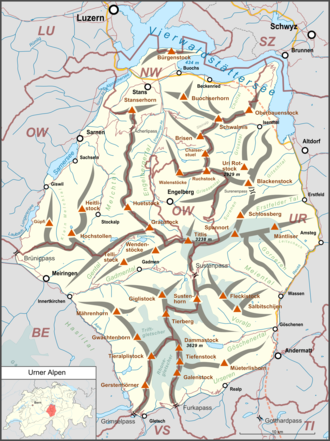
The pass is located in the canton of Uri , 20 kilometers south of Lake Lucerne . It connects the Urner Reuss Valley with that of the Engelberger Aa and Engelberg ( Canton Obwalden ). The transition is between the Blackenstock ( 2931 m above sea level ) in the north and the Engenmandli ( 2448 m above sea level ), a foothill of the Schlossberg , in the south. Further south and south-west are the three-thousand-meter peaks of Schlossberg, Spannort and Titlis , and in the north-west are the 2800 meter high mountain ranges between Engelberger Rotstock , Brunnistock and Gitschen .
history
Finds show that the pass was already used in the Bronze Age and by the Romans . In addition, a building floor plan was excavated east of the pass at the Geissrüggen in 2013 , which could be dated to the early Iron Age, the Hallstatt period , using the radiocarbon method. On the Blackenalp ( 1773 m above sea level ) west of the top of the pass there is a late medieval path chapel.
The canton of Uri extends several kilometers west of the pass. The demarcation was the subject of conflicts and fights for centuries between the Uri and Engelberg monastery . It was not until 1609 that the limit was finally determined.
In 1799, a French division under General Claude-Jacques Lecourbe crossed the Surenen Pass with artillery to attack the Austrian army in the Reuss Valley.
Hiking area
The pass is the starting point for high alpine hiking and some via ferratas . You can cross it on foot or by mountain bike via the alpine hiking trail. About 40 meters below the top of the pass there is a small refuge on the west side. The Spannorthütte SAC is an ideal place to stay .
Web links
- Surenenpass on wandersite.ch
- Suren hike on YouTube
- Hans Stadler: Surenen Pass. In: Historical Lexicon of Switzerland .
Individual evidence
- ↑ a b c Hans Stadler: Surenen Pass. In: Historical Lexicon of Switzerland .
- ↑ 2500 years old: Oldest alpine hut discovered. In: look online. August 7, 2013. Retrieved August 7, 2013 .
- ↑ Marion Sauter (Ed.): Surenenpass. Archeology and history in Attinghausen . (= Archäologische Prospektion - Archaeological Survey . Volume 1) Librum, Hochwald 2016, ISBN 978-3952454213 .
- ↑ Blacken Chapel. In: Catholic Church Erstfeld. Retrieved August 7, 2013 .
- ^ A b Charles Knapp, Maurice Borel, Victor Attinger, Heinrich Brunner, Société neuchâteloise de geographie (editor): Geographical Lexicon of Switzerland . Volume 5: Switzerland - Tavetsch . Verlag Gebrüder Attinger, Neuenburg 1908, p. 732, keyword Surenenpass ( scan of the lexicon page ).

