
Sihlsee
| Sihlsee | |||||||||
|---|---|---|---|---|---|---|---|---|---|
 |
|||||||||
|
|||||||||
|
|||||||||
| Coordinates | 702204 / 219933 | ||||||||
| Data on the structure | |||||||||
| Power plant output: | 123 MW | ||||||||
| Operator: | Etzelwerk | ||||||||
| Data on the reservoir | |||||||||
| Altitude (at congestion destination ) | 889 m above sea level M. | ||||||||
| Water surface | 10.72 km² | ||||||||
| Reservoir length | 8.5 km | ||||||||
| Reservoir width | 2.5 km | ||||||||
| Storage space | 96.5 million m³ | ||||||||
| Total storage space : | Summer: 21 million m³ winter 92 million m³ |
||||||||
| Catchment area | 156 km² | ||||||||
| Design flood : | 340 m³ / s | ||||||||
| Particularities: |
Largest reservoir in Switzerland in terms of area |
||||||||
| BFS no. : 9216 | |||||||||
 |
|||||||||

| Dam Wall In The Beat | |
|---|---|
 |
|
|
|
|
| Coordinates | 701693 / 223476 |
| Data on the structure | |
| Lock type: | Gravity wall |
| Construction time: | 1932-1936 |
| Height of the barrier structure : | 33 m |
| Height above the river bed : | 23 m |
| Building volume: | 28 000 m³ |
| Crown length: | 124 m |
| Chicken mud dam | |
|---|---|
 |
|
|
|
|
| Coordinates | 700057 / 221924 |
| Data on the structure | |
| Lock type: | Earthfill dam with a clay core |
| Construction time: | 1937 |
| Height of the barrier structure : | 15 m |
| Height of the structure crown: | 892.43 |
| Building volume: | 28 000 m³ |
| Crown length: | 155 m |
| Crown width: | 5 m |
| Base width: | 71.1 |
| Slope slope on the air side : | bottom 1: 2, top 2: 3 |
| Slope slope on the water side : | 1: 2.75 |
The Sihlsee is a reservoir in the high valley of Einsiedeln . He is from the Sihl flows through and through a 33-meter high and 124 meter long dam jammed. The lake has an area of 10.72 km², making it the largest reservoir in Switzerland with a maximum length of 8.5 km and a maximum width of 2.5 km. The greatest depth is 23 meters.
construction
At a community meeting in 1926, the contracts with the operators of the Etzelwerk were clearly approved; There was hardly any resistance from the population. The construction of the lake began in 1932. Roads were built around the future lake, two viaducts across it, a dam and two dams before the valley was flooded in 1937.
500 people had to leave the area, another 1,300 were otherwise affected. 93 apartments, 124 barns, 179 peat huts and 14 other buildings such as sawmills, chapels and bridges were flooded. 55 farms were flooded with buildings and land. 454 hectares of litter land, 372 hectares of meadow, 45 hectares of peat soil and 5 hectares of forest fell victim to the lake. Those affected were compensated for their loss. As part of a resettlement project, 30 new farms and houses for 175 people were built. Of the numerous flat and raised bogs, only the Schwantenau east of Biberbrugg has survived , one of the largest raised bogs in Switzerland. The moor gives an idea of the character of the former landscape of today's Sihlsee.
Before the flooding, the effects of new army bombs were tested on two farms; the ruins were then bombed.
lake
The Sihlsee has a volume of around 96 million m³ and feeds the Etzelwerk in Altendorf on upper Lake Zurich , which annually supplies 270 million kWh of traction current for the SBB network to the Ziegelbrücke , Sargans , Gossau SG and Steinen substations . In May 2007, the cantons of Schwyz, Zurich and Zug announced that they no longer wanted to extend the license, which ran until 2017. This would, from the perspective of the grantor, the concession-giving cantons and municipalities to a free reversion to lead the entire system to them. The Federal Supreme Court did not share this point of view and decided that the power plants will remain in the possession of the concessionaire, SBB, even after the concession has expired. The concedents then issued a transitional concession, which runs until December 31, 2022, which prevents the Etzelwerk from being taken out of operation and the income from the water interest for the concedent being lost. The transition license was necessary because the environmental impact assessment for a new license could not have been completed in the remaining time. It is essentially an extension of the previous license.
In addition to smaller motor and sailing boats, the Sihlsee is also used by the Angelika passenger ship with its 40 seats.
If the dams on Lake Sihl were destroyed immediately, parts of the city of Zurich could be flooded up to eight meters. The tidal wave would reach the city limits in Leimbach in one and a half hours, the city center in just under two and the distant city limits near Altstetten in just under three hours.

Willerzell (still without Sihlsee), historical aerial photo from 1924, taken from a height of 900 meters by Walter Mittelholzer

The Sihlsee in the moonlight
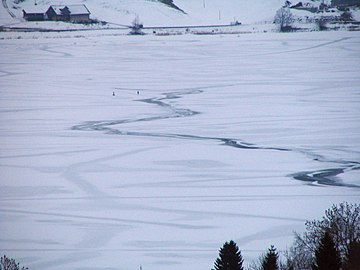
Frozen Sihlsee (2009)


documentary
- Karl Saurer: The dream of big blue water . Switzerland 1993.
See also
literature
- Karl Saurer, Ernst Halter (ed.): The Sihlsee: A landscape changes its face . Offizin Verlag, Zurich 2003, ISBN 978-3-907496-11-4 .
- H. Eggenberger: The projected Etzelwerk . In: Schweizerische Bauzeitung . 1929, doi : 10.5169 / SEALS-43472 .
Web links
- Ralf Jacober: Sihlsee. In: Historical Lexicon of Switzerland .
- Siegfried map from 1933 without Sihlsee, from 1937 with Sihlsee
Individual evidence
- ^ Hochmoor Schwantenau. In: Einsiedeln, Ybrig, Lake Zurich. Retrieved on June 3, 2020 (Swiss Standard German).
- ↑ Pro Natura Magazine 1/2012
- ↑ Etzelwerk remains the property of SBB. In: Lucerne newspaper. September 19, 2012, accessed June 5, 2020 .
- ↑ 3. Granting of a transitional license to the SBB for the use of the hydropower of the Sihl near Etzel for the period from May 13, 2017 to December 31, 2022 . ( Einsiedeln.ch [PDF]).
- ↑ Sihlsee water alarm, Sihlsee flood zone (PDF file; 396 kB) , information sheet from the City of Zurich
- ↑ Karl Saurer: The dream of big blue water. (No longer available online.) In: cinematograph.ch. Archived from the original on March 5, 2016 ; accessed on June 3, 2020 .
Swiss reservoirs with a content of over 10 million m³:
Albignasee |
Arnensee |
Lac de Barberine |
Lago Bianco |
Lac Brenet |
Lago dei Cavagnöö |
Lac de Cleuson |
Lai da Curnera |
Davosersee |
Lac des Dix |
Lac d'Emosson |
Engstlensee |
Gelmersee |
Gigerwaldsee |
Göscheneralpsee |
Lake Gruyère |
Griessee |
Grimselsee |
Lac de l'Hongrin |
Klingnau Reservoir |
Klöntalersee |
Lake Lei |
Limmerensee |
Lake Livigno |
Lake Lucendro |
Lungerersee |
Lake Luzzone |
Lai da Marmorera |
Mattmarksee |
Lac de Mauvoisin |
Lac de Moiry |
Lac de Montsalvens |
Lac de Moron |
Muttsee |
Lai da Nalps |
Lake Naret |
Oberaarsee |
Lac de Pérolles |
Lake Poschiavo |
Raeterichsbodensee |
Lake Ritóm |
Lac de Salanfe |
Lago del Sambuco |
Schiffenensee |
Sihlsee |
Lai da Sontga Maria |
Sufnersee |
Lac des Toules |
Lake Tremorgio |
Lac de Tseuzier |
Lac du Vieux Emosson |
Lake Vogorno |
Wägitalersee |
Wohlensee |
Zervreila Lake