
Lake Zurich
| Lake Zurich | ||
|---|---|---|

|
||
| Zurich from Uetliberg seen from | ||
| Geographical location | Switzerland , Mittelland , (Cantons of Zurich , St. Gallen , Schwyz ) | |
| Tributaries | Linth (Linth Canal), Jona , Aabach , Wägitaler Aa , Hornbach | |
| Drain | Limmat | |
| Islands | Ufenau , Lützelau and Schönenwirt | |
| Places on the shore | Zurich , Rapperswil-Jona , Wädenswil , Horgen , Meilen , Pfäffikon , Thalwil , Uerikon , Feldbach ZH | |
| Data | ||
| Coordinates | 691 603 / 234802 | |
|
||
| Altitude above sea level | 406 m above sea level M. | |
| surface | 90.1 km² | |
| length | 42 km | |
| width | 3.85 km | |
| volume | 3.9 km³ | |
| scope | 87.6 km | |
| Maximum depth | 136 m | |
| Middle deep | 51.7 m | |
| Catchment area | 1811 km² | |
|
particularities |
||

|
||

The Lake Zurich ( Zurich German Zürisee [ t͡syɾiˌz̥eː ]) is a lake in Switzerland . It is located southeast of Zurich in the cantons of Zurich , St. Gallen and Schwyz .
The main tributary of Lake Zurich is the Linth , which rises in the Tödi massif in the Glarus Alps and flows through the canton of Glarus and since the Linth correction (1807 to 1816) through the Walensee and as the Linth Canal near Schmerikon into Lake Zurich. The main outflow from Lake Zurich in the city of Zurich is the Limmat , which flows through the Limmat Valley to the Aare . The Schanzengraben has served as the second lake outflow in Zurich since 1642 , and escaped being filled in around 1834 when the ramparts of the Zurich city fortifications were razed.
geography

The narrow valley in which the lake lies is flanked on the southwest side by the mountain ranges of Etzel and Albis and on the northeast side by the hilly landscape of the Zurich Oberland and the pan handle. On both valley slopes there are sloping terraces that have been formed by lateral moraines . Lake Zurich belongs to the group of lakes at the edge of the Alps, which were created by the interaction of the uplift of the Alps , river erosion and the last ice ages .
The elongated, slightly curved shape of Lake Zurich is roughly like a banana. The lake is around 28 kilometers long from Rapperswil to Zurich, together with the Obersee around 42 kilometers. At the widest point between Stäfa and Richterswil , the lake is 3.85 kilometers wide. Its deepest point between Herrliberg and Oberrieden measures 136 meters water depth . The shore length is 87.6 kilometers.
Lake Zurich has a narrow point near Rapperswil and the Hurden peninsula , which was created because of an ice age moraine, the so-called Hurden stage. The part of the lake between Rapperswil and Schmerikon , separated from the larger part of the lake by the Rapperswil dam , is called the Obersee. In the Linthebene between Tuggen , Reichenburg and Uznach was to the Middle Ages nor the eastern Seeabschnitt which Tuggenersee that due to the large bed load of the Linth in the 16th Century silted is.
There are two islands between Rapperswil and Pfäffikon , the inhabited Ufenau and the uninhabited, protected Lützelau . The island of Schönenwirt in front of Richterswil is the third largest natural island in the lake.
Lake Zurich was created in its current form after the last ice age, when the melt water from the glaciers was dammed up on the terminal moraine.
geology
In geological terms, the western end of Lake Zurich lies in the Molasse basin of the Swiss plateau. In the course of the Tertiary the basin was filled with the debris from the emerging Alps , whereby the sediments can be divided into different layers. Deposits under marine conditions are referred to as sea molasses, those under fluvial conditions as fresh water molasses .
The Upper Freshwater Molasse, which was deposited around 16 to 5 million years ago, is important for the Zurich area. It is made up of alternating layers of hard sandstone banks and soft marl layers and is particularly evident on the Uetliberg and on the hills east of the city. A deep borehole would find a more than 1,000 m thick layer of molasse deposits in the underground of Zurich before the sediments of the Jurassic period would be encountered .
The last significant scenic overprinting of the region was given by the advance of the Rhein-Linth Glacier during the various ice ages. The glacier deepened and widened existing valleys and created new valleys. The Limmattal and Glattal are filled with gravel from the Ice Age and other sediments from the post-ice age. The traces of the Würm glaciation are still most clearly visible . During the so-called stage of Zurich (around 20,000 years ago) the moraine wall was created , which closes Lake Zurich in the north. It is marked by the ridge between the lake and the Sihltal , by the height at the Lindenhof in the old town and by the Burghölzli , while the Sihl valley absorbed the meltwater flow at the edge of the glacier.
climate


Lake Zurich is located in the temperate climate zone . The climate is shaped on the one hand by the winds from western directions, which often bring precipitation , and on the other hand by the bise (east or north-east wind), which is usually associated with high pressure, but brings cooler weather phases in all seasons than would be expected on average. The foehn , which is important in the Alpine valleys and on the edge of the Alps , does not normally show any special climatic effects.
The annual mean temperature at the MeteoSwiss measuring station in Zurich (at 556 m above sea level on the slope of the Zürichberg and thus 150 m above the level of the city center) is 8.5 ° C, with -0.5 ° C in January coldest and in July the warmest monthly mean temperatures of 17.6 ° C. On average, 88 days of frost and 26 days of ice can be expected here. There are 30 summer days on average, while there are normally three hot days . These values are relatively low compared to other Central Plateau stations, which can be explained by the altitude of the station. In the Limmat Valley, significantly more summer days and hot days can be expected on average. The Zurich measuring station has an average of 1482 hours of sunshine per year. The 1136 mm of precipitation falls over the whole year, whereby in the summer half year and especially during the three summer months higher amounts are measured than in winter due to the convective precipitation.
The climate is so mild, especially on the Gold Coast from Zollikon via Küsnacht to Meilen, that hemp palms (Ticino palms) and figs grow in the gardens .
Maritime regulation
At the beginning of the 20th century, the fluctuations in the level of Lake Zurich were up to two meters. This often led to flooding near the shore. Today the water level of Lake Zurich is artificially regulated. The regulation does not take place directly at the lake outflow , but almost two kilometers down the Limmat through the so-called Letten or Platzspitz weir of the Letten power plant .
In addition to stabilizing the sea level, sea regulation serves to generate electricity and protect against flooding . The weir system at Platzspitz directs part of the water through the Letten Canal to the power station. The lake level can be artificially lowered before a flood threatens. When the flood event occurs, more water can be retained in the lake. In this way, floods can be prevented or reduced, especially in lower districts and in the Limmat Valley . Even when the Sihl floods, the Letten weir fulfills an important function: it holds back the water from Lake Zurich to give the Sihl water more space. In this way, damage to the city of Zurich, for example flooding of the underground tracks at Zurich main station , can be avoided.
The current roof weir was built between 1949 and 1951 and replaced the needle weir at Platzspitz . The existing weir is to be replaced by a sector weir after 2020 .
history


Lake Zurich is rich in the remains of prehistoric pile dwellings . In January 1854 remains of pile dwellings were found for the first time near Obermeilen. At that time the lake had a very low water level, which made it possible to work on the otherwise flooded lake bed. Underwater archaeologists also found prehistoric settlements and objects in other places : In addition to numerous other pile-dwelling villages, the finds of the Horgen culture , and in the lower lake basin near Zurich, a Roman temple near the Grosse Hafner, (Zurich- Riesbach ) a former small island. The prehistoric sites Zurich-Enge-Alpenquai , Grosser Hafner and Kleiner Hafner in Zurich, Meilen-Rorenhaab , Erlenbach-Winkel , Freienbach-Hurden-Rosshorn , Freienbach-Hurden-Seefeld , Rapperswil-Jona-Technikum , Seegubel and Wädenswil Vorder Au are part of it the UNESCO world heritage Prehistoric pile dwellings around the Alps .
Already around 1500 BC There was a wooden bridge between Rapperswil and Hurden . In the year 2000 divers found remains of stakes and heaps of ashlar as well as numerous individual items such as coins and weapons that had been lost by the users of the jetty.
After the Roman conquest around 15 BC. Lake Zurich was in the border area between the Roman provinces of Raetia ( Raetia ) and Germania superior (Upper Germany). On its banks, the Roman vici Centum Prata ( Kempraten ) and Turicum (Zurich) served as hubs for goods traffic on the Alpine route.
On October 5, 1563, an ordinance for catching, buying and selling the fish of the lake was issued in the town hall of Zurich. The well-known painter Hans Asper created the fish illustrations .
Modeled on the old wooden bridge, a new wooden footbridge was built near Hurden in 2001 , so that the Jakobsweg , via Pfäffikon SZ over the Etzelpass to Einsiedeln , can be walked in its early form.
Traditional winter icings


Lake Zurich (taken from a report by a Zurich lake police officer) was completely frozen over in the following years:
- 1223, 1259, 1262
- 1407, 1435, 1491
- 1514, 1517, 1573
- 1600, 1660, 1684, 1695
- 1709, 1716, 1718, 1740, 1755, 1763, 1789
- 1830, 1880, 1891, 1895
- 1929, 1963
According to a chronicle mentioned by Dobras, Lake Zurich (just like Lake Constance) froze over in 1435 and the ducks fled to Zurich because of the extreme cold.
1963
The last time the lake froze over in the harsh winter of 1962/1963, the Seegfrörni drew hundreds of thousands onto the ice surface. On January 22, 1963, shipping on Lake Zurich was stopped. On January 24th, Lake Zurich was continuously covered with ice. The ice surface of Lake Zurich was opened for access on February 1, 1963 at 12:00 noon. Previously, it was already possible to walk in the upper part. From February 20 to 23, the ice was closed due to a drop in heat and released again from February 24 to March 8, 1963. On 8./9. In February 1963, the cleaned ice road from Zurich to Rapperswil was opened for speed skaters. Large cracks formed in the ice during the night. The ice police, uniformed men on ice skates, kept order. Flying traders sold to visitors to the lake. The ice thickness was between 10.5 and 13.5 cm on February 1, 1963 and 25 cm on February 10, 1963. At the end of March 1963, shipping could be resumed.
Settlement and population
| right bank of the lake 1 | left bank of the lake |
|---|---|
|
|
|
1Point of reference for "right-side Lakeshore" is the direction of flow of Lintharena and Limmatdruck , d. H. the northeastern shore of Lake Zurich. |
|
The total area of Lake Zurich is 88.17 km², with the canton of Zurich accounting for 59.79 km², the canton Schwyz 17.46 km² and the canton St. Gallen with 10.92 km².
Both shores of Lake Zurich, especially in the western area, have been built over almost completely with residential and commercial estates and transport infrastructure since the great building boom of the 20th century. The residential area on the right bank in the canton of Zurich is nicknamed the Gold Coast due to its sunny location and the above-average income class , while the land on the left bank of the lake is sometimes referred to disparagingly as the Pfnüsel coast .
The hills of Zimmerberg (left bank) and Pfannenstiel (right bank) lie above the Lake Zurich communities . In particular, the Zimmerberg with the Hirzel region in the southernmost tip of the canton of Zurich is comparatively sparsely populated.
Depending on whether political communities or localities (districts) are counted, 31 localities border Lake Zurich and Obersee: 20 (all on Lake Zurich) and eight belong to Canton Schwyz, three of which are partly on Obersee, Pfäffikon and Hurden. Two of the three St. Gallen Lake Zurich communities are located entirely on the Obersee, with the majority of the Rapperswil-Jona community being part of the Obersee.
Zurich is the economic center of the Lake Zurich region. Lake Zurich accounts for 4.1 km² of the entire municipal area of 87.78 km². The political municipality of Zurich - which has been congruent with the Zurich district since 1989 - has around 371,000 inhabitants; 1.08 million people live in the agglomeration, in the so-called “million Zurich”. The metropolitan region , which covers large parts of the eastern and central Swiss plateau, has 1.68 million inhabitants.
The smallest neighboring town in terms of population is Hurden near Pfäffikon with 271 inhabitants (as of 2008).
An estimated 1.2 million people live in the settlements around Lake Zurich.
Other historically and culturally significant locations include a. the rose town of Rapperswil, Pfäffikon, Wädenswil, Horgen, Thalwil, Stäfa and Meilen. (List incomplete)
Archaeological finds from Lake Zurich, in particular finds of simple and useful ceramics from a riverside settlement, are eponymous for the Horgen culture , a Neolithic cultural epoch that dates back to between 3500 and 2800 BC. And is characterized by wetland settlements and pile dwellings . The culture is named after its first place of discovery, Horgen-Scheller on Lake Zurich; other important sites are Sipplingen on Lake Constance or Bad Buchau on Lake Federsee .

Thalwil (1794). Engraving by Heinrich Brupbacher

Horgen (1794). Engraving by H. Brupbacher

Miles (1794). Engraving by H. Brupbacher

Zollikon (1794). Engraving by H. Brupbacher
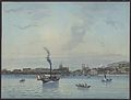
Steamship on Lake Zurich (between 1882 and 1886)


Tourism and transport

The beginnings of shipping
The beginnings of shipping traffic on Lake Zurich are likely to date back to the earliest demonstrable settlement of its shores around 6,000 years ago. It is historically certain that after the conquest of the area populated by Celtic Helvetians around 15 BC. BC, the establishment of a Roman customs post at the vicus Turicum (Zurich). This secured trade on the Walensee-Zürichsee waterway between the Roman provinces of Gallia Belgica and Germania superior and Raetia .
The waterway gained increasing importance in the early Middle Ages as an important link in international freight traffic towards Lake Walen and Bündner passes. In addition to the transit traffic, the pilgrimage to Einsiedeln also developed increasingly, and the lake was used by local traders on the way to the market in Zurich, as well as across the Limmat into the Rhine ( millet trip ).
Transportation of goods today
The lake has lost its important role as a transport axis. But heavy bulk goods are still transported on the water. The transport barges, known as Ledischiff , can load 50 trucks. Every year 300,000 tons of gravel, sand and stones are transported - in the 1970s it was more than three times as much. The Kibag has several loading quays, including one in the city of Zurich in Wollishofen.
Tourism on Lake Zurich

Franz Carl Caspar, a citizen of Rorschach, founder of the “Steamship Company for Lake Constance and Rhine”, was also interested in introducing steam navigation on Lake Zurich and Lake Walen , together with Johann Jakob Lämmlin from Schaffhausen as a technical expert. On March 19, 1834, the two pioneers founded the company "Caspar and Lämmlin, entrepreneurs of steam shipping on Lake Zurich and Lake Walen". They ordered the first Lake Zurich steamer, the "Minerva", which went into operation on July 19, 1835, from the William Fairbairn machine factory in Manchester.
From this first tourist development of the Lake Zurich area, today's Zurich Lake Schiffahrtsgesellschaft (ZSG, since 1957) emerged, whose fleet of a total of 17 ships (as of 2007) provides scheduled, year-round passenger transport on Lake Zurich, the Obersee and on the Limmat, which runs through the city of Zurich guaranteed.
The usual ZVV zone tickets are valid on the scheduled ships, this also includes passenger transport on the independently operating ZSG Limmatschifffahrt and the independent Lake Zurich ferry Horgen – Meilen .
Ferry service

The five car ferries of the Lake Zurich Ferry Horgen-Meilen AG from Horgen to Meilen are an important link for passenger and motorized traffic . In 2007, they carried 2,247,348 people, 1,277,038 cars and 89,034 trucks on their roughly three-kilometer route, usually every ten minutes.
Other continuous passenger ships in regular shuttle service across Lake Zurich run between Richterswil, Wädenswil, Stäfa and Männedorf, then between Thalwil, Erlenbach and Küsnacht, and irregularly between Rapperswil and the island of Ufenau.
The tour of the Stadtzürcher Limmatschiffe (operator is the ZSG) leads on the Limmat from the Landesmuseum to Bürkliplatz and on to Wollishofen and the Zürichhorn . The Hafen Enge stop is also served by the Limmat ships.
Rail and vehicle traffic

In 1859 the first steam train ran in Rapperswil, as the junction of the railway lines from Rapperswil to Rüti and from Rapperswil along the Obersee to Schmerikon .
About the seedamm since 1878 leads railway line of the SOB and the road to Pfäffikon SZ.
The legendary Arlberg-Orient-Express drove for a while from Bucharest , Budapest , Vienna and the Arlbergbahn along Lake Zurich to Zurich and on to Basel , Paris and Calais . The two railway lines to the left and right of Lake Zurich were built in 1875 and 1894, respectively.
leisure
When the weather is nice, the lakeside promenades are the destination of many walkers, especially in the area of the city of Zurich. In the summer months there is a lot of traffic on Lake Zurich; Swimmers, divers, private watercraft and scheduled boats have to share the space.
Almost 12,000 watercraft are registered in the canton of Zurich:
- approx. 5800 motor ships
- approx. 2100 sailing ships with engines
- approx. 2200 sailing ships without engines
- approx. 1400 rowing boats
economy
Drinking water supply
The lake is an important source of drinking water for the region. Nine waterworks alone cover 40% of the drinking water requirements of the Canton of Zurich. Around 152 million liters of water are taken from the lake in the canton of Zurich every day for the drinking water supply. Throughout the year, the withdrawal amounts to around 78 million cubic meters or two percent of the lake's water volume.
Viticulture

The lake and the foehn in autumn favor the cultivation area on Lake Zurich. Wine can be grown around the lake , mostly the grape varieties Riesling , Silvaner , R Noiseling , Blauburgunder and Completer .
With 50 hectares, Stäfa on the right bank of the lake is the largest wine-growing community in the canton of Zurich, and there are still a few vineyards in Meilen and Herrliberg . On the left bank is on the Au peninsula , the wine museum Au . The Federal Research Institute for Fruit, Viticulture and Horticulture and the University of Wädenswil , where winemakers, oenologists and cellar masters are trained, are located in Wädenswil .
Around 2000 years ago, the Romans brought wine across the Alps to Zurich, and with it the knowledge of how it was grown. According to findings, the Romans already cultivated vineyards on the shores of Lake Zurich.
photos
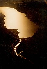
View over the Limmat and Lake Zurich to the south
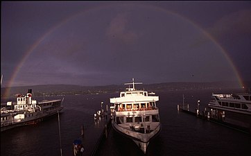
Thunderstorm over Wollishofen

Lake Zurich with Ufenau
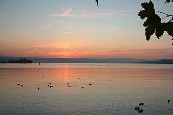
Sunset in Rapperswil
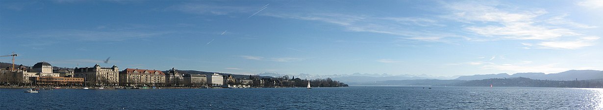
Panorama from the view of the Alps from Lake Zurich. 47.36536 ° N , 8.54119 ° O


literature
- Peter Ziegler: Lake Zurich. In: Historical Lexicon of Switzerland .
- Albert Schoch: Contributions to the settlement and economic geography of the Lake Zurich area. In: Annual reports of the Geographical-Ethnographic Society in Zurich. Volume 17, 1916-1917. (Digitized version)
See also
- List of lakes in the canton of Schwyz
- List of lakes in the canton of St. Gallen
- List of lakes in the canton of Zurich
Web links
- Seegfrörni 1963 - Photos, films, memories ( Memento from October 15, 2016 in the Internet Archive ) Website Neue Zürcher Zeitung
- Lake Zurich (Zurich) , Lake Zurich (St. Gallen) , Lake Zurich (Schwyz) on the ETHorama platform
Individual evidence
- ↑ a b c d e Lake Zurich on the website of the Building Department of the Canton of Zurich, accessed on March 5, 2017.
- ↑ a b Lakes (Federal Office for the Environment FOEN). Retrieved January 19, 2020 .
- ↑ a b Der Zürichsee , Zürichsee-Schifffahrtsgesellschaft (ZSG), accessed on March 27, 2017.
- ↑ René Hantke: The late worm ice age stages on the Swiss north side of the Alps. In: Quaternary Science Journal 21, 1970, pp. 71-80, doi: 10.3285 / eg . 21.1.06 .
- ↑ J. Grüninger: From the becoming of the Linth plain. In: 23rd yearbook of the St. Gallen Cantonal Teachers' Association, 1939.
- ^ Walter Drack, Rudolf Moosbrugger-Leu: The early medieval church of Tuggen. In: Journal for Swiss Archeology and Art History, 1960, pp. 176–216.
- ^ Conrad Schindler : On the Quaternary of the Linth region . Contributions to the geological map of Switzerland, Delivery 169, 2004. Swisstopo Wabern BE. Terra plana? Magazine for culture, history, tourism and business . 3/2005, Sarganserländer Druck AG Mels. Preservation of monuments and archeology in the canton of St. Gallen 1997–2003, p. 340 ff.
- ^ Canton of Zurich: Maritime regulation
- ^ Federal Office for the Environment: Fact sheet on Lake Zurich Regulation
- ↑ Adi Kälin: Where the water level of Lake Zurich is determined In: Neue Zürcher Zeitung of February 1, 2019
- ^ Website Die Pfahlbauer ( Memento from January 16, 2005 in the Internet Archive ), media release from February 2004
- ↑ archaeologie.zh.ch: Archaeological rescue excavation for the Opéra car park: Government council gives the green light for the evaluation , accessed on August 31, 2010
- ↑ The Horgen culture
- ↑ Cantonal Archeology Zurich , Activity Report 2003–2005
- ↑ http://www.palafittes.org/de/unesco-welterbe/fundstellen-schweiz/index.html (link not available): Rapperswil-Jona / Hombrechtikon-Feldbach ( Seegubel , CH-SG-01), Rapperswil-Jona -Technikum (CH-SG-02), Freienbach-Hurden-Rosshorn (CH-SZ-01) in connection with the prehistoric and historical lake crossings , accessed on February 15, 2013
- ↑ UNESCO World Heritage Center website (June 27, 2011), press release Six new sites inscribed on UNESCO's World Heritage List , accessed February 15, 2013
- ↑ The «pile dwelling fever» is drawing closer. In: Zürichsee-Zeitung. Linth-Zeitung, April 7, 2004, archived from the original on September 29, 2007 ; Retrieved April 23, 2014 .
- ^ Theodor von Liebenau : History of fishing in Switzerland. Bern 1897, p. 115.
- ^ Heinrich Grimm: New contributions to the "fish literature" of the XV. to XVII. Century and through their printer and bookkeeper. In: Börsenblatt for the German book trade - Frankfurt edition. No. 89, November 5, 1968 (= Archive for the History of Books. Volume 62), pp. 2871–2887, here: p. 2882.
- ↑ The years 1223 to 1963 (except 1435) were quoted from the report Seegfrörni Zürichsee 1963. Historical Seegfrörni Zürichsee ( Memento from February 22, 2014 in the Internet Archive ) (accessed on January 20, 2011)
- ^ Werner Dobras: Seegfrörne. The exciting story of the sea frost from 875 to today. 2nd, modified edition. Stadler Verlagsgesellschaft, Konstanz 1992, ISBN 3-7977-0266-3 , pp. 10-11.
- ^ Report Seegfrörni Zürichsee 1963. Historical Seegfrörni Zürichsee ( Memento from February 22, 2014 in the Internet Archive ) (accessed on January 20, 2011)
- ↑ Protocol of the Zurich Seegfrörni 1963 by Ulrich Gut, * 1922 (accessed on January 20, 2011)
- ↑ Pictures from the frozen Lake Zurich in 1963 (accessed on January 20, 2011)
- ^ Landscape Sprawl Switzerland - Quantitative Analysis 1935 to 2002 and conclusions for spatial planning. Final scientific report. National Research Program 54th Zurich 2008.
- ↑ 1,564,000 live in the catchment area of Lake Zurich including Walensee (as of 2005). Source: Office for Environment and Energy (AFU) of the Canton of St. Gallen.
- ↑ Walter Bernet: Leisurely, but efficiently . In: Neue Zürcher Zeitung . No. 200 , August 29, 2012 ( article on NZZonline ).
- ↑ Website Stadt Opfikon , Verkehr (ÖV), accessed on March 27, 2017.
- ↑ Jan Hudec: Actually, it wouldn't be necessary to save water . In: Neue Zürcher Zeitung . August 7, 2018, p. 18th f . ( nzz.ch [accessed on August 10, 2018]).
- ↑ Typical Lake Zurich grapes. Archived from the original on October 31, 2013 ; Retrieved May 11, 2010 .
- ↑ Viticulture Museum
- ↑ a b Wine-growing regions from Lake Zurich to Weinland. (PDF) p. 2 , accessed on March 15, 2010 .
Swiss lakes with an area of over 1 km² (without artificial reservoirs ):
Aegeri | Baldeggersee | Lake Biel | Lake Constance | Lake Brienz | Lake Geneva | Greifensee | Hallwilersee | Lac de Joux | Lake Poschiavo | Langensee | Lauerzersee | Lake Lugano | Lungerersee | Lake Murten | Lake Neuchâtel | Oeschinensee | Pfäffikersee | Sarnersee | Sempachersee | Silsersee | Lake Silvaplana | Lake Thun | Lake Lucerne | Walensee | Lake Zug | Lake Zurich