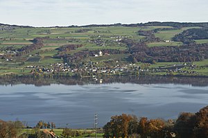
Baldeggersee
| Baldeggersee | ||
|---|---|---|

|
||
| Gelfingen am Baldeggersee | ||
| Geographical location | Central Switzerland | |
| Tributaries | Ron | |
| Drain | Aabach | |
| Places on the shore | Gelfingen | |
| Data | ||
| Coordinates | 662.28 thousand / 227 844 | |
|
|
||
| Altitude above sea level | 463 m above sea level M. | |
| surface | 5.3 km² | |
| scope | 12.938 km | |
| Maximum depth | 66 m | |
|
particularities |
artificial sea ventilation |
|
| BFS no. : 9157 | ||

|
||
The Baldeggersee is a 5.3 km² lake in the canton of Lucerne , in the Swiss plateau .
geography
The lake is located in the southern Seetal , embedded between the two long ridges of the Erlosen in the west and the Lindenberg in the east. The mean altitude is 463 m above sea level. M. The lowest point of the lake bed is 397 m above sea level. M. , which corresponds to a maximum depth of 66 m. The mean depth of the lake is 33 m.
The Baldeggersee has a length of 4.5 km and a width of 1 to 1.7 km. Its water volume is 0.173 km³. It belongs to Pro Natura and is therefore the largest privately owned lake in Switzerland.
The catchment area of the lake is 73 km² (including the lake area). The main tributary is the Ron , which flows into the lake at Baldegg . Furthermore, some small brooks on the western slope of the Lindenberg and from Erlosen lead their water to the lake. Because all the tributaries arise in the vicinity and therefore only carry little water, the mean time of the water stay in the lake is 5.5 years. The outflow is the Aabach , which leaves the lake at its northern end and flows into the Hallwilersee after a few kilometers . The shores of the lake are relatively flat on all sides. The only community directly on the lake is Gelfingen . The two larger towns of Hitzkirch and Hochdorf are a bit away from the lake at the foot of the Lindenberg.
Emergence
The Baldeggersee owes its formation to the Ice Age Reuss Glacier, which carved out and deepened today's Seetal. When the glacier retreated, a so-called body of dead ice remained here for a long time , preventing the over-deepened valley floor from being filled with river sediments.
Water quality
The lake is located in an area that is used intensively for agriculture. As a result, the lake was exposed to pollution from over-fertilization (phosphorus, nitrates, ammonia) as early as the 1920s. Furthermore, the then still untreated wastewater from settlements and industry was added. This problem could be solved by building sewer systems. In contrast, in the course of the 20th century, the nutrient input through agriculture increased, which ultimately led to rapid algae growth and, as a result, to a strong decrease in the oxygen that is essential for the marine ecosystem.
From 1980 onwards, a combination of different measures aimed to improve water quality. On the one hand, through educational work and financial incentives by the federal government and the canton, farmers were encouraged to limit nutrient enrichment in the lake through more ecological management. On the other hand, the Baldeggersee has been artificially ventilated since 1982 as the first lake in the world. With this artificial oxygen input, the oxygen content could be increased again almost to the legally required 4 mg oxygen per liter of water. In winter, compressed air, which is fed in at the bottom of the lake, is used to force the water to circulate. As a result, the phosphorus content of the lake could be reduced to approx. 26 mg / m³ by 2010. However, the goal is a value between 15 mg / m³ and 20 mg / m³.
See also
List of lakes in the canton of Lucerne
literature
- Sebastian Stoll, Cäcilia von Arb, Christof Jörg, Sebastian Kopp, Volker Prasuhn: Evaluation of the areas that contribute significantly to the phosphorus pollution of the Baldeggersee . Final report 2019. Ed .: Agroscope , Reckenholz. March 25, 2019, p. 149 ( admin.ch [PDF; 16.4 MB ]).
Web links
- Waltraud Hörsch: Baldeggersee. In: Historical Lexicon of Switzerland .
- Baldeggersee in Lucerne's Seeland Information page on the website for aerial photographs of Switzerland with aerial photographs and further information
- Environment + Energy Canton Lucerne, information on Lake Baldeggersee
- Renovation concept and lake ventilation ( Memento from February 8, 2012 in the Internet Archive )
Individual evidence
- ↑ a b c d Seen (Federal Office for the Environment FOEN). Retrieved January 18, 2020 .
