Ägeri lake
| Ägeri lake | ||
|---|---|---|

|
||
| Ägerisee near Morgarten | ||
| Geographical location |
Schwyz Alps Canton ZG CH |
|
| Tributaries | Dorfbach, Trombach and Hüribach | |
| Drain | Lorze | |
| Places on the shore | Oberägeri , Unterägeri | |
| Data | ||
| Coordinates | 689 599 / 219792 | |
|
|
||
| Altitude above sea level | 724 m above sea level M. | |
| surface | 7.2 km² | |
| scope | 15.214 km | |
| Maximum depth | 83 m | |
|
particularities |
BFS no. : 9270 |
|

|
||
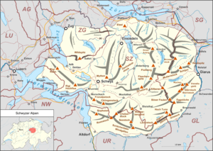
The Ägerisee is a 7.2 km² large lake in the Swiss canton of Zug , which was created by a glacier and is in the Schwyz Alps at 724 m above sea level. M. lies. Its main inflow is the Hüribach , the outflow is the Lorze .
The Ägerisee has been used as a drinking water reservoir since 1992. Water is still used on the lake today .
tourism
The tradition of tourist shipping, which began in 1890, is being continued with two motor ships by Ägerisee Schifffahrt AG, a subsidiary of Zugerland Verkehrsbetriebe , founded in 2002 .
A monument dedicated to the Battle of Morgarten (1315) stands on the lakeshore, inaugurated in 1908 . At the end of January 2006, the frozen lake was opened for use in some places for the first time since 1981.
Recordings
Web links
- Pictures of Lake Aegeri and the surrounding area at www.zug-schweiz.ch
- Renato Morosoli: Lake Aegeri. In: Historical Lexicon of Switzerland .
- Ägerisee on the ETHorama platform
See also
List of lakes in the canton of Zug
Individual evidence
- ↑ a b Lakes (Federal Office for the Environment FOEN). Retrieved January 18, 2020 .
- ↑ a b c Position, height & depth according to SwissTopo (maps of Switzerland)


