Lake Davos
| Lake Davos | ||
|---|---|---|

|
||
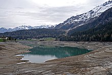
| The Davosersee, in the background the Wolfgangpass | ||
| Geographical location | Graubünden , Switzerland | |
| Tributaries | Flüelabach (partial feed line), Totalpbach , various mountain streams | |
| Drain | Pressure tunnel to Klosters , Landwasser (overflow) | |
| Location close to the shore | Davos | |
| Data | ||
| Coordinates | 784 305 / 188234 | |
|
|
||
| Altitude above sea level | 1559 m above sea level M. | |
| surface | 59 ha | |
| volume | 15,600,000 m³ | |
| scope | 3.77 km | |
| Maximum depth | 54 m | |
|
particularities |
Natural reservoir |
|
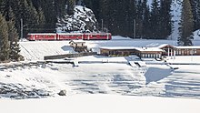
The Davosersee , also spelled Davoser See out of date , is located in the canton of Graubünden a little north of the well-known winter sports resort Davos in Switzerland . It marks the north-eastern end of the Davos landscape , a high valley traversed by Landwasser and stretching south-west to the Zügen Gorge . North of the lake, the low Wolfgang Pass leads over to Klosters in Prättigau . It is named for the Seehorn directly above it .
Due to thermal winds, the lake is a very wind-safe sailing and surfing lake in summer . The water temperature reaches a maximum of 20 ° C.
Emergence
The lake was created by a landslide from the Totalp in the Parsenn area , which dammed the waters of today's upper Landwasser area that had flowed off towards Prättigau. However, the water did not flow over and then cut through the landslide mass, as it did with the Ruinaulta , but was able to flow away on the slightly lower opposite side of the valley and has since continued to eat its way into the rocks of the Zügen Gorge . The Davosersee is the remainder of this lake, which once encompassed the entire low-incline of today's high valley and was later mainly filled in by the bed load from Flüelabach and Dischmabach . On the other hand, the growing alluvial fan of the Flüelabach gradually increased the altitude of the lake runoff towards the land water, which counteracted the ongoing reduction in the lake area through sedimentation.
Lake Davos receives its water not only from the flowing streams such as the Totalpbach, but also from groundwater inflows from the alluvial fan of the Flüelabach. The former natural runoff, the lake water , was considered the beginning of the land water, despite the lower water flow compared to the Flüelabach. Thanks to hydraulic engineering measures for energy generation, this situation has changed significantly today.
use
From time immemorial, the lake contributed to the equalization of the runoff, which could be important in the winter months with little runoff. Until the 1920s, Lake Davos was used for tourism and business all year round. In winter it was driven on by horse-drawn sleigh and was also used for a long time to extract ice, which was transported to the rest of Switzerland by rail in winter.
Since the pressure tunnel to the Klosters power plant was commissioned in 1922, the lake has been used to generate electricity . In order to ensure smooth operation, part of the Flüelabach is drained underground into the lake during the winter months when there is little drainage. Nevertheless, more water flows to Klosters to generate electricity than the surrounding streams feed in, so that in the cold season the lake basin largely dries out and can no longer be used for other purposes.
An initiative by local politicians who wanted to keep the water level at natural height over the winter was rejected by the Davos electorate because of the associated losses in electricity generation.
The water is also pumped up in three reservoirs, which provide water for snow-making in ski areas.
Individual evidence
- ↑ a b c R. Keller: Precipitation, runoff and evaporation in the Swiss high mountains. On the life's work of Otto Lütschg-Lötscher in: Geography IV, 1950, pp. 54–67, in it Chapter 3: Water management in the high mountains using the example of the Davos valley
- ↑ Dominik Meier, Jürg Brandenberger: Money for snow-making systems - «State snow» is supposed to save ski areas. In: srf.ch . November 27, 2019, accessed November 27, 2019 .
Web links
- Davosersee on schweizersee.ch


