Rabiusa
|
Rabiusa Rabiosa, Safierrhein, Savier Rhein |
||
|
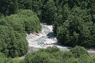
Rabiusa in the Safien Valley |
||
| Data | ||
| Water code | CH : 320 | |
| location | Canton of Graubünden ; Switzerland | |
| River system | Rhine | |
| Drain over | Vorderrhein → Rhine → North Sea | |
| source | on the northeast slope of the Bärenhorn 46 ° 34 '53 " N , 9 ° 14' 23" E |
|
| Source height | approx. 2550 m above sea level M. | |
| muzzle | in the Versamer Schlucht in the Vorderrhein Coordinates: 46 ° 48 ′ 17 ″ N , 9 ° 19 ′ 51 ″ E ; CH1903: 744 434 / 185478 46 ° 48 '17 " N , 9 ° 19' 51" O |
|
| Mouth height | 618 m above sea level M. | |
| Height difference | approx. 1932 m | |
| Bottom slope | approx. 59 ‰ | |
| length | 33 km | |
| Catchment area | 138 km² | |
| Outflow A Eo : 138 km² at the mouth |
MQ Mq |
2.79 m³ / s 20.2 l / (s km²) |
Source and mouth of the Rabiusa
|
The Rabiusa ( , Rhaeto-Romanic also Rabiosa , i.e. 'the raging', in the Safier dialect Rii , i.e. Rhine ) is a 32-kilometer tributary of the Rhine .
The mountain river rises in the northern slopes of the Bärenhorn ( 2929 m above sea level ), where the old mule track leads from Safien over the Safierberg alpine pass ( 2486 m above sea level ) to Splügen , i.e. in the border area with the Hinterrhein district . The Rabiusa flows through the wooded Safien Valley and flows into the impassable Versamer Gorge, where it is spanned by the Versamer Tobelbrücken , in the also deeply cut Vorderrhein ( Rhine Gorge ).
At Safien-Platz the Carnusbach flows from a south-easterly direction right into the Rabiusa. The Walser village Safien-Platz is the only place directly on the river.
bridges
10 road and 6 pedestrian bridges cross the Rabiusa.
Web links
Individual evidence
- ↑ a b Geoserver of the Swiss Federal Administration ( information )
- ↑ Evaluations of the water network. (XLSX) FOEN , December 2013, accessed on August 9, 2017 (listing of Swiss rivers> 30km).
- ↑ a b Topographical catchment areas of Swiss waters: sub-catchment areas 2km2. Retrieved May 30, 2019 .
- ↑ https://peter-hug.ch/?such=Rabiusa
- ↑ Schweizerisches Idiotikon, Vol. VI, Sp. 996, Article Rīn (under Condition 1b)

