Col de Champex
| Col de Champex | |||
|---|---|---|---|
| Compass direction | Northwest | southeast | |
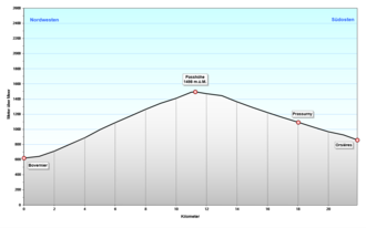
| Pass height | 1498 m above sea level M. | ||
| Canton | Valais | ||
| Watershed | Durnand → Dranse | ||
| Valley locations | Bovernier | Orsières | |
| expansion | Pass road | ||
| Built | 1926 | ||
| profile | |||
| Ø pitch | 7.8% (880 m / 11.3 km) | 6% (637 m / 10.6 km) | |
| Map (Valais) | |||
|
|
|||
| Coordinates | 574 317 / 97877 | ||
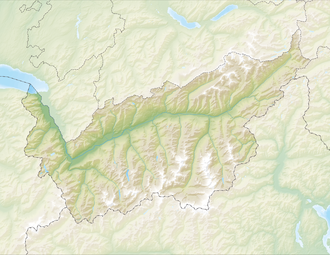
The Col de Champex is a pass in the French-speaking part of the Swiss canton of Valais . It is located between the hamlet of Les Valettes in the municipality of Bovernier in Val d'Entremont and the village of Somlaproz in Val Ferret in the municipality of Orsières . The pass height is 1498 m above sea level. M. Just south of the saddle, 30 meters deep, lies the village of Champex-Lac with the small lake Lac de Champex and the postcard idyll.
The tour over the Champex saddle is a popular route for motorcyclists. The north ramp above the Durnand Gorge has around 20 hairpin bends and the east ramp 9. On the east side there are beautiful views of the Grand Combin massif .

