Les Agites
| Les Agites | |||
|---|---|---|---|
|
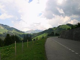
Road on the pass |
|||
| Compass direction | south | North | |
| Pass height | 1569 m above sea level M. | ||
| Canton | Vaud | ||
| Watershed | Rhone | Hongrin → Saane → Aare → Rhine | |
| Valley locations | Yvorne | La Lécherette | |
| expansion | Street | ||
| Lock | Autumn-Spring Mon. – Fri. blocked |
||
| profile | |||
| Ø pitch | 9.4% (1131 m / 12 km) | 1.1% (189 m / 18 km) | |
| map | |||
|
|
|||
| Coordinates | 562 716 / 134870 | ||
At Les Agites there is a road in the canton of Vaud that connects Yvorne and La Lécherette . The watershed between the Rhone and the Rhine is located near Ayerne and is lower than the highest point of the road that goes around the ridge. So it is not an actual pass crossing, it starts as a mule track at Roche (VD).
The south side of the road is in the Rhone Valley . The 12 km long ascent to Les Agites can be reached via various serpentines . In the middle of the ascent is the village of Corbeyrier . Before reaching the highest point, you have to cross an approx. 300 meter long tunnel, a typical connecting road as it was created by the Swiss Army in many places.
The north side of the road is much flatter and runs along the south bank of Lac de l'Hongrin . However, this part of the street is only open to private motorized traffic in the summer months on Saturdays and Sundays. At the village of La Lécherette , the route joins the Col-des-Mosses pass road.
The Veloroute V4 from «Veloland Schweiz» uses this pass.


