Albula Pass
| Albula Pass | |||
|---|---|---|---|
|
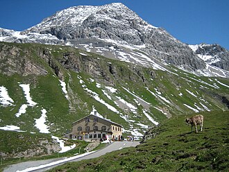
The hospice at the top of the pass; North side |
|||
| Compass direction | west | east | |
| Pass height | 2315 m above sea level M. | ||
|
|
|
||
| Watershed | Albula → Hinterrhein → Rhine | Ova d'Alvra → Inn → Danube | |
| Valley locations | Bergün | La Punt | |
| expansion | Street | ||
| Built | 1855-1865 | ||
| Lock | November - June | ||
| Mountains | Albula Alps | ||
| particularities | in winter: toboggan run from Preda to Bergün |
||
| profile | |||
| Ø pitch | 5.6% (1348 m / 24 km) | 6.9% (620 m / 9 km) | |
| Max. Incline | 12% | 12% | |
| map | |||
|
|
|||
| Coordinates | 783.95 thousand / 162 006 | ||
The Albula Pass ( Rhaeto-Romanic ) is 2315 m above sea level. M. high mountain passage in the Albula Alps in the canton of Graubünden in Switzerland .
geography
The Albula Pass connects Bergün in the Albula Valley with La Punt in the Upper Engadine . The North Sea / Black Sea watershed runs over it . The sign at the pass indicates a height of 2315 m above sea level. M. , but because the reference point for height measurements in Switzerland has changed, the lower height information is correct according to the current measurement method.
Because the narrow road over the pass was no longer important in terms of traffic after the construction of the Albula Railway , but above all because of the more favorable conditions on the Julier Pass , it is closed every year from November to June due to the risk of avalanches. In the rest of the time, mainly tourists use the pass.
history
In 1695, the citizens of Bergün on the road financed the straightening of the most difficult section of the route on Bergünerstein . The road had to be carved out of the rock by blasting. This makes it the first road that was blasted into a rock wall with the help of explosives. Previously, it served as an alternative route when the paths and roads of the parallel passes over the Julier and Septimer were impassable. The costly investment should be worth it, the traffic over the pass increased in the following years and with it the customs duties as well as the remuneration of the traders .
A sudden end to this economic activity brought the opening of the Albula Railway in 1904. The local economy recovered surprisingly quickly from the structural crisis and instead switched to tourism. Since then, this branch of industry has determined what is happening on the Albula Pass.
The pass area is located in a high alpine zone, where snowfalls can sometimes be expected even in summer. The narrow road conditions are unsuitable and partially blocked for larger vehicles ( e.g. for larger coaches ). In autumn 2018, a hurricane destroyed the hospice and individual high-voltage lines in exposed locations. In the winter months, the northern part of the road over the Albula Pass between Preda and Bergün is converted into a six-kilometer-long toboggan run . The difference in altitude is 400 meters; a sleigh ride takes up to 20 minutes. The Rhaetian Railway will transport the sledges and the driver between the two stations .
Occasionally a stage of the annual Tour de Suisse leads over the pass.
The pass is crossed under the Rhaetian Railway's 5865 m long Albula tunnel at a height of around 1800 m , the highest alpine tunnel of this length.
On the north side of the pass is Alp Weissenstein , which serves as a research station for ETH Zurich .
literature
- Martin Bundi : Albula Pass. In: Historical Lexicon of Switzerland . June 4, 2002 .


