Böhler (pass)
| Böhler-Passhöchi | |||
|---|---|---|---|
|
Boehler |
|||
| Compass direction | west | east | |
| Pass height | 611 m above sea level M. | ||
| Canton | Aargau | ||
| Watershed | Suhre , Aare , Rhine | Wyna , Suhre , Aare , Rhine | |
| Valley locations | Schöftland | Unterulm | |
| expansion | Street | ||
| Lock | - | ||
| profile | |||
| Ø pitch | 4.9% (146 m / 3 km) | 4.9% (148 m / 3 km) | |
| Map (Switzerland) | |||
|
|
|||
| Coordinates | 648 810 / 239800 | ||
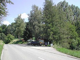
The Böhler-Passhöchi is a Swiss pass in the canton of Aargau , which connects Schöftland in the middle Suhrental with Unterkulm in the middle Wynental .
There is a kiosk at the top of the pass, but it has been closed since autumn 2015.
The Böhler- Hochwacht with a fireplace at the edge of the forest is located about 1 km north of the top of the pass at 654 m . The Böhler-Hochwacht is one of the many signal points on mountain peaks from which messages were previously passed on via fire signals.
Surname
Both Bööler (e.g. at swisstopo ) and Böhler (e.g. at Google Maps ) are used as spellings on the Internet . The signage on site uses the name Böhler .
Web links
Commons : Bööler - Collection of images, videos and audio files
- Böhler at quaeldich.de
- In the Aargau Emmental (Hochwacht) at hikr.org


