Rüsler
| Rüsler | |||
|---|---|---|---|
|
|
|||
| Compass direction | southwest | Northeast | |
| Pass height | 640 m above sea level M. | ||
| Canton | Aargau | ||
| Watershed | → Reuss → Aare → Rhine | → Limmat → Aare → Rhine | |
| Valley locations | Oberrohrdorf | Neuenhof | |
| expansion | Street | ||
| Lock | Driving ban for motor vehicles | ||
| profile | |||
| Ø pitch | 16.6% (183 m / 1.1 km) | 8.2% (247 m / 3.0 km) | |
| Map (Aargau) | |||
|
|
|||
| Coordinates | 666 153 / 254 545 | ||
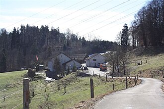
The Rüsler (also Rüdler or Rüssler ) is a settlement spots and a street crossing in the Swiss canton of Aargau , where the Reuss valley to the Limmat connects.
Location and surroundings
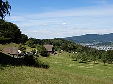
The settlement is on the Rüdlersberg , which is part of the Heitersberg ridge . The settlement is part of the Swiss community of Neuenhof and actually consists of a farm with several buildings. He is at 634 m above sea level. M. near the transition of the same name at the highest point of the connecting path between Oberrohrdorf in Reuss Valley and Neuenhof in Limmat Valley , which is about 200 meters southwest of the settlement at 640 m . Although accessible by a road, it is not allowed to cross the mountain with motorized vehicles without a permit. However, there are several hiking trails and bike routes in all directions over the Rüsler.
history
The connection via the Rüsler has existed since the Middle Ages. The name Rüsler was originally an abbreviation of the name Rüdlersberg, but has changed over the centuries from Rüdler to Rüssler to Rüsler.
The farm is first mentioned in 1436, when the Rüdler farm was sold to Hans Kilchmann von Melligen by the heirs of the Mellig citizen Hans Bitterkrut. According to the Grafschaftsurbar, the farm belonged to the Dietikon office and court. The owner had to pay 2 Mütt kernels and 1 Malter oats as loan interest, directly to the Emperor of the Holy Roman Empire of the German Nation . The owner had to take the oath to the emperor and the city of Zurich and to pay homage to the emperor if he was in Zurich. In 1458 the farm of Hans Kilchmann passed to his son Rudolf. In 1479 Hans Fridolin Frey and his heirs acquired the farm. In 1505, Hans Frey, mayor of Melligen, and his two brothers exchanged the farm with the Wettingen monastery . The brothers received goods from the monastery near Mellingen in exchange. From 1505 the farm belonged to the Wettingen monastery. As a result of the abolition of all monasteries in the canton of Aargau on January 13, 1841, the farm came into the possession of the canton, which subsequently sold it.
In 1892 a pint tavern was opened on the Rüsler, which was only allowed to sell drinks. This received the rights of a catering establishment in 1899. When the Vogler family took over the business, Ed. Stucki called her Rüslerhof. On August 2, 1935, a fire broke out, which destroyed the restaurant with its house and barn. The host couple Oswald Frey with their seven children were able to save themselves. The restaurant was rebuilt after the fire.
literature
- Roman W. Brüschweiler, Viktor Egloff, Paul Fischer, Anton Kottmann, Fridolin Kurmann, Fritz Senft and Rudolf Stutz; Neuenhof - a village and its history Baden-Verlag Baden 1993 ISBN 3-85545-075-7


