Col de la Croix (Jura)
| Col de la Croix (JU) | |||
|---|---|---|---|
|
Col de la Croix (JU) |
|||
| Compass direction | North | south | |
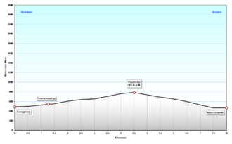
| Pass height | 789 m above sea level M. | ||
| Canton | law | ||
| Valley locations | Courgenay | Saint-Ursanne | |
| expansion | Street | ||
| Built | ? | ||
| Lock | - | ||
| profile | |||
| Ø pitch | 6.6% (299 m / 4.5 km) | 9.3% (325 m / 3.5 km) | |
| Max. Incline | 9% | 9% | |
| Map (Switzerland) | |||
|
|
|||
| Coordinates | 577555 / 246930 | ||
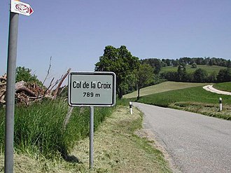
The Col de la Croix is a pass in the Swiss canton of Jura . It is located between the towns of Saint-Ursanne and Courgenay ; the pass is at 789 m above sea level. M.
Web links
Commons : Col de la Croix - Collection of images, videos and audio files


