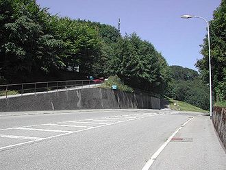
Lower Hauenstein
| Lower Hauenstein | |||
|---|---|---|---|
|
Lower Hauenstein |
|||
| Compass direction | south | North | |
| Pass height | 691 m above sea level M. | ||
| Canton | Solothurn | Basel-Land | |
| Valley locations | Olten | Sissach | |
| expansion | Pass road | ||
| profile | |||
| Ø pitch | 3.8% (295 m / 7.7 km) | 2.6% (315 m / 12 km) | |
| Max. Incline | 6.3% | 6.5% | |
| Map (Basel-Country) | |||
|
|
|||
| Coordinates | 632495 / 247925 | ||
The Untere Hauenstein is a Swiss Jura pass that connects Läufelfingen ( canton Basel-Landschaft ) with Trimbach ( canton Solothurn ) on a 10 km long road with an average gradient of 6 percent. The pass is at 691 m above sea level. M.
Main road 2 leads over the pass from Lucerne and Olten to Basel . In the middle of the route, the road crosses the town of Läufelfingen on the north ramp of the pass.
history
In addition to the nearby crossing over the Erlimoospass , the Romans may have expanded the topographically more difficult but more direct route over the Hauensteinpass. In the steep passage from Trimbach, the old pass trail crosses a rock step at Chäppeliflue about half a kilometer before the village of Hauenstein . In 1993 during ground work in the artificially deepened ravine, cart tracks were uncovered that could have come from the Roman era. Nearby Roman coins came to light that could be ancient passport offerings. The pass connects the Roman street settlement of Olten with the former Roman town of Augusta Raurica .
In the Middle Ages and up to modern times, the Hauenstein was an important trade route as a north-south connection across the Jura, which helped the sovereigns and the neighboring cantons to generate considerable income. A certificate from 1206 attests that at that time carts were led from the Chäppeliflue to the Lindenrain with a lowering rope (Hengseil). After the Schöllenen Gorge was opened up in the 13th century, the Untere Hauenstein was an important stage on the international trade route Northern Italy - Gotthard Pass - Lucerne - Basel - Southern Germany / Alsace - Frankfurt am Main . In the early 19th century, 10,000 carts a year sometimes passed the mule track.
From 1827 to 1829 the canton of Solothurn built a new, less steep pass road from Trimbach to the top of the pass.
The two railway tunnels (crest tunnel from 1857 and base tunnel from 1912 to 1915) of the Hauenstein line run under the Untere Hauenstein. For the time being, this resulted in a decline in the movement of goods and travel, which increased again with the rise of car traffic. A motel was built for travelers early on at the top of the pass . After the opening of the A2 with the Belchen tunnel in 1970, traffic over the pass decreased.
The blocking point Unter Hauenstein was one of the three main axes (Unterer Hauenstein, Oberer Hauenstein , Birstal ) that would have had to be defended by Border Brigade 4 of the Swiss Army during the Second World War .
literature
- Peter Frey: The lower Hauenstein in the late Middle Ages. The political and economic importance of a Jura pass . In: Yearbook for Solothurn History . tape 42 , 1969, p. 5–135 , doi : 10.5169 / seals-324410 .


