Challhöchi
| Challhöchi | |||
|---|---|---|---|
|
Pass height |
|||
| Compass direction | North | east | |
| Pass height | 848 m above sea level M. | ||
| Cantons | Basel-Country | Solothurn | |
| Valley locations | Eptingen | Ifenthal | |
| expansion | Pass road / motorway tunnel | ||
| Mountains | Chain Jura | ||
| profile | |||
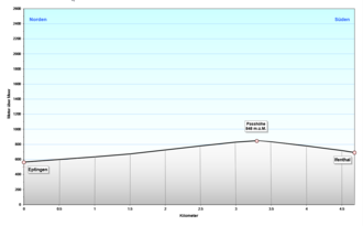
| Ø pitch | 8.5% (282 m / 3.3 km) | 11.2% (157 m / 1.4 km) | |
| Map (Basel-Country) | |||
|
|
|||
| Coordinates | 629921 / 246549 | ||
The Challhöchi is 848 m above sea level. M. high mountain pass in the Swiss chain Jura southeast of Basel on the border of the cantons of Basel-Landschaft and Solothurn .
It is the transition between the upper Basel area and the Olten area - the road above it connected the two places Eptingen and Ifenthal and Hägendorf , but was only of local importance. Today this task has been taken over by the Swiss A2 motorway , which crosses under the pass with the Belchen tunnel. The pass is named after the hamlet of Chall , a farm settlement belonging to the municipality of Eptingen.
The naming should stem from the fact that it was a bare height (without trees).
The Diegterbach rises not far north of the Challhöhi, just under 200 meters away.
During the Second World War , the pass with the Challhöchi barrier was fortified.
See also
Web links
Individual evidence
- ↑ a b Map Viewer of Swisstopo


