Ruppenpass
| Ruppenpass | |||
|---|---|---|---|
|
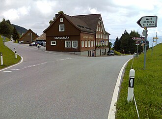
Junction to Oberegg on the Ruppen (pass) |
|||
| Compass direction | west | east | |
| Pass height | 1003 m above sea level M. | ||
| Canton | Canton of Appenzell Ausserrhoden | Canton of St. Gallen | |
| Valley locations | Trogen | Altstätten | |
| expansion | Pass road | ||
| Mountains | Appenzell Alps | ||
| profile | |||
| Ø pitch | 1.9% (100 m / 5.2 km) | 6.5% (538 m / 8.3 km) | |
| Max. Incline | 9% | ||
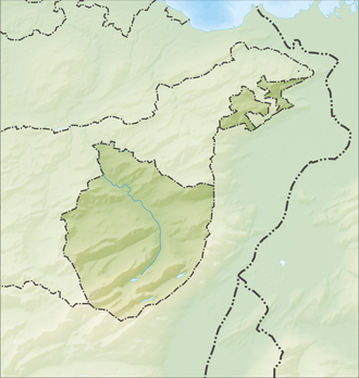
| Map (Appenzell Innerrhoden) | |||
|
|
|||
| Coordinates | 756 343 / 251 465 | ||
The Ruppenpass is a pass between the Swiss cantons of St. Gallen and Appenzell Ausserrhoden .
location
The pass is located between the towns of Trogen and Altstätten . The pass is at 1003 m above sea level. M. in the municipality of Oberegg in the canton of Appenzell Innerrhoden at the junction to St. Anton . The apex is about 10 m higher and about 500 m further in the direction of Trogen in the canton of Appenzell Ausserrhoden. On the side of the pass facing the St. Gallen Rhine Valley is the hamlet of Ruppen (locals call it Ruppendörfli ), which belongs to Altstätten.
history
As early as the Middle Ages, a mule track connected the Rhine valley market town of Altstätten with Trogen in Appenzell. After the state did not want to participate in the financing of a well-developed trade route, the Altstätten community received a loan from the Trogen and Speicher communities . In addition, the municipality of Altstätten founded a stock corporation to finance this road construction project. The engineers Lorez and Ferdinand Adolf Naeff worked out the road routing plan and in the years 1837/38 the pass crossing was expanded with a mobile road on today's route . The opening took place in September 1838 and the last section was completed in 1842. The Ruppen achieved its greatest importance from May 1842 to the 1860s, when an express mail van from St. Gallen - Feldkirch drove here every day. This stretch moderately shortest route between St. Gallen and in Vorarlberg nearby Feldkirch lost then regained importance. In July 1899, the canton of St. Gallen took over Ruppnerstrasse.
Today the road over the Ruppen is mainly used in regional traffic and in the summer months by motorcycle enthusiasts.
Web links
- Thomas Fuchs: Ruppenpass. In: Historical Lexicon of Switzerland .
- Ruppenpass at quaeldich.de
- Ruppenpass at alpenrouten.de
credentials
- ↑ Thomas Fuchs: Ruppen. In: Historical Lexicon of Switzerland . July 14, 2010 , accessed June 6, 2019 .
- ↑ HP magazine for historical securities, January 1984 edition, p. 16


