Älplisee
| Älplisee | ||
|---|---|---|

|
||
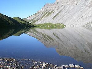
| Älplisee with the Schaftällihorn | ||
| Geographical location | Arosa ( Schanfigg , Graubünden , Switzerland ) | |
| Tributaries | Plessure | |
| Drain | Plessure | |
| Data | ||
| Coordinates | 768 452 / 180 382 | |
|
|
||
| Altitude above sea level | 2156 m above sea level M. | |
The Älplisee is a mountain lake situated at 2156 m near Arosa in Graubünden , Switzerland .
Location and description
The lake is located on the Aroser Älpli , southwest of Innerarosa behind the Älpliriegel in the source area of the Plessur between the Schwellisee and the mountains Erzhorn , Aroser Rothorn and Älplihorn .
Geology and formation
The Älplisee is a trough lake without vegetation, formed by the deposits of a local glacier . It lies on the border between the crystalline Silvretta blanket, the Tschirpen blanket and the Arosa Dolomites . The left bank is surrounded by pastureland, and the right bank consists of dolomite and limestone scree from the Älpliseehorn , which extends to the water. The inflow and outflow are partly underground, above ground through the Chlus , which is the breakthrough through the terminal moraine of the glacier. The Älplisee has crystal clear and very cold water, which normally does not allow bathing. The ice cover is around eight months a year.
Fish stocks
As with the Schwellisee, various attempts were made to use trout in the Älplisee. Since the lake sometimes dries up or freezes to the bottom, these attempts were unsuccessful.
Further use
The Älplisee is not used directly for tourism. In summer, the heavily frequented mountain hiking trails in the direction of Erzhornsattel, Rothorn, Ramozhütte / Welschtobel , Hörnli and Gredigs Fürggli lead past it. Occasionally, summer camps and boy scout groups spend the night on the shores of Lake Älplisees. In winter, a popular variant run leads from Parpaner Rothorn / Gredigs Fürggli down to the lake, which is then crossed on skis in the direction of Chlus / Schwellisee. The normal ascent of the ski tour over the Mutta to Schafrügg and to Meisserhüttli begins at the refuge below the lake (point 2070) .
The legend of Tüfelsch Ruobstei
Similar to Schwellisee , Schwarzsee , Hauensee and Urdensee , the Älplisee area is also the scene of an old legend .
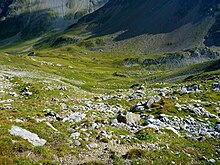
In the Schafälpli above the Älplisees there is a strikingly large stone to the right of the hiking trail. A woman's shoe is drawn on the stone and next to it the foot of a goat. The devil once parked his mother near this stone to be able to rest. He was on the way to Gredigs Älpli. As he put the load on the stone, the twig with which the devil had sewn his mother's skirt broke, whereupon he cursed quite hard.
gallery
literature
- Hans Danuser : Arosa place and field names with inclusion of the Welschtobel and some border areas of neighboring communities, self-published Danuser, Arosa 2011, ISBN 3-905342-49-9 , p. 161.
- Manfred Hunziker: Ringelspitz / Arosa / Rätikon , Alpine Touren / Bündner Alpen , Verlag des SAC 2010, ISBN 978-3-85902-313-0 , p. 317
- Ernst Rahm: The Arosa Lakes , Arosa printing house, Arosa 1982, p. 11.
- Hans Danuser: Arosa - as it was then (1850-1907) , vol. 1, self-published by Danuser, Arosa 1997, p. 137.
Web links
- Tour suggestions Älplisee
- Älplisee on schweizersee.ch


