Ringed point
| Ringelspitz / Piz Barghis | ||
|---|---|---|
|
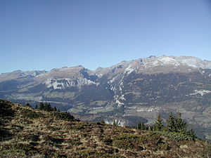
View from the Bot da la Crusch to the northwest: Flimserstein , Trin , Ringelspitz |
||
| height | 3247 m above sea level M. | |
| location |
|
|
| Mountains | Glarus Alps ( Western Alps ) | |
| Dominance | 29.9 km → Bifertenstock | |
| Notch height | 841 m ↓ Panixerpass | |
| Coordinates | 745 185 / 196 053 | |
|
|
||
|
Ring point in the middle left |
||
The Ringelspitz ( Rhaeto-Romanic Piz Barghis ) with a height of 3247 m above sea level. M. in the Glarus Alps mountain is the highest in the canton of St. Gallen .
geography
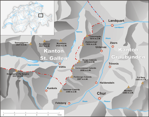
Located on the border with the canton of Graubünden, the Ringelspitz offers, thanks to its completely free location and the great distance to other higher peaks, a wide view from the Wetterstein and the Ötztal Alps to the Valais Alps and the Bernese Alps , from Adamello to the heights of the Black Forest .
The entire northern flank of the Ringelspitze massif, including the summit tower and the firn field, is privately owned as part of the Panära-Alp . The Ringel Mountain belongs to the Sardonamassiv , the chain Sazmartinhorn , the group Gray horns ( Pizol ) and the Calandakette to Tamina mountains . Accordingly, the Ringelgebirge belongs to the northern western Alps, southeast of the Glarus Alps . To the north of the Ringelspitz lies the Calfeisental with the Gigerwaldsee , in the east the ridge falls relatively gently towards the Kunkelspass , from where the summit is easiest to reach. In the south lies the valley of the Vorderrhein .
geology
As with its western neighbors, the summit structure of the Ringelspitz consists of Verrucano , a flat, greenish rock that rests on a broad base of much younger, steep flysch slates and from this through a yellowish dolomite and limestone band that is visible from the south and west is separated. A boldly built twin tower forms the summit (with a cross and a book). It falls towards the southwest in a jagged ridge, the Tscheppgrat , while on the east side, beyond a notch, the Vorder Ringel rises up with a rounded summit head. The central ridge stretches up to this notch from the south.
At the northern foot of the tower, the glowing firn terrace, the Ringelfirn, spreads out . To the southeast lies the steep Tamins Glacier, with several crevasses . Towards the Val Lavadignas , the south-western slope falls in rugged slate heaps . In the 1990s, a considerable part of the east face of the summit tower fell down onto the Tamins Glacier, tearing the former normal route with it. Climbing the tower near the northeastern edge has now become even more exposed and difficult.
source
- Manfred Hunziker: Ringelspitz / Arosa / Rätikon , Alpine Tours / Bündner Alpen , Verlag des SAC 2010, ISBN 978-3-85902-313-0 , p. 200 ff.
Web links
- Ringelspitz on the ETHorama platform
- Ringelspitz / Piz Barghis tour reports
- Ringelspitz on GeoFinder.ch
- Ringelspitz on Peakbagger.com (English)


