Reschenpass
| Reschenpass / Passo di Resia | |||
|---|---|---|---|
|
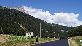
Pass summit on the Reschen, looking northwest, Piz Lad on the left |
|||
| Compass direction | north | south | |
| Pass height | 1507 m slm | ||
| region | State of Tyrol , Austria | Autonomous Province of South Tyrol , Trentino-Alto Adige , Italy | |
| Watershed | Valmiurbach → Inn → Danube → Black Sea | Adige → Adriatic Sea | |
| Valley locations | Pfunds Kajetansbrücke , Nauders | Times | |
| expansion | Reschenstrasse (B180) ; Cycle path (from Nauders) |
|
|
| Mountains | Sesvenna group , Ötztal Alps | ||
| particularities | The border between Italy and Austria does not run over the top of the pass, but is about two kilometers to the north. | ||
| profile | |||
| Ø pitch | 3.2% (513 m / 16 km) | 3.1% (583 m / 19 km) | |
| Max. Incline | 9% | ||
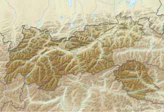
| Map (Tyrol) | |||
|
|
|||
| Coordinates | 46 ° 50 '4 " N , 10 ° 30' 36" E | ||
The Reschen Pass or simply Reschen ( Italian Passo di Resia ) is a mountain pass in the Alps , west of the Brenner Pass and east of the Bernina Pass . The watershed between the Danube ( Black Sea ) and the Adige ( Mediterranean Sea ) runs along it .
The pass crosses the main Alpine ridge and separates the Ötztal Alps in the east from the Sesvenna group in the west. It connects the Vinschgau ( South Tyrol , Italy ) with the Upper Inn Valley ( Tyrol , Austria ). The top of the pass is entirely on Italian territory and is at 1507 m above sea level near the village of Resia . The border between Italy and Austria runs since the entry into force of the Treaty of Saint-Germain in 1920 approximately two kilometers north of the pass. At the state border you will also find two information boards with the information "Reschenpass 1455 m". This height information relates to the border crossing (not to the pass height) and is therefore misleading. On the North Tyrolean side the pass area belongs to the municipality of Nauders , on the South Tyrolean side to the municipality of Graun in Vinschgau .
Surname
Although many names in the area around Reschen have a Romanesque or often a Rhaetian origin, the name Reschen itself is only of medieval and therefore German origin. How the Romans called the Reschen is, like on the Brenner, completely unknown, because people generally talked about the road, the Via Claudia Augusta , but not about the pass it crossed. Similar to the Brenner, the Reschen is said to have got its name from an old farm near the pass. This is said to have belonged to a "Resch" or "Rösch" and is first mentioned in 1393 as "on the Reschen" . The family name, which is still widespread regionally, originally means something like "the perch, rugged". Sometimes the view is also taken that the Reschen got its name from the Romanesque name for sawmill "reseca", after all, the entire Reschen Pass was still very wooded in the Middle Ages . But historians mostly reject this view. Sometimes the Reschenpass is also referred to as the "Reschenscheideck" or "Reschenscheidegg".
The Italian name Passo di Resia does not, like many other Romanesque names, go back to a Latin name, but is an invention of Ettore Tolomei in the course of the Italianization of German names in South Tyrol.
history
The Reschenpass has long been one of the most important north-south connections across the Alps . Already in Celtic times it connected the Upper Inn Valley in the north with the Vinschgau in the south as a mule track . The Reschenpass was part of the Roman road Via Claudia Augusta, which was opened around the year 50 and which was the main connection between Italy and the Augsburg region until the construction of the Via Raetia in the 2nd century AD . Until the construction of the Kuntersweg in the 14th century, it was one of the most important historical alpine crossings alongside the Bündner passes . Since then the Brenner has become much more important, so around 1430 over 90 percent of the long-distance trade traffic between Augsburg and Venice - 6500 freight wagons per year - was carried out on the Brenner route, also known as the "lower road".
From Roman times until 1854, the fortified Inn Bridge near Finstermünz north of Nauders was a customs post . The Reschen Pass only became the border between Italy and Austria in 1920 with the entry into force of the Treaty of Saint-Germain . Numerous fortifications and barriers of the Vallo Alpino are still visible on and in the vicinity of the top of the pass , particularly impressive on Plamort .
Before the First World War, the construction of a Reschenbahn from Landeck to Mals began; construction work came to a standstill during the war and was briefly resumed during the Second World War.
In 1950 the damming of the Reschensee ( Lago di Resia in Italian ) on the Italian side of the pass was completed. The place Graun and a large part of the village Reschen were flooded. Of the old Graun, only the church tower of the old parish church of St. Katharina is still visible and is now used by many tourists as a photo opportunity. Contrary to popular belief, this is not due to its height, but rather to the fact that it was the only building that was not demolished before the flooding. When the water in the reservoir is low, the tower stands in a lagoon and can be hiked around.
The builder of the alpine road over the Reschen Pass was Carl von Ghega , who already designed and built the famous Semmering Railway , which was one of the pioneering technical achievements of the time. Today the road has been taken the dangers of yesteryear through tunnels and galleries. With the exception of a few bottlenecks, bicycle traffic is now guided on separate cycle paths.
The 1990s brought radical changes to the Reschen. Thanks to Austria's accession to the EU in 1995, the customs stations became superfluous, and the Schengen Agreement also ended systematic border controls on April 1, 1998.
Web links
Individual evidence
- ↑ Südtiroler Kulturinstitut (Ed.): The upper way: from Landeck over the Reschen to Meran (yearbook of the Südtiroler Kulturinstitut 5/6/7). Bolzano 1967, p. 236.
- ^ Gerold Walser: Studies on the history of the Alps in ancient times (= Historia - individual writings. Volume 86). Franz Steiner Verlag, Stuttgart 1994, ISBN 978-3-515-06498-9 , p. 117 ( Google book preview ).
- ↑ Tolomei: Prontuario dei nomi locali dell'Alto Adige . Reale Società Geografica Italiana and Archivio per l'Alto Adige, 1909–1916
- ^ Martin Kluger: The Fugger in Augsburg , p. 13 ISBN 978-3-939645-63-4 . Reading sample (PDF, 1 MB)
- ↑ Steffan Bruns: Alpine passes - history of the alpine pass crossings . From the Inn to Lake Garda. 1st edition. tape 3 . L. Staackmann Verlag KG, Munich 2010, ISBN 978-3-88675-273-7 , p. 62 .


