
Semmering Railway
| Semmering Railway | |
|---|---|
|
UNESCO world heritage |
|

|
|
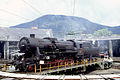
| ÖBB EuroCity train on the Rumplergraben viaduct |
|
| National territory: |
|
| Type: | Culture |
| Criteria : | ii, iv |
| Surface: | 156.18 ha |
| Reference No .: | 785 |
| UNESCO region : | Europe and North America |
| History of enrollment | |
| Enrollment: | 1998 (session 22) |


The Semmering Railway is a section of the Southern Railway in Austria . It runs from Gloggnitz over the Semmering to Mürzzuschlag . It was the first standard-gauge mountain railway in Europe , was planned by Carl von Ghega and opened in 1854. The line and locomotive construction of the Semmering Railway are considered milestones in railway history. It has been a UNESCO World Heritage Site since 1998 .
Routing and key technical data

The Semmering Railway has a length of 42 km, whereby the distance between the two end points is only 21 km as the crow flies . It overcomes a height difference of 459 m from Gloggnitz to the apex and 271 m from Mürzzuschlag. The apex is at 898 m above sea level. A. The route is characterized by 14 tunnels (including the old Semmering tunnel at 1,434 m and the new Semmering tunnel at 1,512 m), 16 viaducts (several of which are two-story) and over 100 arched stone bridges and culverts. Over almost 60% of the total length, the gradient is at least 20 ‰, with a maximum of 28 ‰. The route is only half straight (22.4 km), the other half (20.4 km) in arcs, with 16% of the route having the narrowest arc radius of 190 m. Most of the route leads along mountain slopes, side valleys are bridged with viaducts.

| Engineering structures | |||||||||||||||||||||||||||||||||||||||||||||||||||||||||||||||||||||||||||||||||||||||||||||||||||||||||||||||||||||||||||||||||||||||||||||||||||||||||||||||||||||||||||||||||||||||||||||||||
|---|---|---|---|---|---|---|---|---|---|---|---|---|---|---|---|---|---|---|---|---|---|---|---|---|---|---|---|---|---|---|---|---|---|---|---|---|---|---|---|---|---|---|---|---|---|---|---|---|---|---|---|---|---|---|---|---|---|---|---|---|---|---|---|---|---|---|---|---|---|---|---|---|---|---|---|---|---|---|---|---|---|---|---|---|---|---|---|---|---|---|---|---|---|---|---|---|---|---|---|---|---|---|---|---|---|---|---|---|---|---|---|---|---|---|---|---|---|---|---|---|---|---|---|---|---|---|---|---|---|---|---|---|---|---|---|---|---|---|---|---|---|---|---|---|---|---|---|---|---|---|---|---|---|---|---|---|---|---|---|---|---|---|---|---|---|---|---|---|---|---|---|---|---|---|---|---|---|---|---|---|---|---|---|---|---|---|---|---|---|---|---|---|---|
|
|||||||||||||||||||||||||||||||||||||||||||||||||||||||||||||||||||||||||||||||||||||||||||||||||||||||||||||||||||||||||||||||||||||||||||||||||||||||||||||||||||||||||||||||||||||||||||||||||
history
prehistory
Until the twelfth century, the pass over the Semmering was quite meaningless, as the merchants avoided the impassable area and avoided the mountains further east. Only then did a path emerge. In 1728, Emperor Charles VI. build a steep road with gradients of up to 17%.
Since this road no longer met the traffic requirements of the 19th century, Archduke Johann wanted to build a railway from Vienna to Trieste not via Hungary , but via the Semmering. On the Lower Austrian side there was already a line to Gloggnitz (1842), on the Styrian side one to Mürzzuschlag (1844). The endpoints of the two routes were connected by a road built in 1841, on which all goods were transported over the pass by horse and cart with up to twelve harnessed horses .
planning

A rail connection between Gloggnitz and Mürzzuschlag was required to replace cost-intensive road transport. However, at the time there were doubts about the technical possibility of implementation.
In 1841, the building director's adjunct and later building director Carl von Ghega was commissioned to plan the Semmering crossing . To this end, in 1842 he explored experiences in Great Britain and the United States there and planned three variants, which he presented to the then General Director of the State Railways, Hermenegild Ritter von Francesconi :
- Variant south of the Schottwiener valley, where today the route of the Semmering expressway S 6 runs,
- Variant of a steep ramp with a maximum gradient of 36 ‰ and
- the variant finally executed.
Ghega also had to assess other submitted projects that included longer tunnels.
Technical difficulties
At that time, tunnels were only considered manageable with little rock cover. When building longer tunnels, vertical shafts were sunk at intervals in order to be able to drive intermediate attacks from them. This method is still used today to speed up construction or because geological conditions require it. Tunnels were still mined by hand, as there was no more suitable explosive such as dynamite apart from black powder . The tunnel construction was fraught with risk: the Weinüllenwand tunnel had to be re-routed after a rock fall on October 27, 1850, in which 14 miners died - originally the route was intended to be led through a short tunnel and in galleries along the Weinzeile wall, after which the route became Relocated to the mountain. Three tunnels were blasted, which were connected by two galleries: The tunnels were named Lechner-Tunnel , Am Giegeneste and Unter der Geierkirche , one of the galleries had only one opening, the second six openings. It was only after this that the name of the wine list wall tunnel became established for the entire construction . Abandoned construction sites on the originally planned route are still recognizable in nature on the east and south sides.
The route was planned when there were no suitable locomotives for adhesion operation for the intended gradients . Ghega introduced the latest technologies that had only recently been developed into the locomotive design that was ultimately used. He asserted himself against opponents who considered such a route to be feasible only as a cog railway or with cables.
Opponent of the project
The opponents of the project (especially the Chamber of Engineers and Architects) favored the rope level principle, which roughly corresponds to today's funiculars . At that time, this technique was widely used to overcome steep inclines and represented the state of the art at the time.
construction

Under the influence of the March Revolution of 1848 and in order to alleviate unemployment, construction work began relatively quickly at both ends of the line, from Gloggnitz and Mürzzuschlag , as early as the summer of 1848 . The line, engineering structures, line supervision structures and stations were laid out at the same time, often built from the excavated material from the tunnels. The material extracted from the landscape was used directly for its structural design, but steel structures were hardly used.
A big problem with the construction of the route was the fact that the route could not be measured with the necessary precision with the means at the time. New instruments and surveying techniques first had to be developed. The gradient ratio of up to 28 ‰ (= more than 1 m height difference over a 40 m route length) and the minimum curve radius of 190 m were new.
The tunnels and viaducts for the lines were built by 20,000 workers, including a third women, in six years and were a major achievement for the time, both technically and organizationally. 89 people died in accidents at work (one of them during the blasting work at the Klamm-Tunnel, 14 at the wine list wall), several hundred from the diseases such as cholera that are rampant in the workers' accommodation . The Moravian company Gebrüder Klein from Zöptau , which had already proven experience in railway construction on numerous routes in Bohemia and Moravia, played a decisive role in the tunnel construction .
opening
Construction work was completed in 1854. As early as October 23, 1853, the first locomotive ran on the Mürzzuschlag – Payerbach line. Shortly afterwards, the track was continuously passable. On May 16, 1854, Emperor Franz Joseph drove the route together with Ritter von Ghega - he had been knighted in 1851. On July 17, 1854, it was opened to passenger traffic. However, since it was only viewed as part of the entire southern runway project, it was never officially opened.
business


While hardly any maintenance was necessary on the route, the water in the summit tunnel in particular was causing problems by the turn of the century. Wooden gates were supposed to protect the tunnel from ingress and then freezing mountain water, and attempts were made to keep the tunnel dry with gas burners.
At the time of construction, there was little experience with the driving dynamics of railways. Therefore - and to save construction costs - the viaducts were built as circular arcs. This has the disadvantage that trains traveling over them exert centrifugal forces on the viaducts and thus stress them heavily. Additional supporting pillars on the Adlitzgraben viaduct were a supplement because the viaduct threatened to sink. This was the only improvement to the route that was carried out during Ritter von Ghega's lifetime.
Over the decades, the load on the route grew steadily. At first it was only approved for passenger traffic, followed by freight traffic in 1868.
20th century
The route suffered particularly during the Second World War . While no funds were available for maintenance, coal trains with a total weight of up to 900 t and three locomotives drove over the pass. During the Yugoslavia campaign more than 75,000 tons were transported every day.
In the last weeks of the war, the Semmering Railway was a strategic goal of the Red Army . On April 1, 1945, the 103rd Guards Rifle Division of XXXVII. Guards Rifle Corps of the 9th Guards Army in Gloggnitz and blocked the rail connection over the Semmering in order to make it impossible to move German troops over the southern railway line . The two other divisions of the corps, the 98th and 99th Guards Rifle Divisions, also penetrated the Schwarzatal and thus secured the left flank of the Soviet advance into Vienna. German alarm units, which were later combined to form the 9th Mountain Division (East) , were able to stabilize the situation until the end of the war and prevent the Soviets from advancing further into Styria via the Semmering Pass.
In the last days of the war, the highest orders ordered the destruction of the tunnels and viaducts of the Semmering Railway in order to delay the advance of the Red Army. The arrangements for this order were withdrawn by order of Colonel Heribert Raithel , the commander of the mountain division. Instead, the decision was made to loosen the rails in a tunnel near Breitenstein and then let some locomotives and wagons roll down from Semmering, which then derailed in the manipulated tunnel and thus blocked the Semmering Railway long enough without completely destroying it.
In 1949, a second, single-track tube began to be built for the crest tunnel, which was already in need of renovation, some of which was built up to 100 m away from the old tunnel. The lines come together again at the tunnel exits. The new tunnel, which was opened on March 1, 1952, has a length of 1512 m. The old tube with a length of 1,434 m received a new lining and was reduced to a track. It was put back into operation in February 1953.
At the time of the steam locomotives, in the summer months flying sparks from the chimneys of the heavily loaded machines often led to forest fires along the route. Today embankment fires are mainly caused by sparks when braking due to the steep gradient and during maintenance work (here especially on Eichberg ). From 1956 to 1959 the Semmering Railway was gradually electrified.
The difficult-to-access terrain made special precautions necessary for ongoing operations. A total of 55 track keeper's houses were erected as two-story stone buildings along the route, within sight. Today quite a few of them are still there, but now mostly serve as weekend houses. In addition, 32 signal houses were built in half-timbered construction. As railway signals were used so-called " basket signals ". The railway attendants were connected to one another - for the first time on Austrian railways - with electric bells. Telegraphs were only used later . The track was built for left-hand traffic, long left and only switched to right-hand traffic in December 2019. Since 1977, operations between Payerbach-Reichenau and Mürzzuschlag have been centrally controlled by the dispatcher at Semmering station.
During the entire period of operation there were three serious railway accidents (1967, 1976 and 2015).
Rolling material

International express train with locomotive of the ÖBB 1044 series

From the 1920s, the 82 line, later the ÖBB 95 - here as a memorial in the Payerbach-Reichenau train station - provided pre-tensioning and pushing services.
The class 52 war locomotives were also indispensable on Semmering

Before electrification, the " Blue Lightning " provided international express train services (special train, 2003)

4010 with control car 6010 004–7 in front on the Krauselklauseviadukt (2002)
The 1010 from the early days of electrification now runs the "Magic Mountains Adventure Train" (Payerbach-Reichenau station)

The “Seraing” locomotive of the 1851 locomotive competition
Regional train with city shuttle set and 1142 at the Wolfsbergkogel stop
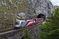
The "Taurus" electric locomotive 1116.249 with the Railjet RJ 539 exiting the Weinscheinwand tunnel on May 23, 2017

4023.011 as train R 6487 exiting the Weinscheinwand tunnel on May 23, 2017


For the development of locomotives that could cope with the gradients of the Semmering Railway, engineering competitions were held, in which quite adventurous constructions were proposed. The competition held at Semmering in 1851 led to a worldwide surge in development in locomotive construction.
Influential personalities polemicized against the selected locomotives while it was being built. Four types remained as suitable, namely the locomotives " Bavaria " from the Bavarian company Maffei , " Vindobona " from the machine factory of the Vienna-Gloggnitzer Bahn, " Neustadt " from the locomotive factory Günther and " Seraing " from the Belgian company Cockerill . Wilhelm von Engerth was then commissioned to coordinate the advantages of the four competing types.
The first locomotives used were the Engerth type support tender locomotives with the C2t wheel arrangement. Engerth locomotives were later also manufactured with other axle sequences. However, as the steep inclines required traction rather than speed, the steam locomotives for all types of trains were subsequently built according to the principles for freight locomotives (many driven wheels with a small diameter), a principle that became the standard for all subsequent mountain railways. Express trains were usually run on the valley routes with high-wheeled express train locomotives, in the Gloggnitz and Mürzzuschlag stations the locomotives were changed or pre-tensioning and pushing machines were added.
Not only starting up the mountain, but also the descent made it difficult. Before the introduction of automatic braking systems, up to five brakemen had to ride along to bring the train safely back down into the valley.
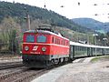
Electrical operation began in 1959 with the six-axle locomotives of the 1010 series. Their construction quickly led to heavy wear and tear on rails and wheels, so that to this day only the most powerful four-axle locomotives of the ÖBB are used. Currently these are the machines of the Taurus family, as well as the thyristor locomotives of the 1044 and 1042 and 1142 series , which had carried the main load in the previous decades. In addition, the Semmering was a main area of application for the class 4010 express railcars until December 2006 .
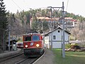
In regional traffic, a class 4023 multiple unit mainly runs between Payerbach-Reichenau and Semmering / Mürzzuschlag . In the event of failure, the 4023 will be replaced by its predecessor 4020 . A pair of REX trains between Vienna and Mürzzuschlag is operated with a double unit of the 4744 series (cityjet).
Numerous nostalgic trains run across the Semmering, the steam locomotives for them are provided by the Strasshof Railway Museum near Vienna and other collections. A special feature presented by the ÖBB experience trains "Magic Mountains" provided and "Vienna Alps". They were up to the timetable change in December 2008 as planned circulating on weekends and holidays at the normal rate nostalgia trains, consisting of historical rolling stock of the first class and a locomotive of the series 1010 or 1141 were formed.
In the summer of 2015, a nostalgic train operated by the Südburgenland Rail Association .
Comparison of travel times and mileage
- 1860: Travel time 2 hours 4 minutes, trailer load 140 t
- 1938: driving time 1 hour
- 1990: travel time 42 minutes, trailer load 1,000 t
Sights along the way


A trip on the Semmering Railway is still valued as a special experience thanks to the varied landscape, the typical villa buildings and the characteristic sequence of viaducts and tunnels. A railway hiking trail has also been set up along the route so that you can get on and off at the numerous stops. On the occasion of the 150th anniversary of the Semmering Railway, a children's playground was built on the Bahnwanderweg and the artist duo 1000 & was commissioned to plan a sculpture that was set up at the Semmering train station in 2008.
There are also numerous historical objects along the Semmering Railway, many of which date from the time of the monarchy , but some are even older.
- the Südbahnhotel
- Ghegadenkmal at the Semmering train station
- Historical post office Küb
- Hotel Panhans in Semmering
- the landscape of the magic mountains
- Museum train Höllentalbahn
- Gloggnitz Castle
- GHEGA Museum and viaduct cold channel
- the Southern Railway Museum in Mürzzuschlag
- Guard houses
Meaning and effect
International


Since 1998, the Semmering Railway with surrounding landscape UNESCO - World Heritage Site . In 1993 it was proposed by the two federal states of Lower Austria and Styria on the initiative of the non-governmental organization (NGO) "Alliance For Nature" . As early as 1923, the Semmering Railway was placed under monument protection in Austria . This protection was confirmed by the Federal Monuments Office in 1997. As a result of this application, UNESCO had a global comparative study of railway monuments carried out, which confirmed the global cultural significance of the Semmering Railway. It was then included in the world heritage list as the world's first railway line. At the end of October 2017, a total of 164 notebooks, sketches, drawings, watercolors, lithographs and steel engravings were entered in the list of world heritage documents as historical documents for the construction of the route . These honors mark the high point of appreciation for the railway line to date.
The reasons for these awards were that their builder Carl Ritter von Ghega had designed them in such a way that nature and technology were not in contradiction, but harmonized with one another. Only in this way did he succeed in building the first standard-gauge mountain railway in Europe. At the time of its completion, the Semmering route was already understood as "landscaping", which offered a unique travel experience. Peter Rosegger already described the Semmering Railway as a "harmonious combination of technology and nature". UNESCO also recognized the danger for the Semmering Railway and its surrounding landscape from the planned base tunnel: "If the Semmering Railway is actually replaced by a base tunnel, this could lead to the closure and, in the worst case, to the decay of this important mountain and landscape railway" (Bernd von Droste zu Hülshoff, founding director of the UNESCO World Heritage Center).
In 2004 the Southern Railway Museum was opened in Mürzzuschlag , in which many exhibits and documents about the Semmering Railway can be seen. On September 1, 2012, the first museum for Carl Ritter v. Ghega in Breitenstein, located directly on the viaduct cold channel, opened. It shows the life and work of Ghega and his most important employees.
The Semmering Railway also found its way into world literature: the rigors of construction are described in the novella Die Steinklopfer by Ferdinand von Saar , which was written twenty years after it was built. Peter Rosegger reported on the first contact and culture shock of the local population when using the new technology in the story When I sat on the steam truck for the first time .
Austria and regional
The Semmering landscape was opened up for tourism through the construction of the Semmering Railway. Numerous hotel buildings and villas bear witness to this era. The population of the municipality of Semmering grew between 1869 and 1929 from 135 to 1816 inhabitants. With the arrival of many Viennese, well-known architects such as Ferstel or Flattich also planned here . They combined the down-to-earth, landscape-typical style with a "cottage style" .
The enormous boom at the turn of the century and the upgrading of the region as a winter sports area in the first third of the twentieth century were initially interrupted by the war and later by the changed holiday needs. Not least because of this, the unique cultural landscape has remained unchanged.
In many communities, streets, buildings and squares were named after the Semmering Railway or Carl Ritter von Ghega. In the Semmering region there is a Ghegagasse in almost every municipality, but also in the third district of Vienna a street near the former Südbahnhof is called Ghegastraße.
Time and again, the train with the surrounding landscape was used as a motif for postage stamps or banknotes. The cold groove could be seen on the back of the penultimate issue of the 20 Schilling banknote , the front showed a portrait of the builder, Carl Ritter von Ghega (date of issue: November 4, 1968).
Designation of other railway lines
The semmering railway's pioneering achievement was immediately noticed in the German-speaking area. The name Semmeringbahn or Semmering with a regional addition was therefore used very soon for similar mountain railways . These include the following routes in Germany, the Czech Republic and Poland:
- Saxon Semmering Railway ( Freital Ost – Possendorf railway and Bautzen – Bad Schandau railway )
- Siegerland Semmering ( Kreuztal – Cölbe railway line )
- Erzgebirge Semmering ( Karlovy Vary – Johanngeorgenstadt railway )
- Teplice Semmering Railway ( Most – Moldava v Krušných horách line )
- Prague Semmering ( railway line Praha-Smíchov-Hostivice )
- Silesian Semmering ( Hanušovice – Głuchołazy railway line )
Semmering base tunnel
Due to the restrictions imposed by the mountain railway on the Austrian Southern Railway , numerous variants for tunneling under the Semmering Pass have been developed since the middle of the 20th century. The first project of a base tunnel started in the 1990s. However, due to a massive water ingress and a negative nature conservation notice by the state of Lower Austria, the tunneling had to be stopped and subsequently discontinued.
Since spring 2012, preparatory work has again been carried out for a Semmering base tunnel between Gloggnitz and Mürzzuschlag . In 2014, the Administrative Court examined the legality of the environmental impact assessment and the approval process and in May 2015 gave the green light for the tunnel construction, which is to be completed by 2026.
Regardless of this, the opponents of tunneling still see the World Heritage status granted to the Semmering Railway as endangered. According to UNESCO and the expert Toni Häfliger who works for them, this world heritage status is not affected. The UNESCO sees no danger for the world heritage "Semmering Railway with surrounding landscape" by the construction of the Semmering base tunnel.
See also
literature
- The twenty-five year anniversary of the Semmering Railway. Commemoration for the participants in the anniversary celebration on May 17, 1879 . Publishing house by R. von Waldheim, Vienna 1879. (digitized version)
- Gerhard Artl, Gerhard Gürtlich , Hubert Zenz (eds.): From the devil's work to a world cultural heritage - 150 years of the Semmering Railway. Plöchl, Freistadt / Vienna 2004, ISBN 3-901407-73-1 .
- Nicolas Marie Josephe Chapuy, Bernhard Fiedler, Robert Wagner (eds.): Südbahn-Album: picturesque views near the kk Südbahn from Vienna to Trieste. Taken from nature in 1856. (Reprint: (= Topographia Austria approx. Volume 8). Academic Printing and Publishing House ADEVA, Graz 1991, ISBN 3-201-01548-2 )
- Anthony Coulls: Railways as World Heritage Sites. (= Occasional Papers of the World Heritage Convention). ICOMOS , 1999, p. 13f.
- Günter Dinhobl: The Semmeringerbahn. Oldenbourg Verlag for History and Politics, Munich / Vienna 2003, ISBN 3-7028-0395-5 .
- Markus Hehl: The Big Book of the Alpine Railways - Over 150 years of conquering the Alps. GeraMond, Munich 2005, ISBN 3-7654-7144-5 .
- Alfred Horn (Hrsg.): Picturesque atlas of the railway over the Semmering. Folding panorama 480 × 20 cm . With an accompanying brochure with historical-statistical data on Carl Ritter von Ghega (32 pages) and a foreword to the new edition. Archive Verlag Vienna, 2005.
-
Markus Inderst :
- The winding road to the south. In: EisenbahnGeschichte. 71, 2015, pp. 58-65.
- Tunnels, trenches, viaducts. In: EisenbahnGeschichte. 72, 2015, pp. 44-51.
- Competition on the magic mountain. In: EisenbahnGeschichte. 74, 2016, pp. 54-61.
- In search of the real mountain locomotive. In: EisenbahnGeschichte. 75, 2016, pp. 68-79.
- Four couplers as a breakthrough. In: EisenbahnGeschichte. 76, 2016, pp. 62-67.
- As far as possible. In: EisenbahnGeschichte. 78, 2016, pp. 68-74.
- From the universal locomotive to the specialist. In: EisenbahnGeschichte. 79, 2016, pp. 70-79.
- Access to the tried and tested. In: EisenbahnGeschichte . 80, 2017, pp. 56-63.
- A big leap . In: EisenbahnGeschichte . 81, 2017, pp. 66-73.
- Strong and curvy . In: EisenbahnGeschichte . 82, 2017, pp. 56-67.
- Karl-Heinz Knauer, Günter Dinhobl: Fascination Semmering - an exhibition. Technical Museum, Vienna 2004, ISBN 3-902183-09-8 .
- Wolfgang Kos (ed.): The conquest of the landscape. Semmering, Rax, Schneeberg. Exhibition catalog. Falter, Vienna 1992, ISBN 3-85460-062-3 .
- Mihaly Kubinszky (Ed.): Architecture on the Semmering Railway - beautiful landscape, beautiful buildings. Slezak, Vienna 1992, ISBN 3-85416-156-5 .
- Richard Mauterer: Semmering Railway - data, facts, propaganda. Signals-Verlag, Vienna 1990, ISBN 3-901147-01-2 .
- Elmar Oberegger: Vienna-Graz-Trieste. On the history of the "Archduke Johann Railway". (= Publications of the information office for Austrian railway history. 3). Sattledt 2007.
- Robert Pap: UNESCO World Heritage Semmering Railway. Tourist region Lower Austria South, Semmering 2000, ISBN 3-9501742-1-4 .
- Christian Schuhböck: World Heritage Semmering Railway - Guide to the world's first UNESCO railway World Heritage site . Ed .: Alliance For Nature. Kral-Verlag, Berndorf 2009, ISBN 978-3-902447-70-8 .
- Csaba Székely, Manfred Tuschel: 1x Semmering and back. Railway chats. Österreichischer Bundesverlag, Vienna 1984, ISBN 3-215-04990-2 .
- Carl Ritter v. Ghega, Franz Xaver Sandmann , Robert Wagner: Picturesque atlas of the railway over the Semmering. Verlag Gerold, Vienna 1854. (Reprint: (= Topographia Austriaca. Volume 6). Akademische Druck- und Verlagsanstalt ADEVA, Graz 1989, ISBN 3-201-01493-1 )
Movies
- SWR: Railway Romanticism - World Heritage Semmering Railway (episode 348)
- SWR: Railway romance - clouds of steam over the Semmering (episode 509)
- Manfred Baur, Hannes Schuler: The conquest of the Alps. Over the pass. Part 1 (5 parts). 2009, documentation. 45 min.
Web links
World cultural heritage Semmering Railway
- Entry on Semmering Railway in the Austria Forum (in the AEIOU Austria Lexicon )
- Entry on the UNESCO World Heritage Center website ( English and French ).
- Province of Lower Austria: UNESCO World Heritage Site - Semmering Railway
- Alliance For Nature - Alliance for Nature: Semmering Railway World Heritage Site.
- Interesting facts / tourist information for visitors: Semmering Railway World Heritage Site
Documentation about the Semmering Railway
- Info portal about the Semmeringbahn: Semmeringbahn.at
- Municipality Payerbach : semmeringbahn.info 150 years Semmering Railway
- the ebepe pages: The Semmering Railway - photo documentation and reports from the 150th anniversary. August 2005.
- Austrian Media Library : The Semmering - Portrait of a Cultural Landscape . Radio feature (1982) by Wolfgang Kos
Exhibitions
- Technical Museum : Information on the Fascination Semmering Railway exhibition
- Southern Railway Museum website
Current
- ÖBB-Infrastruktur AG : Project information on the Semmering Base Tunnel construction project new
- Expansion planning for the existing line
Photos and videos
- Philipp Glitzner, "Trains in the Landscape": Semmering Railway: A journey over the Magic Mountain - photos of the Semmering route and the surrounding natural landscape
- Railway in Austria: Photo album about the Semmering Railway
- Eisenbahntunnel.at: Vienna Südbahnhof - Spielfeld-Straß (Südbahn, Semmeringbahn) - pictures of all tunnel portals of the southern railway line
Individual evidence
- ^ C. Székely, M. Tuschel: 1 × Semmering and back. Railway chats. 1984, p. 109.
- ^ C. Székely, M. Tuschel: 1 × Semmering and back. Railway chats. 1984, pp. 141-144.
- ↑ Manfried Rauchsteiner : The War in Austria 1945 , Österr. Bundesverlag, Vienna 1984, ISBN 3-215-01672-9 , pp. 219-221.
- ↑ Friedrich Brettner : The last battles of World War II in the border area of Lower Austria - Styria - Burgenland. KRAL-Verlag, 2013, ISBN 978-3-99024-171-4 , pp. 122 and 123.
- ↑ The old Semmering tunnel is back in operation. In: Railway. 2/1953, pp. 37-38, Zeitschriften-Verlag Ployer, Vienna
- ↑ nostalgiezug.at Homepage Verein Schiene Südburgenland
- ↑ UNESCO World Document Heritage - Two new entries . Press release of the Austrian UNESCO Commission of October 31, 2017, accessed on November 2, 2017
- ↑ ghega-museum.at
- ^ Article on the Ö1 homepage from October 24, 2014, accessed on May 19, 2015.
- ↑ Semmering - The end of the dispute is in sight. In: Solid - economy and technology in construction. January 23, 2015.
- ^ Toni Häfliger: Report in the Semmering Railway (Austria) mission, 20-23. April, 2010. (PDF, 4.3 MB)
- ↑ Conquering the Alps: Over the pass. ( Memento from May 17, 2014 in the Internet Archive ) at: phoenix.de
Coordinates: 47 ° 38 ′ 35.5 ″ N , 15 ° 49 ′ 52 ″ E

Cultural heritage: Historic center of the city of Salzburg (1996) | Schönbrunn Palace and Gardens (1996) | Cultural landscape Hallstatt – Dachstein / Salzkammergut (1997) | Semmering Railway (1998) | City of Graz - Historic Center and Eggenberg Palace (1999) | Wachau cultural landscape (2000) | Fertő / Neusiedler See cultural landscape (2001) | Historic Center of Vienna (2001, R ) | Prehistoric pile dwellings around the Alps (2011)
Natural heritage: ancient beech forests and primeval beech forests of the Carpathians and other regions of Europe (2017)
![]() World Heritage Sites :
Wachau Cultural Landscape |
Semmering Railway
World Heritage Sites :
Wachau Cultural Landscape |
Semmering Railway
![]() Biosphere reserves :
Vienna Woods
Biosphere reserves :
Vienna Woods
![]() Intangible cultural heritage :
Pharmacy's own house specialties |
Falconry |
Charcoal burning |
Storytelling |
Jew's harp game in Austria |
Austrian Sign language |
Austrian Folk dance movement |
Austrian Scythe forging |
Bad luck |
Perchtoldsdorfer Guard Entry |
Ratcheting in Holy Week |
Forging in Ybbsitz |
Silent Night - the song for Christmas |
Association for mutual assistance in the event of fire "ancillary service" |
Knowledge of traditional seed cultivation and production
Intangible cultural heritage :
Pharmacy's own house specialties |
Falconry |
Charcoal burning |
Storytelling |
Jew's harp game in Austria |
Austrian Sign language |
Austrian Folk dance movement |
Austrian Scythe forging |
Bad luck |
Perchtoldsdorfer Guard Entry |
Ratcheting in Holy Week |
Forging in Ybbsitz |
Silent Night - the song for Christmas |
Association for mutual assistance in the event of fire "ancillary service" |
Knowledge of traditional seed cultivation and production
![]() World document heritage :
no entry
World document heritage :
no entry
![]() World Heritage Sites :
Hallstatt – Dachstein / Salzkammergut cultural landscape |
Semmering Railway |
City of Graz - historical center and Eggenberg Palace
World Heritage Sites :
Hallstatt – Dachstein / Salzkammergut cultural landscape |
Semmering Railway |
City of Graz - historical center and Eggenberg Palace
![]() Global Geoparks :
Styrian Eisenwurzen
Global Geoparks :
Styrian Eisenwurzen
![]() Intangible cultural heritage :
Pharmacy's own house specialties |
Falconry |
Festival of the civil and rifle guards of the Murau district |
Exposure discharging at Maxlaun in Niederwölz |
Charcoal burning |
Basket making - the art of wickerwork with wicker, straw and split wood |
Laßnitzer Volksschauspiele |
Storytelling |
Jew's harp game in Austria |
Murau carnival race |
Öblarner Krampus Game |
Austrian Sign language |
Austrian Folk dance movement |
Austrian Scythe forging |
Ratcheting in Holy Week |
Samson wear in Lungau and Murau district |
Silent Night - the song for Christmas |
Knowledge of the Lipizzaner breed |
Knowledge of traditional seed cultivation and production
Intangible cultural heritage :
Pharmacy's own house specialties |
Falconry |
Festival of the civil and rifle guards of the Murau district |
Exposure discharging at Maxlaun in Niederwölz |
Charcoal burning |
Basket making - the art of wickerwork with wicker, straw and split wood |
Laßnitzer Volksschauspiele |
Storytelling |
Jew's harp game in Austria |
Murau carnival race |
Öblarner Krampus Game |
Austrian Sign language |
Austrian Folk dance movement |
Austrian Scythe forging |
Ratcheting in Holy Week |
Samson wear in Lungau and Murau district |
Silent Night - the song for Christmas |
Knowledge of the Lipizzaner breed |
Knowledge of traditional seed cultivation and production
![]() World document heritage :
no entry
World document heritage :
no entry