
Payerbach
|
market community Payerbach
|
||
|---|---|---|
| coat of arms | Austria map | |
 |
|
|
| Basic data | ||
| Country: | Austria | |
| State : | Lower Austria | |
| Political District : | Neunkirchen | |
| License plate : | NK | |
| Surface: | 17.69 km² | |
| Coordinates : | 47 ° 42 ' N , 15 ° 52' E | |
| Height : | 483 m above sea level A. | |
| Residents : | 2,060 (January 1, 2020) | |
| Postcodes : | 2640, 2650, 2671, 2673 | |
| Area code : | 02666 | |
| Community code : | 3 18 21 | |
| NUTS region | AT122 | |
| Address of the municipal administration: |
Ortsplatz 7 2650 Payerbach |
|
| Website: | ||
| politics | ||
| Mayor : | Eduard Rettenbacher (PP) | |
|
Municipal Council : ( 2020 ) (21 members) |
||
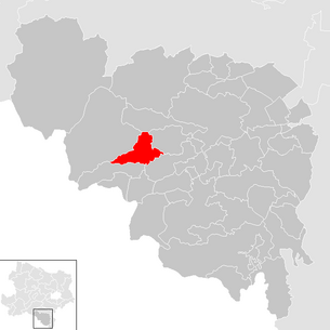
| Location of Payerbach in the Neunkirchen district | ||
  |
||
 Payerbach, view of the Schwarza |
||
| Source: Municipal data from Statistics Austria | ||

|
Payerbach ( capital of a market town ) locality cadastral municipality Payerbach |
|
|---|---|
| Basic data | |
| Pole. District , state | Neunkirchen , Lower Austria |
| Judicial district | Neunkirchen |
| Pole. local community | Payerbach |
| Coordinates | 47 ° 41 ′ 30 " N , 15 ° 51 ′ 46" E |
| height | 483 m above sea level A. |
| Residents of the village | 1090 (January 1, 2020) |
| Building status | 457 (2001 ) |
| Area d. KG | 6.15 km² |
| Post Code | 2650 |
| Statistical identification | |
| Locality code | 05240 |
| Cadastral parish number | 23129 |
| Counting district / district | Payerbach (31 821 000) |
| Source: STAT : index of places ; BEV : GEONAM ; NÖGIS | |
Payerbach is a market town with 2060 inhabitants (as of January 1, 2020) in the Neunkirchen district in Lower Austria .
geography
Payerbach is located in the industrial district in Lower Austria. The area of the market town covers 17.69 square kilometers. 55.54 percent of the area is forested.
- geology
On the border of the Limestone Alps and the Vienna Basin , Payerbach lies in the Grauwackenzone , which has its foothills in the Payerbach area. To the south is the Semmering Mesozoic , which dips under the Grauwackenzone. The geological layers are overlaid by the northern limestone Alps in the north of Payerbach. These layers continue both to the west and partly to the east of Payerbach.
The Vienna Basin extends from the east between the Grauwackenzone and the Central Alpine Zone to the eastern part of the local area. Metamorphic rocks such as quartzite, slate, phyllite , but also green rocks and other metamorphic effluent rocks are embedded in the Grauwackenzone.
- Thermal water
Due to the geological peculiarities of the region (fissured limestone, quartzite and dolomite), water-filled pores and fissures under the earth have long been suspected, in which thermal water could well be found. In 1991 seismological investigations demonstrated the existence of water deposits below Payerbach. Three years later, in 1994, test bores were finally carried out in Schmidsdorf to a depth of 2,500 meters, which brought water with a temperature of 70 ° C to the surface. A commercial use of this water could not take place until today.
Community structure
The municipality comprises eight localities (population in brackets as of January 1, 2020):
- Geyerhof (23)
- Kreuzberg (100)
- Bucket (211)
- Muhlhof (75)
- Payerbach (1090)
- Pettenbach (173)
- Schmidsdorf (307)
- Werning (81)
The 5 cadastral communities (KG) are (area: December 31, 2017):
- Kreuzberg (583.61 ha)
- Küb (217.77 ha)
- Payerbach (614.60 ha)
- Pettenbach (144.73 ha)
- Schmidsdorf (207.52 ha)
About the KGs and localities:
- KG and the village of Payerbach: The cadastral municipality of Payerbach forms the northern part of the municipality and borders Reichenau an der Rax in the west . It is the largest part of the market town in terms of both area and population. The districts of Payerbach are:
- Werning (east) and
- Geyerhof (north).
- KG Küb: Küb (the name probably comes from the Old Slavic word Chyba / Chub) borders KG Payerbach in the west, Kreuzberg in the south, Pettenbach in the west and Schmidsdorf in the north; This means that Küb is surrounded by the other four cadastral communities in the heart of the Payerbach community. The cadastral community extends around 500 meters on both sides of the Küberbach, which is a feeder to the Schwarza . The historic post office is a tourist attraction in the heart of Küb, which can be reached with the Semmering Railway (Küb stop). When one speaks of Küb, one usually means the northeastern part of Neuküb today , in fact the original Küb is located further south up the mountain, where there are numerous villas.
- KG Schmidsdorf: Schmidsdorf is located in the southeastern part of the municipality and extends to KG Payerbach on both sides along the Schwarza to the municipality of Gloggnitz in the west. Prigglitz is located north of Schmidsdorf . The districts also belong to Schmidsdorf
- Mühlhof and
- Schlöglmühl - on the other side of the Schwarzaufer.
- KG Pettenbach: Pettenbach is located in the east of the municipality of Payerbach and connects to the Höllgraben in the south. On the eastern border of the municipality, the place connects to the two Gloggnitz cadastral communities Heufeld and Eichberg. The village is traversed by the Pettenbachbach, which flows into the Schwarza in Schmidsdorf .
- KG Kreuzberg: KG Kreuzberg extends from the Payerbach district along the Payerbachgraben southwards to the municipality of Breitenstein . In the east it stretches from the Handlhof junction and up on the Kreuzberg to the so-called Dreiländereck , where the communities Payerbach, Breitenstein and Gloggnitz border each other.
Neighboring communities
| Burg-Vöstenhof | Prigglitz | |
| Reichenau |
.svg)
|
Gloggnitz |
| Breitenstein |
history

In ancient times, the area was part of the Noricum province .
The name "Beierbach" is first mentioned in a document in 1094 in a deed of foundation of Count Ekbert von Formbach Pitten. Payerbach owes its establishment in the 11th century to its location on the then important road over the Preiner Gscheid into the Mürz Valley (which lost its importance from the 13th century due to the Semmeringstraße).
An iron smelter was operated in Payerbach by the 12th century at the latest.
The parish church of Sankt Jakob was probably built in the 12th century and after being destroyed in the 15th century it was converted into a hall church.
From 1790, the Innerberger Main Union mined Spateisenstein (Siderite), an iron ore with almost 50 percent iron content (the production was stopped in 1903 due to lack of profitability).
In the municipality there are remains of several small mines, in which iron ore, copper and other ores as well as coal and barite were mined from the 16th century to the 19th century . In 1848, the large community of Reichenau was created through the March constitution , a merger of the two communities Payerbach and Reichenau. The large community was ruled by two mayors, one each from Reichenau and Payerbach.
In the following decades, more and more aristocrats settled in the region, which also led to tourist development. Numerous villas were built, and the summer freshness found its way into the region.
On June 25, 1908, the municipality was separated again by law. Payerbach was again an independent municipality with five cadastral communities. On January 1, 1909, the new administration finally came into force, and Prof. Anton Weiser was appointed as the first mayor.
On August 17, 1917 and 1918, imperial masses were read by Emperor Karl and his wife Zita at the chapel .
Population development

religion
According to the 2001 census data , 75.7% of the population were Roman Catholic , 6.8% Protestant , and 3.8% Muslim . 0.7% belonged to Orthodox churches , 11.2% of the population had no religious denomination.
politics
The municipal council has 21 members.
- With the municipal council elections in Lower Austria in 1990, the municipal council had the following distribution: 11 SPÖ and 10 ÖVP.
- With the municipal council elections in Lower Austria in 1995, the municipal council had the following distribution: 11 SPÖ, 5 Pro-Payerbach (ÖVP), 4 ÖVP, and 1 LIF.
- With the municipal council elections in Lower Austria in 2000, the municipal council had the following distribution: 13 Pro-Payerbach (ÖVP), 7 SPÖ, and 1 FPÖ.
- With the municipal council elections in Lower Austria in 2005 , the municipal council had the following distribution: 10 Pro-Payerbach (ÖVP), 8 SPÖ, and 3 list Erwin Klambauer.
- With the municipal elections in Lower Austria in 2010 , the municipal council had the following distribution: 13 Pro-Payerbach (ÖVP), 6 SPÖ, and 2 list Erwin Klambauer.
- With the municipal council elections in Lower Austria in 2015 , the municipal council had the following distribution: 15 Pro-Payerbach (ÖVP), 4 SPÖ, and 2 Greens.
- With the municipal council elections in Lower Austria 2020 , the municipal council has the following distribution: 15 Pro-Payerbach (ÖVP), 4 SPÖ, and 2 Greens.
- mayor
- until 2009 Peter Pasa (Pro-Payerbach)
- since 2009 Eduard Rettenbacher (Pro-Payerbach)
Culture and sights


Payerbach was shaped during the time of the monarchy, when it flourished. Many architecturally valuable buildings still remind of this time. Payerbach gained its reputation largely through the summer freshness . It is now making great efforts to be able to build on this legacy again.
- With the Payerbach-Reichenau train station, Payerbach is the starting point for many tourist activities, including the Höllentalbahn (museum train) to Hirschwang . It brought tourists to the valley station of the cable car on the Rax and the entrance to the Höllental, where the newly created romantic hiking trail leads along the Vienna high spring water pipeline to Kaiserbrunn .
- The market town is also located on the Semmering Railway World Heritage Site . It can be accessed by train over viaducts and through tunnels. But you can also hike its daring route through mountains, over bridges and rock galleries on the railway hiking trail. Among the special structures of the Semmering Railway in Payerbach are the 228 meter long and 25 meter high Schwarzaviadukt with its thirteen arches (built from 1849 to 1851) and the Payerbach-Reichenau station .
- Catholic parish church Payerbach hl. James the Elder: The Roman Catholic parish church with the so-called "black tower" stands on a rock pulpit above the town . It goes back to a Romanesque foundation that was rebuilt in 1447 after being destroyed. The vaulting of the nave took place around 1525 (star rib vault with octagonal pillars with partially preserved painting of the keystones, in the choir cross rib vault). It was a branch church of Gloggnitz, incorporated into the Bavarian Formbach Abbey and was first mentioned as a parish in 1379. Remnants of frescoes are traced back to the 14th century. With a lot of architectural feeling, a modern choir (west gallery) was added in the course of the last general renovation in 1970, the interior furnishings also largely originate from this period, but also include late Gothic statues and other works from the 18th and 19th centuries.
- Historical post office Küb : A special attraction, which was founded as a long-distance switching center and has already been visited repeatedly by Empress Zita and her followers. Today the post office is only open seasonally and is mainly run as a museum.
- Grillenberg show mine : opened for ore mining on Grillenberg in 1791 and closed in 1892. It was ceremoniously opened on October 5, 1992 by Governor Siegfried Ludwig.
- The Payerbach Pavilion and the adjacent landing stage are also known from the summer break. Both motifs that are not missing on any old postcard of the community.
- After the stationing of the second K&K Mountain Artillery Regiment in Payerbach, the Barbara Chapel was built in 1916 in honor of the patron saint of the Payerbach Regiment in South Tyrol. In 1923 the Barbarakapelle was brought to Küb, where it can still be visited today.
- Also in Küb is the French Cross, which commemorates the fallen in a battle between French and farmers in 1805 in front of Mühlhof Castle , in which the French lost six men.
- The Landhaus Khun was built on the Kreuzberg in 1928 according to plans by the architect Adolf Loos . The Hotel-Restaurant Alpenhof has now been established in the building, which has remained largely unchanged to this day.
- Parks
- Payerbacher Park: The Payerbacher Park is located between the outdoor pool and the Schwarzaviadukt. Instead of a lumber yard, a new part of the park was laid out between 1901 and 1903 under the direction of the palace gardener Gottlieb Zajic. Adjacent to it are the landing stage and the unique pavilion in its unmistakable, almost Saracen-looking wooden construction. A model of a typical villa in the Semmering region was built in the park by the outdoor pool for the 50th anniversary of the Semmering Railway in 1904. This was built and set up by the Payerbach master carpenter Karl Weinzettl.
- Natural monuments
The emperor oak in the park is a 1908 by Emperor Franz Joseph I . Oak planted on the occasion of the 60th anniversary of the government.
economy


In 2001 there were 90 non-agricultural workplaces, and according to the 1999 survey there were 54 in agriculture and forestry. The number of people in work at the place of residence was 954 according to the 2001 census. The 2001 employment rate was 42 percent.
From 1852 to 1982 there was a paper (and pulp) factory in the Schlöglmühl district.
traffic
The municipality of Payerbach is located with the Payerbach-Reichenau , Küb and Schlöglmühl train stations on the Semmering Railway, which became part of the Südbahn when it opened in 1854 . Then as now, the railway was an important factor for the tourism and economy of Payerbach. The most striking visible sign of the Semmering Railway in Payerbach is the viaduct over the Schwarzatal, which is now more than 150 years old.
Payerbach-Reichenau is also the starting point of the electrified narrow-gauge Höllentalbahn to Hirschwang, which is only operated in a museum context .
The Höllental Straße B 27 runs in east-west direction from Gloggnitz to Reichenau. In addition to the southern railway, the B 27 is the most important transport connection, as the municipality of Payerbach, located in the Schwarzatal , can essentially only be reached via Gloggnitz or Reichenau. There are other transport connections to Prigglitz and via Kreuzberg to Schottwien .
Sports
Embedded in the mountainous landscape between Semmering , Rax and Schneeberg there are numerous hiking trails around Payerbach. A walk along the sun promenade on the southern slope above the market town is particularly popular.

The community is also located on the bike and footpath along the Semmering Railway . Another sporting experience is the 43-kilometer cycle path along the Schwarza. In addition, there are many other hiking trails through the Höllental , along the Schwarza or to the surrounding mountains in all alpine degrees of difficulty for an inspection. The Payerbach train station is the starting point for many hiking trails.
In addition to the outdoor swimming pool, a tennis court and mini golf course are also available at local sports facilities.
Sports life in the community is upheld by numerous events as well as by numerous clubs. These include the winter sports club, numerous stick sports clubs, two tennis clubs, a toboggan club, a football club and two motor sports clubs.
Movies
- Schlöglmühl is the location of the documentation Post Adresse 2640 Schlöglmühl , which was filmed by Egon Humer in 1990 after the paper mill was closed .
Personalities

- Jakob Brandstätter (1928–1987), politician (ÖVP), member of the National Council from 1967 to 1987
- Ingela Bruner (1952–2014), former rector of the University of Natural Resources and Life Sciences, Vienna and first rector of an Austrian university
- Traute Foresti (1915–2015), Küb-born poet and actress
- Franziska Kantor (* 1903), painter and sculptor
- Gerald Mader (1926–2019), politician (SPÖ)
- Franz Mannsbarth (1877–1950), aviation pioneer
- Ottilie Matysek (* 1939), former member of the Burgenland state parliament and artist with a studio in Payerbach
- Anton Rella (1888–1945), mathematician, his family had a rest home in Küb, where Rella often went on vacation with guests like his school friend Erwin Schrödinger
- Arnold Schönberg (1874–1951) wrote his string sextet Verkläufer Nacht in Payerbach in 1899
Web links
- 31821 - Payerbach. Community data, Statistics Austria .
- Website of the municipality of Payerbach
Individual evidence
- ↑ Statistics Austria: Population on January 1st, 2020 by locality (area status on January 1st, 2020) , ( CSV )
- ↑ According to the Austrian official calendar, online no town, but settlement name for individual houses and house groups .
- ↑ Federal Office for Metrology and Surveying, Regional Information, reference date December 31, 2017, accessed on January 4, 2018
- ^ Michael Hackenberg: Mining in the Semmering area. Archive for deposit research of the Federal Geological Institute. Volume 24 pages 5-97. Vienna 2003. ISSN 0253-097X pages 32-37. (PDF; 12.7 MB)
- ^ Result of the municipal council election 1995 in Payerbach. Office of the Lower Austrian State Government, March 30, 2000, accessed on October 1, 2019 .
- ^ Election result of the municipal council election 2000 in Payerbach. Office of the Lower Austrian State Government, February 4, 2005, accessed on October 1, 2019 .
- ^ Election result of the municipal council election 2005 in Payerbach. Office of the Lower Austrian State Government, March 4, 2005, accessed on October 1, 2019 .
- ^ Election result of the municipal council election 2010 in Payerbach. Office of the Lower Austrian State Government, October 8, 2010, accessed on October 1, 2019 .
- ^ Election results for the municipal council election 2015 in Payerbach. Office of the Lower Austrian state government, December 1, 2015, accessed on October 1, 2019 .
- ↑ Results of the municipal council election 2020 in Payerbach. Office of the Lower Austrian State Government, January 26, 2020, accessed on January 26, 2020 .
- ↑ Bundesdenkmalamt (Ed.): Dehio-Handbuch. The art monuments of Austria. Topographical inventory of monuments. Lower Austria south of the Danube, part 2, M to Z. Verlag Berger, Horn / Vienna 2003. ISBN 3-85028-365-8 . Pages 1625-1627.

Altendorf | Aspang Market | Aspangberg-St. Peter | Breitenau | Breitenstein | Buchbach | Bürg-Vöstenhof | Edlitz | Enzenreith | Feistritz am Wechsel | Gloggnitz | Grafenbach-St. Valentin | Grimmenstein | Grünbach am Schneeberg | Höflein on the Hohe Wand | Kirchberg am Wechsel | Mönichkirchen | Natschbach-Loipersbach | Neunkirchen | Otterthal | Payerbach | Pitten | Prigglitz | Puchberg am Schneeberg | Raach am Hochgebirge | Reichenau an der Rax | Scheiblingkirchen-Thernberg | Schottwien | Schrattenbach | Schwarzau am Steinfeld | Schwarzau in the mountains | Seebenstein | Semmering | St. Corona am Wechsel | St. Egyden am Steinfeld | Ternitz | Thomasberg | Trattenbach | Warth | Wartmannstetten | Willendorf | Wimpassing in the Black Valley | Cube | Rumble
Cadastral communities: Kreuzberg | Payerbach | Pettenbach | Schmidsdorf
Locations: Geyerhof | Kreuzberg | Bucket | Mühlhof | Payerbach | Pettenbach | Schmidsdorf | Werning
Market place: Payerbach Villages: Küb | Mühlhof | Schmidsdorf | Schlöglmühl | Werning Rotte: Pettenbach Scattered houses: Geyerhof | Kreuzberg Other locations: Mühlhof Castle
Counting district: Payerbach | Payerbach-South