List of listed objects in Payerbach
The list of listed objects in Payerbach contains the 31 listed , immovable objects of the municipality Payerbach in the Lower Austrian district of Neunkirchen .
Monuments
| photo | monument | Location | description | Metadata |
|---|---|---|---|---|

|
Elisabeth Chapel ObjectID : 83238 |
behind Kreuzberg 55 KG location : Kreuzberg |
Donated in 1903 by the industrialist Edmund Bachmann in memory of Empress Elisabeth , neo-Gothic building with three-sided closure under a high gable roof with ridge turret. |
ObjectID : 83238 Status: § 2a Status of the BDA list: 2020-02-29 Name: Elisabethkapelle GstNr .: .69 |
|
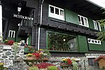
Former Landhaus Khuner, Adolf Loos House ObjectID : 33099 |
Kreuzberg 60, 61 KG location : Kreuzberg |
The Landhaus am Kreuzberg is a late work by the architect Adolf Loos , built in 1929/1930 on behalf of the food industrialist Paul Khuner. Loos designed the house together with his colleague Heinrich Kulka , who was also the site manager. The house was converted into a hotel restaurant in 1959 and has been a listed building since 1963. |
ObjectID : 33099 Status : Notification Status of the BDA list: 2020-02-29 Name: Former Landhaus Khuner, Adolf Loos Haus GstNr .: .71; 535/9 Landhaus Khuner, Payerbach |

|
Southern railway line "Semmering-Bahn" (Gloggnitz-Mürzzuschlag) ObjectID : 24753 |
Küb 14, 15 KG location : Küb |
The Semmering Railway was opened in 1854 and is the oldest standard-gauge mountain railway in Europe. It was planned by Carl Ritter von Ghega . From the train station Gloggnitz to station Mürzzuschlag it 41 kilometers. In the area of the Küb cadastral community there is the Küb stop and a total of 2 route monitoring structures. |
ObjectID : 24753 Status : Notification Status of the BDA list: 2020-02-29 Name: Southern line "Semmering-Bahn" (Gloggnitz-Mürzzuschlag) GstNr .: .23; 73/1; .22 |
|
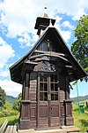
Barbarakapelle ObjektID : 83322 |
at Küb 38 location KG: Küb |
Former garrison chapel of the Austro-Hungarian Mountain Artillery Regiment No. 2 in the Payerbach barracks, 1st consecration in 1917, transfer here and 2nd consecration in 1922/23, small wooden frame construction with triangular closure under a protruding hipped roof with ridge turret |
ObjectID : 83322 Status: § 2a Status of the BDA list: 2020-02-29 Name: Barbarakapelle GstNr .: .78 Barbarakapelle (Küb) |

|
Entrance house of the 1st Vienna high spring water pipeline ObjektID : 83279 |
next to Anton Weiser Straße 34 KG location : Payerbach |
The first Viennese spring water pipeline is part of the Viennese water supply and was the first supply of Vienna with safe drinking water. After four years of construction, the 95-kilometer line was opened on October 24, 1873.
The entrance house bears the number 4. |
ObjectID : 83279 Status: § 2a Status of the BDA list: 2020-02-29 Name: Entry house of the 1st Viennese high spring water pipeline GstNr .: 132/5 |

|
Southern line "Semmering-Bahn" (Gloggnitz-Mürzzuschlag) ObjectID : 24745 |
Bahnhofplatz 1, 2, 3 KG location : Payerbach |
The Semmering Railway was opened in 1854 and is the oldest standard-gauge mountain railway in Europe. It was planned by Carl Ritter von Ghega . From the train station Gloggnitz to station Mürzzuschlag it 41 kilometers. In the area of the cadastral community Payerbach there is the Payerbach-Reichenau train station with its ancillary buildings as well as 3 route monitoring structures. |
ObjectID : 24745 Status : Notification Status of the BDA list: 2020-02-29 Name: Southern line "Semmering-Bahn" (Gloggnitz-Mürzzuschlag) GstNr .: 139; .79; .75; .78; .291; .74; .72; .70 Payerbach-Reichenau train station |
| Boiler house at Payerbach station ObjectID : 55261 |
Bahnhofplatz 4 KG location : Payerbach |
ObjectID : 55261 Status : Notification Status of the BDA list: 2020-02-29 Name: Boiler house at Payerbach station GstNr .: .76 |
||

|
Cemetery Chapel ObjectID : 83666 |
Bahnhofweg 5 KG location : Payerbach |
Built in 1880 as a crypt chapel for Viktor Alexander von Erlanger based on a design by Heinrich Ferstel in the neo-renaissance style |
ObjectID : 83666 Status: § 2a Status of the BDA list: 2020-02-29 Name: Friedhofskapelle GstNr .: 149/4 Erlanger-Mausoleum |

|
Weather house Object ID: 83262 |
Dr. Coumont Straße 2b KG location : Payerbach |
Cast iron weather house with a bell roof, 1908 |
ObjectID : 83262 Status: § 2a Status of the BDA list: 2020-02-29 Name: Wetterhäuschen GstNr .: 523/3 Wetterhäuschen Payerbach |
|
Memorial stone Kaiser-Eiche ObjektID : 83263 |
Dr. Coumont Straße 2b KG location : Payerbach |
Memorial stone marked 1908 |
ObjectID : 83263 Status: § 2a Status of the BDA list: 2020-02-29 Name: Memorial stone Kaiser-Eiche GstNr .: 523/3 Kaisereiche Payerbach |

|
Model "Villa Semmeringhäuschen" ObjektID : 83261 |
Dr. Coumont Straße 2b KG location : Payerbach |
Model of the Villa Mautner-Markhof on Semmering built in 1903 by Franz von Neumann , restored in 1904 by Carl Weinschein |
ObjektID : 83261 Status: § 2a Status of the BDA list: 2020-02-29 Name: Model "Villa Semmeringhäuschen" GstNr .: 523/3 Modell Semmeringhäuschen |

|
Catholic parish church hl. Jacob the Elder ObjectID : 55264 |
Karl Feldbacher Strasse 2 KG location : Payerbach |
Originally a branch of Gloggnitz, incorporated into the Bavarian Abbey of Formbach, documented parish in 1379, allegedly destruction of the church in 1446, restoration and re-consecration in 1447, two-aisled late Gothic hall church with south-west tower, west and north walls with Romanesque core, mid-14th century choir and southern sacristy, 15th century Century extension of the nave to the south and tower, vaulting of the nave around 1525, oratory above the southern sacristy in the middle of the 18th century, new northern sacristy with oratory from 1828, 1970 interior restoration and removal of the neo-Gothic furnishings, 1973 exterior renovation |
ObjectID : 55264 Status: § 2a Status of the BDA list: 2020-02-29 Name: Catholic parish church, Payerbach GstNr .: .18; 628/3 parish church hl. Jakob the Elder, Payerbach |

|
Parsonage Object ID: 33100 |
Karl Feldbacher Strasse 2 KG location : Payerbach |
1820, as a result of the destruction of the old rectory in 1740/41 by a flood (1813), built, two-storey building with hipped roof, extension (rectory) by Karl Albert in 1991/93. |
ObjectID : 33100 Status: § 2a Status of the BDA list: 2020-02-29 Name: Pfarrhof GstNr .: .108 |
|
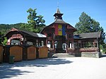
Bandstand Object ID: 83260 |
Kurpark location KG: Payerbach |
Erected in 1909 by Carl Weinzeile , two-armed wooden stand construction with a central pavilion under a tent roof with a bell tower |
ObjectID : 83260 Status: § 2a Status of the BDA list: 2020-02-29 Name: Musikpavillon GstNr .: .223 Musikpavillon Payerbach |

|
Road bridge ObjectID : 83271 |
Location KG: Payerbach |
The bridge over the Schwarza was built in 1986 according to plans by Gustav Peichl using the Art Nouveau railing of the previous bridge from 1900/01. |
ObjectID : 83271 Status: § 2a Status of the BDA list: 2020-02-29 Name: Road bridge GstNr .: 631/7 Local bridge Payerbach |

|
Pedestrian bridge, parking bridge over the Schwarza ObjektID : 83276 |
Location KG: Payerbach |
Built in 1903 by Ed (uard) Ast and Co., formerly the longest straight girder bridge made of reinforced steel |
ObjektID : 83276 Status: § 2a Status of the BDA list: 2020-02-29 Name: Pedestrian bridge, Parksteg over the Schwarza GstNr .: 625/1 Parksteg over the Schwarza, Payerbach |

|
Former Landmarks ObjectID: 83251 |
Mühlhof Straße Location KG: Payerbach |
two former boundary stones of the Neuberg an der Mürz Abbey , erected in 1972 and 1979, respectively, the Neuberg coat of arms incised, inscribed 1677 |
ObjectID: 83251 Status: § 2a Status of the BDA list: 2020-02-29 Name: Former Landmarks GstNr .: 478 |

|
Part of the 1st Vienna Mountain Spring Pipeline ObjectID : 129198 |
along Anton Weiser Straße, KG location : Payerbach |
The first Viennese spring water pipeline is part of the Viennese water supply and was the first supply of Vienna with safe drinking water. After four years of construction, the 95-kilometer line was opened on October 24, 1873. |
ObjectID : 129198 Status : Notification Status of the BDA list: 2020-02-29 Name: Part of the 1st Vienna High Spring Pipeline GstNr .: 132/5 |
|
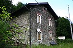
Southern railway line "Semmering-Bahn" (Gloggnitz-Mürzzuschlag) ObjectID : 24754 |
Pettenbach 15, 16 KG location : Pettenbach |
The Semmering Railway was opened in 1854 and is the oldest standard-gauge mountain railway in Europe. It was planned by Carl Ritter von Ghega . From the train station Gloggnitz to station Mürzzuschlag it 41 kilometers. In the area of the cadastral community of Pettenbach there are 2 route monitoring structures. |
ObjektID : 24754 Status : Notification Status of the BDA list: 2020-02-29 Name: Southern line "Semmering-Bahn" (Gloggnitz-Mürzzuschlag) GstNr .: 202/1; .21; .22 |
|
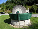
Small monument, former Kollergang ObjektID : 83461 |
at Schlöglmühl 16 KG location : Schmidsdorf |
ehem. pug mill of the paper factory Schlöglmühl set up as a small monument |
ObjectID : 83461 Status: § 2a Status of the BDA list: 2020-02-29 Name: Small monument, formerly Kollergang GstNr .: 19/23 |

|
Schlöglmühl paper mill ObjectID : 83324 |
Schlöglmühl 23, 24, 49, 51 KG location : Schmidsdorf |
The industrial ensemble of the Schlöglmühl paper mill , as a single factory town with its extensive facilities, was structurally and structurally a largely autonomous unit with its own school, doctor's practice, shops and a laundry. On the area of the so-called Schlegelmühle, a grinding and sawmill, the state paper mill Schlöglmühl was built in 1851, which was supposed to cover the paper needs of the state printing house and the kk offices cheaply and reliably. In 1869 the company was privatized as a stock corporation of the kk priv. Paper factory Schlöglmühl and in 1908 incorporated into the paper factory Neusiedl . After a major fire in 1909 that destroyed the largely wooden structures, the factory was rebuilt in reinforced concrete in 1910 and equipped with the most modern machines. With the crisis in the paper industry at the beginning of the 1970s, the Schlöglmühl plant was sold to the Salzer company, but paper production had to be stopped in 1983. The former buildings and the area are now the company settlement area, the machines are no longer available. |
ObjectID : 83324 Status : Notification Status of the BDA list: 2020-02-29 Name: Papierfabrik Schlöglmühl (*) GstNr .: .11 / 1; .22; .77 / 2; .13; .12; 15/2; 373 |

|
Former Workers and civil servants residence ObjectID : 83450 |
Schlöglmühl 27 KG location : Schmidsdorf |
Built around 1780, former barracks for the soldiers who were assigned to the imperial court for the water transport from Kaiserbrunn to Vienna |
ObjectID : 83450 Status: § 2a Status of the BDA list: 2020-02-29 Name: Former Workers and civil servants residence GstNr .: .24 |

|
Former Workers 'and civil servants' residence ObjektID : 83452 |
Schlöglmühl 29 + 30 KG location : Schmidsdorf |
Built around 1870, former single-standing buildings that were connected by inserting a gabled middle section in 1900 (?) |
ObjectID : 83452 Status: § 2a Status of the BDA list: 2020-02-29 Name: Former Workers and civil servants residence GstNr .: .111; .112 |

|
Southern line "Semmering-Bahn" (Gloggnitz-Mürzzuschlag) ObjectID : 24743 |
Schmidsdorf 21 KG location : Schmidsdorf |
The Semmering Railway was opened in 1854 and is the oldest standard-gauge mountain railway in Europe. It was planned by Carl Ritter von Ghega . From the train station Gloggnitz to station Mürzzuschlag it 41 kilometers. In the area of the Schmidsdorf cadastral community, there are 2 route monitoring structures. |
ObjectID : 24743 Status : Notification Status of the BDA list: 2020-02-29 Name: Southern line "Semmering-Bahn" (Gloggnitz-Mürzzuschlag) GstNr .: 124; .40; .41; 246/2 |

|
State kindergarten , former school ObjectID : 83455 |
Schmidsdorf 31 KG location : Schmidsdorf |
Former elementary school, built around 1890 (?) on the site of the factory school in Schlöglmühl, fire in 1945, reconstruction in 1949, today a state kindergarten |
ObjectID : 83455 Status: § 2a Status of the BDA list: 2020-02-29 Name: State kindergarten , former school GstNr .: .53 |

|
Former Wood grinding shop including power station ObjectID : 83456 |
Schmidsdorf 36 KG location : Schmidsdorf |
Note: The former wood grinding shop was demolished. There is only the power plant left. |
ObjectID : 83456 Status : Notification Status of the BDA list: 2020-02-29 Name: Former Wood grinding shop including power station GstNr .: .63 |

|
Overseer's house of the 1st Vienna high spring water pipeline ObjectID : 83458 |
Schmidsdorf 46 KG location : Schmidsdorf |
The single-storey building with a saddle roof and fretwork was built in 1906. |
ObjectID : 83458 Status: § 2a Status of the BDA list: 2020-02-29 Name: Overseer house of the 1st Viennese spring water pipeline GstNr .: .74 |

|
Entrance house of the 1st Viennese high spring water pipeline ObjektID : 83459 |
northeast Wiener Straße 34 KG location : Schmidsdorf |
The first Viennese spring water pipeline is part of the Viennese water supply and was the first supply of Vienna with safe drinking water. After four years of construction, the 95-kilometer line was opened on October 24, 1873.
The entrance house bears the number 5. |
ObjectID : 83459 Status: § 2a Status of the BDA list: 2020-02-29 Name: Entry house of the 1st Viennese spring water pipeline GstNr .: 238/2 |

|
Former Mortuary Object ID: 83453 |
Schlöglmühl, Heufeld KG location : Schmidsdorf |
Former corpse storage house with hipped roof from 1923 |
ObjectID : 83453 Status: § 2a Status of the BDA list: 2020-02-29 Name: Former. Mortuary GstNr .: .113 |

|
Entrance house of the 1st Vienna high spring water pipeline ObjektID : 83457 |
KG location : Schmidsdorf |
For the first Viennese spring water pipeline, see entrance house 5 .
The entrance house is number 6. |
ObjectID : 83457 Status: § 2a Status of the BDA list: 2020-02-29 Name: Entry house of the 1st Viennese spring water pipeline GstNr .: 92/1 |

|
I. Vienna high spring water pipeline in the Schlögelmühl area, former paper mill Object ID: 129199 |
KG location : Schmidsdorf |
For the first Viennese spring water pipeline, see entrance house 5 .
Here the underfloor channel is designed as the bank of the power plant flow. |
ObjektID : 129199 Status : Notification Status of the BDA list: 2020-02-29 Name: Part of the 1st Vienna High Spring Pipeline GstNr .: 92/1; 238/2 |
Web links
Commons : Listed objects in Payerbach - collection of pictures, videos and audio files
Individual evidence
- ↑ a b Lower Austria - immovable and archaeological monuments under monument protection. (PDF), ( CSV ). Federal Monuments Office , as of February 14, 2020.
- ^ Heinrich Kulka. In: Architects Lexicon Vienna 1770–1945. Published by the Architekturzentrum Wien . Vienna 2007.
- ^ Loos Haus am Kreuzberg, history. (No longer available online.) Archived from the original on January 28, 2012 ; Retrieved June 25, 2011 . Info: The archive link was inserted automatically and has not yet been checked. Please check the original and archive link according to the instructions and then remove this notice.
- ↑ Michael Falser: The Landhaus Khuner by Adolf Loos on Semmering / Lower Austria (1929/30). (PDF; 5.6 MB) January 2005, accessed June 25, 2011 .
- ^ Gerhard A. Stadler: The industrial heritage of Lower Austria: history, technology, architecture . Böhlau, 2006, ISBN 978-3-205-77460-0 , p. 691–694 ( limited preview in Google Book Search [accessed April 11, 2012]).
- ↑ § 2a Monument Protection Act in the legal information system of the Republic of Austria .
