List of listed objects in Würflach
The list of listed objects in Würflach contains the 9 listed , immovable objects of the municipality Würflach in the Lower Austrian district of Neunkirchen .
Monuments
| photo | monument | Location | description | Metadata |
|---|---|---|---|---|

|
Shrine Object ID: 94207 |
Gerasdorfer Straße KG location : Würflach |
Tabernacle shrine from the 17th century (?) |
ObjectID : 94207 Status: § 2a Status of the BDA list: 2020-02-29 Name: Bildstock GstNr .: 1659 |

|
Catholic parish church hl. Anna ObjectID : 56362 |
Neunkirchner Straße, Würflach KG location : Würflach |
1353 documented branch of the parish of St. Lorenzen am Steinfeld, possibly Romanesque porch, built in the 15th century as a late Gothic building, 1683 heavy damage from the Turkish siege (collapse of the roof, raising the floor level), 1685 reconstruction, 1731/33 baroque tower tower in place of the destroyed, 1743 arching of the building |
ObjectID : 56362 Status: § 2a Status of the BDA list: 2020-02-29 Name: Catholic parish church hl. Anna GstNr .: .64 |

|
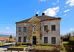
Parsonage Object ID: 94194 |
Neunkirchner Straße, Würflach 81 KG location : Würflach |
two-storey building, central axis with arched niche and figure of St. Josef, inscription panel with chronogram 1890 |
ObjectID : 94194 Status: § 2a Status of the BDA list: 2020-02-29 Name: Pfarrhof GstNr .: .80 |

|
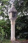
Shrine Object ID: 94214 |
Weinweg location KG: Würflach |
Crossing pillar with a tabernacle under a pyramid helmet, 17th century |
ObjectID : 94214 Status: § 2a Status of the BDA list: 2020-02-29 Name: Bildstock GstNr .: 1667 |

|
Sacred Heart Chapel (Sebastianskapelle) ObjectID : 94193 |
Location KG: Würflach |
The chapel, built around 1500, is built parallel to the parish church to the south and was originally integrated into the defensive wall. Originally the chapel was dedicated to hll. Sebastian and Rochus and was consecrated in 17./18. Century left to decay. Between 1878 and 1892 it was restored; the building was consecrated in 1885 as the Sacred Heart Church. From 1968 to 1982 it served as a mortuary. |
ObjectID : 94193 Status: § 2a Status of the BDA list: 2020-02-29 Name: Herz-Jesu-Kapelle (Sebastianskapelle) GstNr .: .65 |

|
Wehrkirchhof ObjectID : 94195 |
Location KG: Würflach |
The defensive wall was built in the 15th century and originally encompassed the entire churchyard. In 1840 the wall was partially demolished due to the cemetery expansion. |
ObjektID : 94195 Status: § 2a Status of the BDA list: 2020-02-29 Name: Wehrkirchhof GstNr .: 1648/2 Wehrkirchen district Würflach |

|
Corridor / path chapel ObjectID : 94220 |
Hettmannsdorfer Straße KG location : Hettmannsdorf |
Pankratius Chapel, "To the Immaculate Conception" consecrated building from 1908 in neo-Gothic style |
ObjectID : 94220 Status: § 2a Status of the BDA list: 2020-02-29 Name: Corridor / path chapel GstNr .: 588/2 |

|
Residential building ObjectID : 84912 |
Weidenweg 9 KG location : Hettmannsdorf |
The building, together with the neighboring house Weidenweg 127, with which it is connected by a curved gate wall with a round arched passage portal, forms a pair of courtyard and was the residential wing of the courtyard. The house, which originally dates from the 18th century, has a crooked roof, the facade shows plaster band structure, the windows have baroque frames and monastery grilles on the ground floor. The painted representation of the Madonna in an oval mirror is marked 1987. |
ObjectID : 84912 Status : Notification Status of the BDA list: 2020-02-29 Name: Residential house GstNr .: .11 / 1 |

|
Farm (facility) ObjectID: 31974 |
Weidenweg 127 KG location : Hettmannsdorf |
The former farm wing of a Paarhof farm, which is connected to the residential wing (Weidenweg 9) by a curved gate wall with a round arch portal, dates back to the 18th century and has a crooked roof. The facade is structured by plaster strips. |
ObjectID: 31974 Status: Notification Status of the BDA list: 2020-02-29 Name: Farm (facility) GstNr .: .11 / 2 |
Web links
Commons : Listed objects in Würflach - collection of images, videos and audio files
Individual evidence
- ↑ a b Lower Austria - immovable and archaeological monuments under monument protection. (PDF), ( CSV ). Federal Monuments Office , as of February 14, 2020.
- ↑ § 2a Monument Protection Act in the legal information system of the Republic of Austria .
